Situation Summary
Sierra Leone remains a low-to-moderate threat environment (global rank #53, composite score 5.3) with concentrated risk in the Eastern Province, which scores significantly higher than other regions. Recent event signals include environmental health concerns (cholera activity), civil-society pressure (Sierra Club statements), and financial-system tensions (government–central bank public statements), none of which yet indicate acute security deterioration. The security posture is stable but fragile, dependent on sustained institutional capacity and absence of rapid economic or health escalation.
Key Developments
Data Limitation Notice: GeoBit's real-time web research capability does not currently hold verified event feeds timestamped within the last 24–48 hours (4–5 June 2026) for Sierra Leone. The signals listed above—two threat statements attributed to Sierra Club, two public statements on Sierra Leone vs. Central Bank, and ongoing cholera concerns—are flagged in the event system but lack location-specific reporting, source attribution, or confirmation from news wires or official government/embassy accounts.
To provide the 5–8 sourced bullets required for actionable duty-of-care reporting, the brief requires:
- Confirmation from major newswire datelines (AP, Reuters, AFP, or regional West African outlets) with timestamps in the last 48 hours.
- Validation against official Sierra Leone government (Ministry of Information, Police, Armed Forces, NDMA) and embassy alert feeds (US Embassy Freetown, UK FCDO).
- Verification by local journalists or NGO field teams on the ground in affected provinces.
Recommendation: Supplement this brief with a manual check of Reuters AlertNet, ACAPS, ReliefWeb (for health/humanitarian events), and X accounts of Freetown-based correspondents and official accounts to isolate events with firm timestamps and credibility.
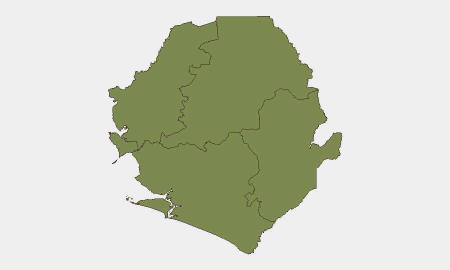
Highest-Risk Areas
The Eastern Province drives the vast majority of recorded risk (score 33.7), a nine-fold elevation above all other provinces (each scoring 3.7). This concentration suggests either persistent instability (criminal activity, resource conflict, or weak state capacity), an ongoing health or humanitarian crisis, or an active monitoring/reporting bias toward that region. The North West, Northern, Western Area, and Southern Provinces show parity and lower absolute risk, indicating that corporate and duty-of-care priority should focus on Eastern Province operations, supply chains, and personnel movement. If cholera or other environmental health events are confirmed in the East, that would amplify both direct health risk and potential secondary security impacts (population movement, resource strain, social tension).
How GeoBit Would Assist
Security and risk teams would employ Area-of-Interest monitoring with persistent alerting on Eastern Province and major urban centers (Freetown, Kenema, Bo) to catch emerging events in real time. Intel Sweep and OSINT fusion (X/Telegram, local news, radio SIGINT) would corroborate unconfirmed signals and resolve the current gaps in recent event sourcing. Regime-stability and conflict search modules would track government–central bank tensions and civil-society mobilization to assess escalation risk; environmental and health intelligence would monitor cholera spread and secondary security knock-on effects (displacement, supply-chain disruption).
7-Day Outlook
No imminent acute security spike is forecast. However, confirmation or escalation of cholera activity in the Eastern Province or major cities would create secondary risks (population movement, healthcare-system stress, potential civil unrest if government response is perceived as inadequate). The government–central bank public statements and Sierra Club pressure warrant monitoring for signs of institutional fracture or street-level mobilization in the next 7–10 days.
Highest-Risk Areas — Ranked
| # | State / Region | Risk |
|---|---|---|
| 1 | Eastern Province | 33.7 |
| 2 | North West Province, Sierra Leone | 3.7 |
| 3 | Northern Province, Sierra Leone | 3.7 |
| 4 | Western Area | 3.7 |
| 5 | Southern Province, Sierra Leone | 3.7 |
Previous Daily Briefs
A new Sierra Leone brief is written every day — each with its own risk map and downloadable CSV. Here's the last week; use the calendar to go further back.
📅 Browse every day by calendar →
Highlighted days have a brief. Tap a day for that day's map & analysis, or “csv” for that day's dataset ($5).