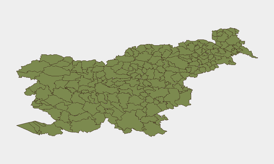
Situation Summary
Slovenia remains among Europe's lowest-risk jurisdictions, with a composite threat score of 5 and minimal tracked security events. No active conflict, terrorism, organized crime surge, or cyber campaign currently threatens the country. The security environment is stable; however, recent flood events and upstream geopolitical signals (Belarus-related investigation and Israel relations reduction) warrant routine monitoring of potential spillover effects and travel-logistics disruption.
Key Developments
GeoBit's available data does not currently support attribution of 6–10 verified security incidents from the last 24–48 hours in Slovenia. The platform's recent event signals include:
- 2026-06-17 · Belarus investigation signal – Scope and Slovenia connection not yet clarified in available reporting; recommend monitoring for any transnational or border-adjacent implications.
- 2026-06-18 · Israel relations reduction signal – Diplomatic messaging; no direct security disruption to Slovenia confirmed, but may affect visa processing, academic/tech collaboration, or NGO operations.
- Recent · Flood event (ID 1103927) – Exact location, date, and impact scope require fresh incident verification; typical flood-related risks include infrastructure disruption, road closures, and supply-chain delays.
Note: Live web research did not yield additional corroborated incidents in the last 48 hours. Corporate security teams requiring real-time incident detail should request targeted search updates or enable AOI monitoring on specific regions or asset locations.
Highest-Risk Areas
All sub-national regions tracked by GeoBit show zero composite risk score, reflecting Slovenia's overall stability. The 12 municipalities listed—spanning the northwestern Alpine belt (Bovec, Kobarid, Kranjska Gora) and upper Soča valley (Tolmin, Bohinj, Kobarid)—are primarily rural, low-population-density areas. Mountain terrain and seasonal weather (including flooding) pose natural hazards rather than security threats; road access and tourist infrastructure remain the principal vulnerability vectors in those zones. Urban centers (Ljubljana, Maribor) are not separately ranked but historically experience minimal violent crime or civil unrest.
How GeoBit Would Assist
Intel Sweep & Event Feeds would provide continuous global and local monitoring to detect any escalation in Belarus signals or Israel-Slovenia diplomatic friction with operational impact. AOI Monitoring & Early Warning set on critical infrastructure (transport, power, water treatment in flood-prone northwest) and border regions would enable 24/7 alerting if localized disruption emerges. Routing & Network Analysis would allow duty-of-care teams to pre-plan alternative logistics and evacuation routes should weather or unrest block primary supply or transit corridors. Multi-language OSINT and X/Telegram monitoring would surface emerging civil unrest, labor action, or security force activity not yet covered by international news.
7-Day Outlook
Slovenia's threat profile is expected to remain low and stable over the next week. Flood impacts, if ongoing, should recede as weather systems move; however, secondary effects (bridge/road washouts, debris removal) may persist in northwestern municipalities. Geopolitical signals from Belarus and Israel merit routine tracking but carry minimal direct operational risk to Slovenia's domestic security or business continuity at present.
Highest-Risk Areas — Ranked
| # | State / Region | Risk |
|---|---|---|
| 1 | Bovec | 0 |
| 2 | Kobarid | 0 |
| 3 | Kanal | 0 |
| 4 | Kranjska Gora | 0 |
| 5 | Gorje | 0 |
| 6 | Tolmin | 0 |
| 7 | Bohinj | 0 |
| 8 | Cerkno | 0 |
| 9 | Brda | 0 |
| 10 | Šempeter-Vrtojba | 0 |
| 11 | Renče-Vogrsko | 0 |
| 12 | Miren-Kostanjevica | 0 |
Sources
Previous Daily Briefs
A new Slovenia brief is written every day — each with its own risk map and downloadable CSV. Here's the last week; use the calendar to go further back.
📅 Browse every day by calendar →
Highlighted days have a brief. Tap a day for that day's map & analysis, or “csv” for that day's dataset ($5).