Situation Summary
Somalia remains at elevated composite threat (rank #14 globally, score 84.4), driven primarily by active Al‑Shabaab insurgency operations across multiple regions. The past 24 hours have seen confirmed IED attacks on security forces in Mogadishu, renewed ambush activity on key supply corridors in Lower Shabelle, and sustained counter-terror operations in Lower Juba. Underlying political fragmentation between federal and member-state authorities, combined with critical funding gaps in the AUSSOM/ATMIS successor mission, continues to degrade coordinated security responses and increase operational risk across the country.
Key Developments
- Mogadishu (Banaadir) – Al‑Shabaab IED strike: A roadside improvised explosive device targeted a Somali National Army vehicle, resulting in reported casualties among security personnel. Attack assessed as consistent with Al‑Shabaab operational patterns against government forces.
- Mogadishu–Lower Shabelle corridor – checkpoint and ambush threat: Al‑Shabaab has re-established checkpoints and ambush positions along supply routes, creating acute risk to SNA convoys and civilian traffic moving between the capital and regional towns.
- Hiraan/Middle Shabelle corridor – sustained insurgent pressure: Al‑Shabaab elements continue harassment of SNA and allied militia positions, including small-arms engagements and IED placement around contested settlements in central Somalia.
- Puntland urban centers (Bosasa/Galkayo axis) – hybrid militant and criminal threat: Pro‑ISIS and Al‑Shabaab cells maintain IED and shooting capability in urban zones; concurrent high rates of armed robbery and banditry add significant layered risk for travel and asset movement.
- Lower Juba (Jilib area) – counter-terror operations and retaliatory risk: Ongoing air and ground operations against Al‑Shabaab are sustaining movement restrictions and elevated risk of retaliatory attacks on civilian and government positions.
- Nationwide travel advisory – U.S. "Do Not Travel" status: U.S. government continues to restrict personnel to Mogadishu airport vicinity and warns of extremely limited evacuation options due to terrorism, crime, kidnapping, and piracy.
- AUSSOM/ATMIS funding crisis: Delayed stipends and equipment reimbursements are degrading morale and operational capacity of African Union-led stabilization forces, undermining security reach across federal member states.
- Federal political fragmentation: Ongoing tensions between federal government and member states, plus clan dynamics, reduce coordination on security and protection of critical infrastructure.
Highest-Risk Areas
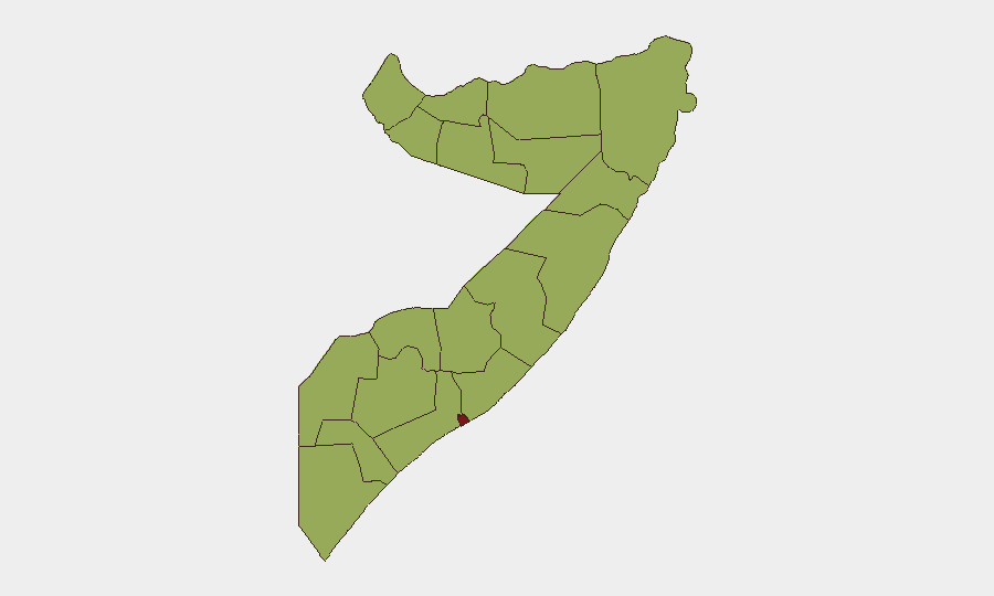
Banaadir (Mogadishu) stands as the single highest-risk region (89.1) due to concentrated Al‑Shabaab IED and small-arms activity against security forces and ongoing criminal threats in an urban environment. All remaining tracked regions score 59.1 and cluster into two drivers: (1) Al‑Shabaab territorial control and insurgent pressure along the central and southern corridor (Hiraan, Middle Shabelle, Middle Juba, Lower Shabelle, Bay, Bakool), and (2) porous borders and cross-border militant safe havens in the north and northeast (Awdal, Woqooyi Galbeed, Gedo, Sahil, Togdheer). The uniformity of scores reflects endemic instability rather than geographic concentration, meaning risk is dispersed and organizations must assume threat across all regions.
How GeoBit Would Assist
Security and risk teams would employ AOI Monitoring & Early Warning on Mogadishu, Lower Shabelle, and central-corridor towns to detect real-time Al‑Shabaab activity shifts and threat-timing patterns. Routing & Network Analysis would identify safer alternative movement corridors and supply-chain bypass options when primary routes are compromised. Conflict & Military battle-mapping, combined with OSINT fusion from local media and Telegram/X feeds, would track SNA disposition changes and Al‑Shabaab tactical repositioning to inform duty-of-care decisions on personnel movement and asset protection.
7-Day Outlook
Al‑Shabaab pressure is likely to sustain or intensify in Mogadishu and central Somalia corridors as government and AU forces remain under-resourced. Personnel and asset movements should assume continued checkpoint threats, IED risk, and limited air-evacuation capacity. No material shift in political or security coordination is anticipated in the near term.
Highest-Risk Areas — Ranked
| # | State / Region | Risk |
|---|---|---|
| 1 | Banaadir | 89.1 |
| 2 | Awdal | 59.1 |
| 3 | Woqooyi Galbeed | 59.1 |
| 4 | Gedo | 59.1 |
| 5 | Bakool | 59.1 |
| 6 | Bay | 59.1 |
| 7 | Middle Juba | 59.1 |
| 8 | Lower Shabelle | 59.1 |
| 9 | Sahil | 59.1 |
| 10 | Togdheer | 59.1 |
| 11 | Hiiraan | 59.1 |
| 12 | Middle Shebelle | 59.1 |
Sources
Previous Daily Briefs
A new Somalia brief is written every day — each with its own risk map and downloadable CSV. Here's the last week; use the calendar to go further back.
📅 Browse every day by calendar →
Highlighted days have a brief. Tap a day for that day's map & analysis, or “csv” for that day's dataset ($5).