Situation Summary
Spain faces an acute environmental security emergency driven by extreme wildfires and record heat across multiple regions, particularly in Castilla-La Mancha and areas near Madrid. Over 200,000 people have been evacuated across southwestern Europe (France and Spain combined) as of 25 July, with infrastructure disruption, road closures, and ongoing firefighting operations constraining movement and access. No credible reports indicate major terrorism, civil unrest, or political-violence incidents in the last 48 hours; current threat landscape is dominated by climate-related hazards and their cascading effects on travel, utilities, and vulnerable populations. Extreme temperatures (44°C+) and unstable weather patterns are forecast to persist, sustaining high re-ignition risk through the near term.
Key Developments
- Guadalajara province (Castilla-La Mancha) – Wildfire, 24–25 July 2026: A large wildfire burned approximately 32,000 hectares, forcing evacuations from 30+ villages. By 25–26 July, firefighting operations had largely stabilized the main fire but hundreds of firefighters remained deployed on hotspots, with selective road closures and restricted civilian access ongoing.
- Areas near Madrid – Severe wildfires, 24–25 July 2026: Authorities reported some of the most devastating fires in the region's historical record, driven by intense winds and extreme heat, prompting widespread evacuations and emergency operations in peri-urban and rural areas east and north of Madrid.
- Murcia and Valencian Community – Red weather alerts, 25 July 2026: Spanish authorities issued red-level heat and weather warnings for southeast regions, with temperatures forecast at 44°C and thunderstorms including hail. Officials advised against unnecessary travel and indoor shelter during peak heat hours.
- Southwestern Europe – Mass evacuation milestone, 25 July 2026: Over 200,000 people were evacuated in Spain and France combined due to wildfires, with Spain's evacuations concentrated in rural communities and small towns around Guadalajara and the Madrid periphery.
- Multiple villages, Guadalajara – Controlled access and return restrictions, 25–26 July 2026: Residents faced ongoing restrictions on movement and home return due to unstable terrain, smoke, and re-ignition risk; selective entry controls remained in effect on major routes.
- National heatwave advisories – 25–26 July 2026: Spanish authorities continued issuing public-safety guidance on extreme heat, warning of health risks to vulnerable populations and potential power-demand surges and transport disruption, particularly in southern and eastern regions.
Highest-Risk Areas
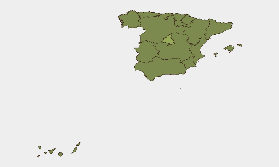
Madrid (54.2) dominates the sub-national risk ranking and reflects both the scale of concurrent wildfire impacts in its periphery and historical concentration of political/administrative activity. Andalusia (35) and Catalonia (30.5) carry elevated baseline risk from prior civil tensions and regional autonomy disputes, though current reporting shows no active escalation. Castilla-La Mancha and eastern regions (Valencian Community, Murcia, Aragon) are now acute-priority zones due to active wildfires, extreme heat alerts, and mass evacuations; infrastructure disruption and travel restrictions in these areas pose direct duty-of-care exposure for corporate personnel and supply chains.
How GeoBit Would Assist
GeoBit's AOI Monitoring & Early Warning capability, paired with Satellite & Imagery Analysis, enables real-time tracking of wildfire perimeters, evacuation zones, and road-closure impacts across Madrid, Guadalajara, and the Valencian Community. Routing & Network Analysis can generate updated travel corridors and alternative logistical paths to avoid fire zones and traffic disruption. Environmental & Health and Risk & Threat Assessment tools provide 7-day fire weather forecasts, heat-stress analysis, and localized infrastructure-strain modeling to support duty-of-care and operational continuity planning.
7-Day Outlook
Extreme heat and unstable atmospheric conditions are forecast to persist through late July, sustaining high wildfire risk and complicating containment efforts. Evacuation zones and road restrictions are likely to remain fluid; personnel travel in Castilla-La Mancha, Madrid periphery, and southeastern regions should be deemed non-essential until weather stabilization and fire suppression permit controlled access. Power disruptions and localized supply-chain delays are probable in affected and adjacent areas over the next 5–7 days.
Highest-Risk Areas — Ranked
| # | State / Region | Risk |
|---|---|---|
| 1 | Community of Madrid | 54.2 |
| 2 | Andalusia | 35 |
| 3 | Catalonia | 30.5 |
| 4 | Castile and León | 28.8 |
| 5 | Region of Murcia | 26.6 |
| 6 | Valencian Community | 26.3 |
| 7 | Castile-La Mancha | 25.9 |
| 8 | Canary Islands | 25.8 |
| 9 | Aragon | 24.3 |
| 10 | Galicia | 24.3 |
| 11 | Balearic Islands | 24.2 |
| 12 | Extremadura | 24.2 |
Previous Daily Briefs
A new Spain brief is written every day — each with its own risk map and downloadable CSV. Here's the last week; use the calendar to go further back.
📅 Browse every day by calendar →
Highlighted days have a brief. Tap a day for that day's map & analysis, or “csv” for that day's dataset ($5).
Atlas — our AI intelligence desk — emails them this snapshot personally. Nothing else, no list.