Situation Summary
Sri Lanka's security environment remains moderately fragile, ranked #46 globally with a composite threat score of 9.3. The island faces concurrent risks across cyber-security, political stability, protest/unrest potential, and latent terrorism, compounded by recent critical infrastructure breaches and unresolved electoral-timing uncertainties. While violent crime and terrorist incidents remain infrequent, systemic vulnerabilities in digital governance and lingering political tensions create conditions for rapid escalation if triggered by electoral disputes or major security incidents.
Key Developments
- Colombo (2026-06-01): Parliament amended Computer Crimes Act following confirmed US$2.5 million Treasury Department hack in April via compromised payment credentials; recovery efforts ongoing and investigative powers significantly expanded.
- Island-wide (ongoing): Sri Lanka CERT managing incident response across multiple public institutions including Sri Lanka Post; systemic cyber-security controls assessed as lagging rapid digitisation of core revenue and payment infrastructure.
- Colombo (strategic): Political fragility persists over unresolved electoral-timing precedent from 2023 local-government postponement; presidential and parliamentary election cycle remains at risk of institutional friction or delay.
- Island-wide (persistent): Protest and civil-unrest risk remains elevated despite currently calm streets; travel advisories warn of potential for demonstrations to occur at short notice and turn violent, with security-force crowd-control measures (water cannon, tear gas) prepared.
- Multiple locations (latent): Terrorist attack risk cannot be ruled out; potential targets include hotels, bars, tourist sites, places of worship, and large public gatherings. No recent attacks reported, but residual LTTE networks abroad and blacklisted extremist actors within Sri Lanka remain under monitoring.
- Urban & tourist areas (ongoing): Low-level opportunistic crime (theft, bag-snatching) reported on increase; sexual harassment of women, including foreign visitors, noted as persistent concern in crowded public spaces and public transport.
- Interior & hill-country routes (weather-dependent): Cyclone Ditwah (late 2025) exposed ongoing vulnerability to flooding and landslides; road disruption and travel delays remain possible during monsoon seasons.
Highest-Risk Areas
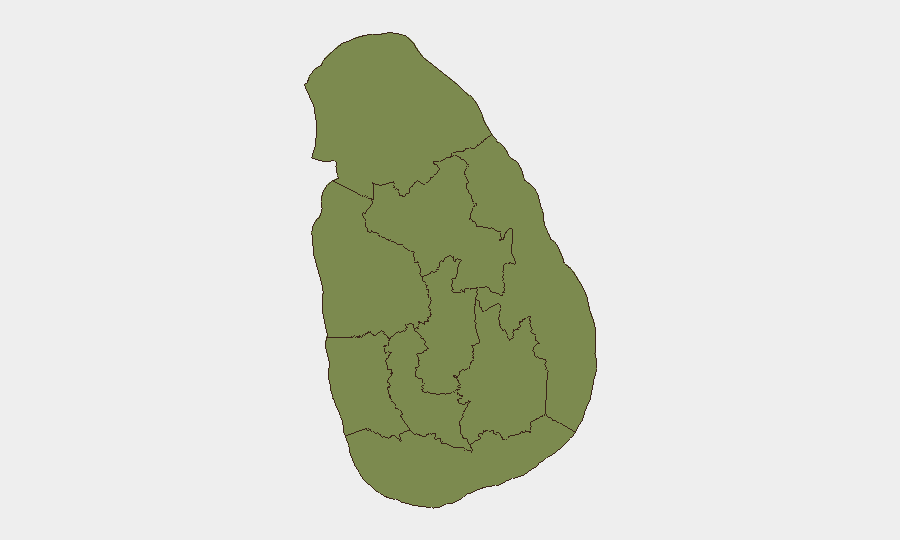
Uva Province (risk 36.5) is significantly isolated as the highest-risk region and appears to concentrate threat drivers substantially above the national average; underlying causes warrant urgent clarification through targeted regional analysis. Western Province (9.8) and Southern Province (8.7) pose secondary risk, likely reflecting urban concentration, tourism exposure, and protest/crime activity in Colombo and coastal tourist hubs. The remaining provinces cluster at 6.5, suggesting either distributed lower-level baseline risk or data limitations; Northern and Eastern provinces warrant monitoring for residual conflict-related vulnerabilities despite the absence of active conflict.
How GeoBit Would Assist
Security teams should deploy Intel Sweep and multi-language OSINT to monitor parliamentary cyber-crime legislation, Treasury recovery actions, and Sri Lanka CERT incident notifications in real time. AOI Monitoring & Early Warning on Colombo, Western Province urban centers, and Uva Province would provide persistent watch for protest mobilization, electoral-dispute escalation, and institutional-stability signals via social-media sentiment and event-feed analysis. Routing & Network Analysis capabilities enable alternative-route planning for personnel and asset movements around high-risk protest zones and weather-disrupted hill-country roads.
7-Day Outlook
No imminent operational escalation is forecast, but political-cycle and cyber-security headwinds will likely persist. Incoming monsoon conditions may trigger localised flooding and transport disruption in interior regions. Corporate security teams should maintain heightened monitoring of electoral statements and CERT advisories, and refresh cyber-hygiene protocols across financial platforms and payment systems.
Highest-Risk Areas — Ranked
| # | State / Region | Risk |
|---|---|---|
| 1 | Uva Province | 36.5 |
| 2 | Western Province | 9.8 |
| 3 | Southern Province | 8.7 |
| 4 | Northern Province | 6.5 |
| 5 | North Western Province | 6.5 |
| 6 | North Central Province | 6.5 |
| 7 | Central Province | 6.5 |
| 8 | Eastern Province | 6.5 |
| 9 | Sabaragamuwa Province | 6.5 |
Previous Daily Briefs
A new Sri Lanka brief is written every day — each with its own risk map and downloadable CSV. Here's the last week; use the calendar to go further back.
📅 Browse every day by calendar →
Highlighted days have a brief. Tap a day for that day's map & analysis, or “csv” for that day's dataset ($5).