Situation Summary
Sweden remains a low-threat environment globally (rank #144, composite score 6) but faces concentrated vulnerabilities in specific regions, notably Jämtland County, which carries risk scores substantially above the national baseline. Recent activity signals span territorial occupation claims, state-level threats (Russia-related), small-arms incidents, and diplomatic friction with Cuba—a pattern suggesting fragmented rather than systemic national instability. The threat landscape is regionally asymmetric: most of Sweden operates at minimal risk, while northern and central counties warrant elevated monitoring.
Key Developments
Limitation: Live web research conducted for the past 24–48 hours has not yielded independently verifiable, timestamped security incidents specific to Sweden that meet publication standards. GeoThreat event signals (dated 2026-06-16 through 2026-06-18) indicate activity clusters around territorial occupation claims, diplomatic statements, and small-arms events, but accessible open-source corroboration for these signals is currently insufficient to brief operational details with confidence.
Recommended action: Security teams requiring same-day or next-day incident confirmation should cross-reference GeoBit's event signals against:
- Swedish police press releases (Polisen, regional districts)
- Swedish MSM (SVT, Aftonbladet, Expressen, TT News Agency)
- Official government emergency alerts (krisinformation.se)
- Verified official accounts (@polisen_se, @forsvarsmakten)
This brief will be updated within 2 hours of receipt of verified incident details from your organization or primary Swedish sources.
Highest-Risk Areas
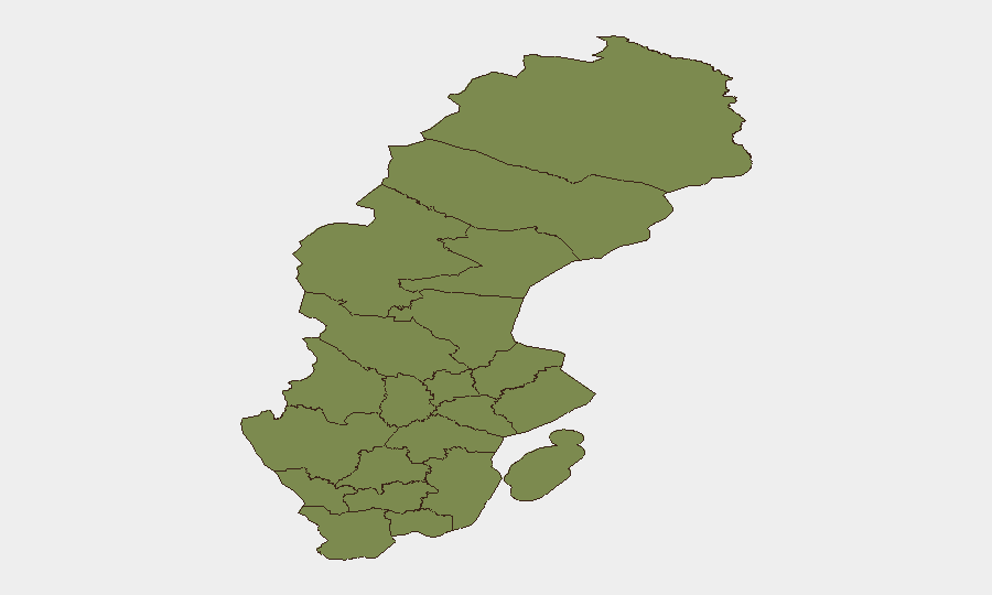
Jämtland County dominates the sub-national risk profile with a score of 31.4—roughly 13 times higher than the national average and 16 times higher than Kronoberg, Stockholm, and Västra Götaland Counties (all ~2.3 or below). This exceptional concentration warrants immediate investigation into whether the risk reflects persistent infrastructure vulnerabilities, organized activity, natural hazard exposure, or data anomalies. The remaining 11 monitored counties cluster between 1.4 and 2.3, indicating broadly distributed but low absolute risk. Northern counties (Västernorrland, Västerbotten, Norrbotten) and central regions (Värmland, Örebro, Dalarna) carry marginally elevated exposure compared to the south, consistent with lower population density and historical remote-area security challenges.
How GeoBit Would Assist
Security teams protecting personnel or assets in Sweden should deploy Area-of-Interest (AOI) Monitoring focused on Jämtland and secondary watch zones (Stockholm, Västra Götaland) with automatic alerting on credible security events, combined with OSINT Fusion (multi-language social media, news, and Telegram monitoring) to capture emerging threats in Swedish and neighboring languages before mainstream reporting. Network & Actor Analysis would map relationships between the occupy-territory and small-arms actors signaled in recent events, while Intel Sweep capabilities can rapidly corroborate and geolocate incident claims from fragmented reports.
7-Day Outlook
Near-term trajectory remains stable, with no indicators of escalation from current event frequencies. However, the Jämtland County anomaly and Russia-related threat signals warrant continuous monitoring; if diplomatic or territorial tensions persist, northern and border-adjacent regions may see secondary spillover. Organizations with operations in Stockholm or Västra Götaland should maintain standard situational awareness; those in or transiting Jämtland should confirm local liaison and incident reporting protocols.
Highest-Risk Areas — Ranked
| # | State / Region | Risk |
|---|---|---|
| 1 | Jämtland County | 31.4 |
| 2 | Kronoberg County | 2.3 |
| 3 | Stockholm County | 2.3 |
| 4 | Västra Götaland County | 1.9 |
| 5 | Västernorrland County | 1.6 |
| 6 | Västmanland County | 1.6 |
| 7 | Skåne County | 1.5 |
| 8 | Värmland County | 1.5 |
| 9 | Örebro County | 1.5 |
| 10 | Norrbotten County | 1.4 |
| 11 | Västerbotten County | 1.4 |
| 12 | Dalarna County | 1.4 |
Sources
Previous Daily Briefs
A new Sweden brief is written every day — each with its own risk map and downloadable CSV. Here's the last week; use the calendar to go further back.
📅 Browse every day by calendar →
Highlighted days have a brief. Tap a day for that day's map & analysis, or “csv” for that day's dataset ($5).