Situation Summary
Togo remains a low-threat environment at the national level (composite score 26), with no discrete security incidents recorded in the current 24–48 hour window. However, significant sub-national risk concentration persists in the northern Savanes and Kara regions, driven by longstanding cross-border instability, militant activity, and porous frontier controls shared with Burkina Faso. The overall security posture is stable but regionally fragmented, with southern and maritime zones substantially lower-risk than the north.
Key Developments
No verified discrete security, civil-unrest, conflict, crime, political-instability, or infrastructure incidents were identified in Togo over the last 24–48 hours. Live web research across news, social media, and regional sources returned no corroborated developments in this period. Monitoring should continue for signals in border regions (Savanes, Kara) where cross-border spillover from Burkina Faso militant activity has historically driven risk spikes.
Highest-Risk Areas
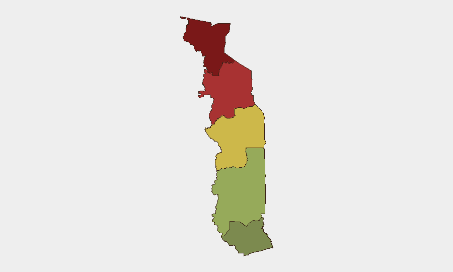
Savanes Region (risk score 92) and Kara Region (risk score 78) dominate the threat landscape and account for the majority of national risk. Both regions share long, porous borders with Burkina Faso, where jihadist and militant groups have expanded operational reach since 2015. Risk in these areas reflects exposure to cross-border armed group activity, trafficking networks, and intercommunal tensions, rather than active domestic insurgency. By contrast, Maritime Region (score 28) and Plateaux Region (score 45) present substantially lower operational risk; Lomé and coastal zones remain the safest areas for corporate activity.
How GeoBit Would Assist
Teams with personnel or assets in Togo should deploy Area-of-Interest (AOI) Monitoring & Early Warning on Savanes and Kara regions to detect emerging incidents before they escalate or affect supply chains and travel. Multi-language OSINT (X/Twitter, Telegram, radio SIGINT) across border communities and local media will surface early warning signals of cross-border militant activity, trafficking, or intercommunal friction. Routing & Network Analysis should be used to pre-plan alternative travel corridors and supply-chain diversions in the event of northern corridor disruption.
7-Day Outlook
No imminent spike in activity is indicated; Togo's near-term trajectory remains stable. However, broader Sahel instability and the seasonal pattern of militant activity in the Burkina Faso–Togo frontier warrant sustained vigilance on northern regions. Any significant cross-border incident in Burkina Faso or Niger should prompt immediate re-assessment of Savanes and Kara exposure.
Highest-Risk Areas — Ranked
| # | State / Region | Risk |
|---|---|---|
| 1 | Savanes Region | 92 |
| 2 | Kara Region | 78 |
| 3 | Centrale Region | 65 |
| 4 | Plateaux Region | 45 |
| 5 | Maritime Region | 28 |
Previous Daily Briefs
A new Togo brief is written every day — each with its own risk map and downloadable CSV. Here's the last week; use the calendar to go further back.
📅 Browse every day by calendar →
Highlighted days have a brief. Tap a day for that day's map & analysis, or “csv” for that day's dataset ($5).