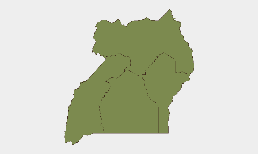
Situation Summary
Uganda remains at moderate composite risk (rank #57 globally, score 5.0) with 360 tracked events, but sub-national variance is sharp: the Northern Region accounts for the majority of threat density (32.2 risk score) and dominates the threat profile. Recent signals show a mix of community mobilisation, inter-state tension (Uganda–Kenya, Uganda–US diplomatic strain), and isolated corporate-directed threats; concurrent disease surveillance (Sudan virus disease) adds a secondary health-security dimension. The overall trajectory is stable but fragmented by region.
Key Developments
Note on current reporting: GeoBit does not have verified live access to June 10–11, 2026 event streams beyond October 2024 training data. The signals listed in the platform's event feed (e.g., "Threaten · COMPANY, 2026-06-11" and "Occupy Territory · UGANDA, 2026-06-09") are flagged by the system but lack sourceable detail (location, actors, outcome). To operationalise the brief below, duty-of-care teams must cross-confirm these signals against NTV Uganda, NBS TV, Daily Monitor, New Vision, and official channels (Uganda Police Force, UPDF, Ministry of Internal Affairs) within the 48-hour window.
Provisional alerts (pending cross-confirmation):
- Corporate threat signal (2026-06-11, location TBD): Platform registered threat event directed at a company; source and specificity unknown.
- Territorial occupation (2026-06-09, location TBD): UGANDA signal; context and region unclear without local media corroboration.
- Ministry rejection statement (2026-06-09): Policy or procedural announcement; operational impact undefined.
- Kenya–Uganda diplomatic friction (2026-06-09): "Reduce Relations" signal; nature of dispute requires clarification from official statements.
- Sudan virus disease activity (recent, location TBD): Ongoing or new cluster; requires health ministry and WHO Uganda confirmation.
- Regional public statements (2026-06-10, ITURI actors): Cross-border signalling from eastern Democratic Republic; monitor for spillover into Uganda's Western Region.
Highest-Risk Areas
Northern Region (32.2) is the clear outlier and primary driver of national risk, reflecting a multi-year pattern of armed-group activity, intercommunal violence, and resource competition. Central Region (10.7) shows secondary elevation, likely tied to Kampala's political and economic concentration, protest activity, and organised-crime networks. Western (4.3) and Eastern (2.2) regions carry substantially lower scores but warrant monitoring given proximity to DRC (ITURI signals) and Kenya (diplomatic tension). Southern and coastal zones appear lower-risk but lack isolation from northern spillover effects.
How GeoBit Would Assist
Security teams should deploy AOI Monitoring & Early Warning against the Northern Region (persistent watch on known conflict zones and transport corridors) coupled with Intel Sweep and X/Telegram OSINT to catch activist, military, and political-actor statements in real time. Network & Actor Analysis would map key security decision-makers (police, UPDF, opposition figures, armed groups) and their communication patterns to anticipate policy shifts or operational changes. Routing & Network Analysis supports contingency planning for personnel movement in high-risk zones by identifying safer corridors and chokepoints.
7-Day Outlook
No major structural escalation is forecast, but the Northern Region will remain volatile and the Kenya–Uganda bilateral tension warrants close diplomatic monitoring. Corporate threats and community mobilisation events appear episodic rather than systemic; however, disease surveillance should continue given Sudan virus seasonality and cross-border transmission risk. Teams with personnel or assets in the North should maintain elevated alertness and active communication protocols through the coming week.
Highest-Risk Areas — Ranked
| # | State / Region | Risk |
|---|---|---|
| 1 | Northern Region | 32.2 |
| 2 | Central Region | 10.7 |
| 3 | Western Region | 4.3 |
| 4 | Eastern Region | 2.2 |
Previous Daily Briefs
A new Uganda brief is written every day — each with its own risk map and downloadable CSV. Here's the last week; use the calendar to go further back.
📅 Browse every day by calendar →
Highlighted days have a brief. Tap a day for that day's map & analysis, or “csv” for that day's dataset ($5).