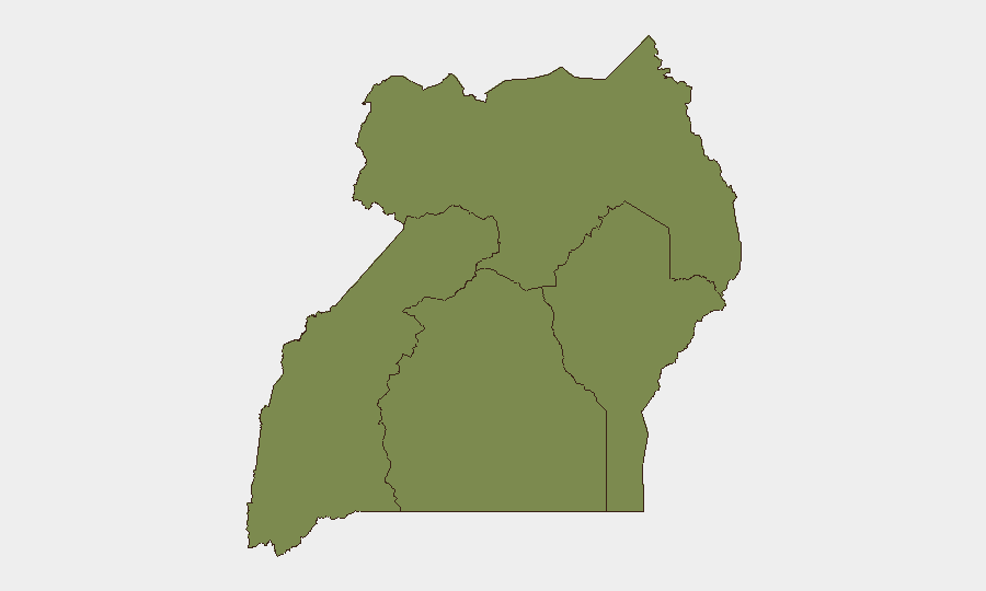
Situation Summary
Uganda maintains a composite threat score of 5 globally (ranking #156), reflecting a moderately fragmented security environment with concentrated volatility in the Central Region. Recent event signals indicate diplomatic friction (particularly EU and US-related statements), internal governance disputes involving the Justice Ministry and military, and transnational tensions with the Democratic Republic of Congo. The threat landscape remains regionally asymmetric, with Central Region risk substantially outpacing other areas.
Key Developments
Recent event signals do not contain sufficient date-stamped, verifiable incident reports from the past 24–48 hours (June 18–19, 2026) to generate a confidence-grounded list of specific developments. GeoBit's event feed reflects governmental and diplomatic statements (e.g., Justice Minister and military statements on June 18; US Health Official engagement on June 19) and an investigation-level signal involving Ugandan entities on June 18, but open-source web research has not returned corroborating incident details, locations, or security consequences that would meet briefing-standard recency and specificity.
To populate this section with actionable intelligence—incident locations, casualty/displacement figures, checkpoint activity, or asset-risk implications—live news-wire access (Daily Monitor, NTV Uganda, Nile Post), timestamped X/Twitter feeds from Uganda Police Force and UPDF, and official travel advisories are required.
Highest-Risk Areas
Central Region (composite risk 31.7) dominates Uganda's threat landscape by a factor of four, driven by governance sensitivities, diplomatic engagement, and the concentration of national institutions and expatriate presence in Kampala and surrounding areas. Northern Region (7.7) remains secondary but elevated, consistent with historical displacement and inter-communal dynamics. Western and Eastern Regions pose significantly lower threat profiles (6.2 and 1.7, respectively). Corporate security planning should weight Central Region exposure—personnel, supply chains, facilities—as the priority for scenario planning and duty-of-care protocols.
How GeoBit Would Assist
Intel Sweep & OSINT Fusion would aggregate and correlate diplomatic statements, military communications, and local reporting to distinguish signal from noise in the current event cluster. AOI Monitoring & Early Warning pinged against Kampala and secondary urban centers would provide persistent alerting on protest activity, checkpoint operations, or asset-proximity incidents. Conflict & Military tracking (force structure, weapon-capability monitoring) combined with Network & Actor Analysis would map decision-maker movements and institutional stability signals, enabling proactive duty-of-care posture adjustment before publicly visible escalation.
7-Day Outlook
The next seven days will likely see continued diplomatic and bureaucratic statement activity with low probability of immediate street-level escalation. However, the concentration of Central Region risk and recent governance signals warrant sustained monitoring; security teams should maintain heightened situational awareness and ensure communication protocols with local partners are current. If transnational tensions (Uganda–DRC) translate into border activity or military movements, Northern and Western Region risk profiles could shift upward within 48–72 hours.
Recommendation: To strengthen next briefing, provide GeoBit access to live news wires (past 24 hours) or direct incident reports, enabling grounding of event signals in specific locations, times, and asset-risk implications.
Highest-Risk Areas — Ranked
| # | State / Region | Risk |
|---|---|---|
| 1 | Central Region | 31.7 |
| 2 | Northern Region | 7.7 |
| 3 | Western Region | 6.2 |
| 4 | Eastern Region | 1.7 |
Sources
Previous Daily Briefs
A new Uganda brief is written every day — each with its own risk map and downloadable CSV. Here's the last week; use the calendar to go further back.
📅 Browse every day by calendar →
Highlighted days have a brief. Tap a day for that day's map & analysis, or “csv” for that day's dataset ($5).