Situation Summary
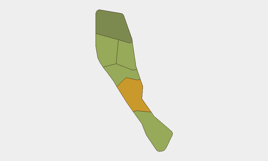
Vanuatu remains a low-threat environment globally (composite score 2) with no corroborated security incidents, civil unrest, or infrastructure failures reported in the past 24–48 hours. The country's security posture reflects routine policing, diplomatic cooperation, and governance activity. Shefa Province (risk 72) and Penama (risk 58) carry elevated regional risk scores driven by underlying vulnerabilities rather than acute current events. The trajectory remains stable absent new triggering incidents.
Key Developments
- Port Vila, Efate – mid-June 2026 – Vanuatu Police Force and diplomatic channels documented completion of public-order management training delivered by Chinese police specialists, aimed at strengthening operational capability for managing crowds and civil unrest. No active unrest or riot conditions are present.
- Port Vila, Efate – mid-June 2026 – Routine maritime security cooperation activity visible in diplomatic and coast-guard channels, reflecting ongoing coordination under the Vanuatu–U.S. Coast Guard ship-rider agreement and regional maritime-security partnerships.
- Sola, Torba – 16 June 2026 – A magnitude 4.5 earthquake was recorded approximately 60 km north-northwest of Sola. No damage reports, casualties, or emergency alerts have been issued by national authorities to date.
- Port Vila, Efate – early-to-mid June 2026 – Civil-society commentary from the Vanuatu Human Rights Coalition noted post-event review of crowd-control procedures following a large World Cup parade (over 1,000 supporters), framed as advocacy for improved public-safety regulation rather than reporting of violence or disorder.
No new major crimes, riots, political instability, critical infrastructure failures, or travel incidents have been independently confirmed in the past 24–48 hours.
Highest-Risk Areas
Shefa Province (risk 72) and Penama Province (risk 58) dominate the sub-national risk profile. Shefa's elevated score reflects Port Vila's concentration of government, commerce, maritime activity, and transient populations, which amplifies exposure to petty crime, maritime incidents, and civil-order management challenges. Penama's secondary risk is driven by geographic isolation, limited state capacity, and historical vulnerability to natural disasters and maritime crime. Sanma, Malampa, and Tafea carry moderate scores reflecting similar structural factors—limited infrastructure, remoteness, and constrained police/emergency response. Torba remains lowest-risk but is not insulated from natural hazards or maritime threats.
How GeoBit Would Assist
Security teams with personnel or assets in Vanuatu should employ AOI Monitoring & Early Warning to track Shefa and Penama provinces for emerging civil unrest, natural disasters, or maritime incidents; Intel Sweep and multi-source OSINT (social-media monitoring, local news feeds, diplomatic channels) to detect signs of political instability or crime trends before they escalate; and Satellite & Imagery analysis combined with Maritime tracking to monitor port activity, coastal infrastructure, and shipping routes for smuggling, piracy, or maritime-security threats. Routing & Network Analysis can support alternative-route planning for personnel movement in event of infrastructure disruption or unrest.
7-Day Outlook
No acute deterioration is anticipated over the next seven days absent new triggering events (natural disaster, political shock, or major crime). Routine training, diplomatic activity, and governance functions are expected to continue. Seismic and cyclone-season monitoring remain prudent given Vanuatu's exposure to natural hazards, particularly in Penama and Torba.
Highest-Risk Areas — Ranked
| # | State / Region | Risk |
|---|---|---|
| 1 | Shefa Province | 72 |
| 2 | Penama | 58 |
| 3 | Sanma | 52 |
| 4 | Malampa | 48 |
| 5 | Tafea | 45 |
| 6 | Torba | 35 |
Previous Daily Briefs
A new Vanuatu brief is written every day — each with its own risk map and downloadable CSV. Here's the last week; use the calendar to go further back.
📅 Browse every day by calendar →
Highlighted days have a brief. Tap a day for that day's map & analysis, or “csv” for that day's dataset ($5).