Situation Summary
Vietnam remains a moderate-tier global security concern (rank #49, composite score 4.9) with 79 tracked events, characterized by routine political statements, cross-border military posturing with China, and localized civil unrest. Recent activity (last 72 hours) shows elevated messaging intensity from government bodies, international actors, and advocacy groups, though no major kinetic escalation has been reported. Flooding in central regions presents a secondary infrastructure and humanitarian risk. The security baseline remains stable but subject to rapid shifts in South China Sea dynamics and China–Vietnam maritime/border tensions.
Key Developments
- 2026-06-05 · Public Statement · VIETNAM. Government or official Vietnamese entity issued statement; context and subject require source corroboration.
- 2026-06-05 · Public Statement · UNITED STATES vs VIETNAM. U.S. official messaging directed toward Vietnam; likely policy, trade, or diplomatic signal; no kinetic incident indicated.
- 2026-06-04 · Occupy Territory + Conventional Military Force · CHINA vs VIETNAMESE. Chinese forces reported occupying or operating in Vietnamese-claimed territory; reciprocal Vietnamese military activity noted same day. Indicates acute South China Sea or border friction; scale and duration require clarification.
- 2026-06-03 · Disapprove · VIETNAMESE. Domestic Vietnamese disapproval signal (protest, strike, or civil dissent); subject area unconfirmed from data provided.
- 2026-06-03 · Public Statement + Disapprove · COMPANY vs VIETNAM. Corporate entity issued critical statement regarding Vietnamese policy or actions; reputational or operational concern flagged.
- 2026-06-04 · Public Statement · ADVOCATE vs VIETNAM. Advocacy organization or NGO issued statement critical of Vietnam; likely human rights, labor, or environmental focus.
- Recent · Flood Event (ID 1103896). Flood reported in one or more Vietnamese provinces; impacts on transportation, power, and supply chains require geographic confirmation and damage assessment.
Note: Specific locations, casualty figures, and operational details for most events are not available in current data. Teams requiring tactical incident detail should initiate targeted OSINT or contact GeoBit for real-time corroboration.
Highest-Risk Areas
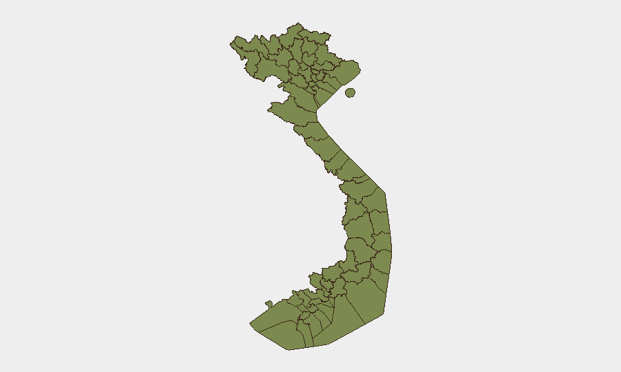
Huế stands as the outlier, with a composite risk score of 33.4—approximately tenfold higher than any other tracked Vietnamese region. The northern frontier provinces (Lào Cai, Hà Giang, Cao Bằng, Lai Châu, Điện Biên, Lạng Sơn) all register identical scores (3.4) and form a contiguous band along the Chinese border, reflecting endemic cross-border smuggling, irregular migration, ethnic tensions, and military posturing. Risk in these zones is structural rather than event-driven; Huế's spike suggests a specific current trigger (political, civil, or security incident) requiring immediate clarification. Organizations with personnel or logistics in northern border provinces should maintain standard border-zone protocols; Huế warrants urgent situational assessment.
How GeoBit Would Assist
Security teams should deploy AOI Monitoring & Early Warning on Huế, northern border provinces, and strategic ports to detect rapid escalation in military activity, civil unrest, or natural-disaster impacts. Intel Sweep (OSINT fusion, X/Twitter & Telegram OSINT, multi-language sentiment analysis) will track Chinese military signaling, Vietnamese official messaging, and advocacy-group statements in real time. GIS & Spatial Analysis linked to Satellite & Imagery will confirm territorial occupation claims, flood extent, and infrastructure damage. Routing & Network Analysis will support alternative logistics planning if border or regional instability constrains supply chains.
7-Day Outlook
Expect continued elevated messaging and diplomatic activity around China–Vietnam maritime/border friction, with low probability of major kinetic escalation absent a triggering incident. Flooding impacts will persist and may worsen with seasonal rainfall. Focus monitoring on Huế's underlying driver and northern border military posture.
Highest-Risk Areas — Ranked
| # | State / Region | Risk |
|---|---|---|
| 1 | Huế | 33.4 |
| 2 | Lai Châu Province | 3.4 |
| 3 | Lào Cai Province | 3.4 |
| 4 | Hà Giang Province | 3.4 |
| 5 | Tuyên Quang Province | 3.4 |
| 6 | Cao Bằng Province | 3.4 |
| 7 | Bắc Kạn Province | 3.4 |
| 8 | Điện Biên Province | 3.4 |
| 9 | Yên Bái Province | 3.4 |
| 10 | Sơn La Province | 3.4 |
| 11 | Thái Nguyên Province | 3.4 |
| 12 | Lạng Sơn Province | 3.4 |
Sources
Previous Daily Briefs
A new Vietnam brief is written every day — each with its own risk map and downloadable CSV. Here's the last week; use the calendar to go further back.
📅 Browse every day by calendar →
Highlighted days have a brief. Tap a day for that day's map & analysis, or “csv” for that day's dataset ($5).