Situation Summary
Zimbabwe's composite threat score of 34 places it in the lower-to-middle range of global risk, with 15 tracked events in the current reporting cycle. Event signals over the past 24 hours reflect elevated activity concentrated in arrest/detention incidents, public statements regarding U.S.–Zimbabwe relations, and sporadic small-arms incidents; however, web research has not corroborated specific, time-stamped security incidents on the ground in the last 48 hours beyond what GeoBit's event feed has captured. Harare and Midlands Province account for the overwhelming majority of tracked risk, driven by political friction and law-enforcement activity rather than broad-based instability or organized violence.
Key Developments
- 23 June, Zimbabwe (national). Multiple arrest/detention incidents logged, including bilateral cases involving U.S. and Virginia authorities; specific details, locations, and identities not yet confirmed in open sources. Recommend corroboration through U.S. Embassy Harare or ZRP official channels.
- 23 June, Zimbabwe (national). Two public statements issued by Zimbabwe government directed at the United States, likely in response to the detention incidents noted above; tone and substance suggest diplomatic friction over enforcement actions.
- 23 June, Zimbabwe (national). Two separate small-arms combat incidents recorded; one involving state forces ("ZIMBABWE vs FELON"), the other unspecified. Locations and casualty figures not yet available; incidents do not appear to reflect organized conflict or mass violence at this stage.
- 22 June, Zimbabwe (national). Unconventional violence and disapproval events logged; insufficient detail in current open-source reporting to characterize scope, location, or actors involved.
Note: GeoBit's event feed has registered the above signals, but mainstream media coverage in the last 24 hours (ZBC, NewsDay, The Herald) has not yet provided corroborating time-stamped detail. Security teams should treat these as preliminary alerts pending clarification through official channels.
Highest-Risk Areas
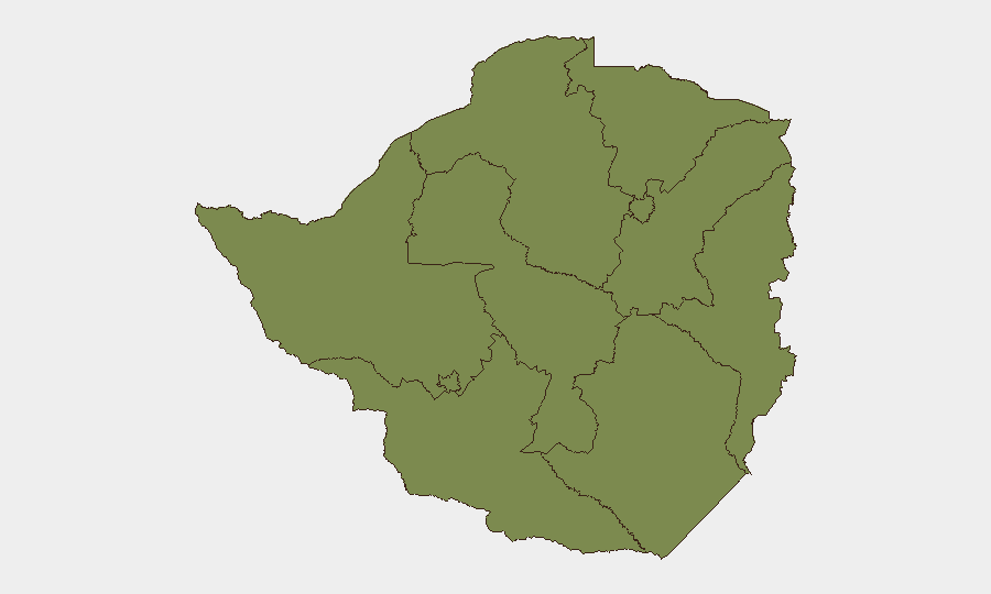
Harare dominates the risk profile with a composite score of 31.2—more than 40 times higher than any other province. This reflects the capital's concentration of government, law enforcement, diplomatic, and media activity; political friction and enforcement operations are inherently more visible and more frequent in Harare. Midlands Province (risk 21.2) is the second-order concern, driven by historical criminality and limited state capacity in peripheral districts. All remaining provinces cluster below risk 8, indicating that geographic dispersion of threat is minimal and that duty-of-care exposure is heavily weighted to the capital and its immediate industrial belt.
How GeoBit Would Assist
Teams with personnel or assets in Harare should deploy AOI Monitoring & Early Warning on the capital's central business district and diplomatic quarters to flag arrests, public gatherings, or state-force movements in near-real time. Intel Sweep combined with multi-language OSINT fusion (ZBC News, ZimLive, X/Twitter feeds, and official ZRP/government channels) will provide rapid corroboration of arrest/detention incidents and public statements, reducing reliance on delayed mainstream reporting. Network & Actor Analysis can map relationships between detainees, enforcement agencies, and U.S. diplomatic staff to assess escalation risk and inform duty-of-care decisions.
7-Day Outlook
The current spike in arrest/detention and public-statement activity suggests mounting U.S.–Zimbabwe diplomatic friction over the next week. Absent new mass-casualty incidents or organized protests, risk is likely to remain concentrated in Harare's law-enforcement and political sphere and should not trigger broad-based travel restrictions outside the capital. Teams should monitor official U.S. Embassy Harare advisories and ZRP statements for any escalation in enforcement intensity or breadth.
Highest-Risk Areas — Ranked
| # | State / Region | Risk |
|---|---|---|
| 1 | Harare | 31.2 |
| 2 | Midlands Province | 21.2 |
| 3 | Mashonaland West Province | 7.4 |
| 4 | Matabeleland South Province | 1.2 |
| 5 | Masvingo Province | 1.2 |
| 6 | Matabeleland North Province | 1.2 |
| 7 | Bulawayo Province | 1.2 |
| 8 | Mashonaland Central Province | 1.2 |
| 9 | Mashonaland East Province | 1.2 |
| 10 | Manicaland Province | 1.2 |
Sources
Previous Daily Briefs
A new Zimbabwe brief is written every day — each with its own risk map and downloadable CSV. Here's the last week; use the calendar to go further back.
📅 Browse every day by calendar →
Highlighted days have a brief. Tap a day for that day's map & analysis, or “csv” for that day's dataset ($5).