Situation Summary
Antigua and Barbuda remains in a low-threat operating environment with no confirmed security incidents or instability indicators in the last 24–48 hours. The composite threat score of 5 and absence of tracked events reflect a stable baseline across the nation-state. Antigua island carries elevated sub-national risk (score 72) relative to Barbuda and Redonda, though this differential reflects underlying structural conditions—including higher population density and associated crime prevalence—rather than acute escalation or emergency. The security trajectory remains stable with no signals of imminent disruption.
Key Developments
- No discrete security incidents confirmed in the last 24–48 hours across Antigua and Barbuda meeting travel, physical-security, or duty-of-care thresholds. Open-source news, official channels, and regional feeds contain no reports of protests, riots, armed conflict, terrorism, infrastructure failure, or major crime events in this window.
- Regional peace and human-security cooperation (OECS multilateral track, June 2026). Sasakawa Peace Foundation and OECS Commission have announced a Memorandum of Understanding to expand peace and human-security initiatives across member states including Antigua and Barbuda—a policy development reflecting institutional investment in stability, not a response to acute threat.
- No U.S. State Department or major international security advisory changes flagged for Antigua and Barbuda in the last 24–48 hours. Routine travel and operational guidance remains in effect; no emergency alerts or incident-response statements issued.
- Routine governance and social coverage dominates local media. Recent reporting from major Antigua news outlets focuses on education, local politics, and development matters; no amplified alerts regarding crime spikes, civil unrest, or security deterioration detected.
Highest-Risk Areas
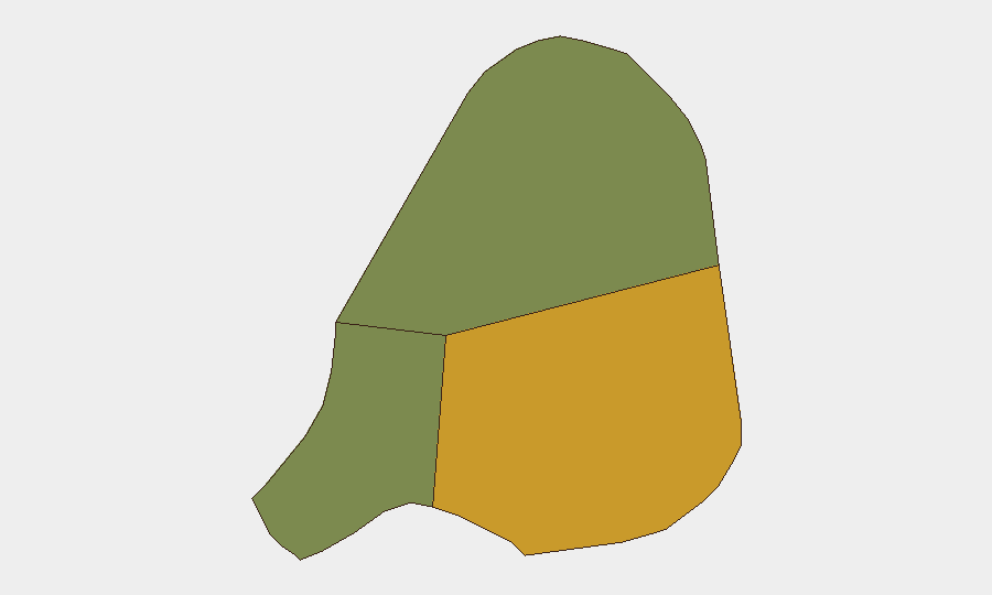
Antigua island (composite risk 72) is the primary driver of sub-national variance, reflecting higher urbanization, population concentration, and associated petty crime and gang activity in St. John's and surrounding parishes. Barbuda (risk 18) and Redonda (risk 8) carry markedly lower exposure. The gap does not indicate imminent escalation on Antigua but rather baseline structural conditions: density, informal settlements, youth unemployment, and transit-corridor exposure to regional narcotics flows. Teams with personnel or assets on Antigua should maintain standard vigilance around property security, travel timing, and area awareness; those on Barbuda and Redonda face substantially lower routine threat.
How GeoBit Would Assist
Corporate security and duty-of-care teams operating in Antigua and Barbuda should deploy AOI Monitoring & Early Warning focused on Antigua's main commercial and residential zones to detect protest activity, crime patterns, or infrastructure disruption in real time. Complementary Intel Sweep and multi-language OSINT (including X/Twitter, local radio, and regional news feeds) enable rapid corroboration of emerging incidents and validate travel/staffing decisions. For longer-term risk management, Routing & Network Analysis can identify alternative transport corridors and safe zones during localized unrest, while Conflict & Military search tracks any spillover from broader Caribbean instability (e.g., gang activity, narcotics trafficking) that may affect operations.
7-Day Outlook
No acute security triggers are visible on the near-term horizon. Antigua and Barbuda is expected to remain in a baseline, low-incident posture over the next seven days absent external shocks (e.g., regional political escalation, hurricane, or major crime event). Teams should continue routine situational awareness and maintain contact with local authorities and peer networks; no immediate protective measures beyond standard due diligence are warranted.
Highest-Risk Areas — Ranked
| # | State / Region | Risk |
|---|---|---|
| 1 | Antigua | 72 |
| 2 | Barbuda | 18 |
| 3 | Redonda | 8 |
Previous Daily Briefs
A new Antigua and Barbuda brief is written every day — each with its own risk map and downloadable CSV. Here's the last week; use the calendar to go further back.
📅 Browse every day by calendar →
Highlighted days have a brief. Tap a day for that day's map & analysis, or “csv” for that day's dataset ($5).