Situation Summary
Bahrain experienced a significant external security shock on June 27, 2026, when Iran launched multiple drones at the kingdom, marking a direct cross-border kinetic event. The Iranian Revolutionary Guard Corps (IRGC) claimed targeting the U.S. Fifth Fleet at Salman Port; U.S. officials reported no casualties or major damage, though air defense systems were activated across the territory. Domestic political tensions remain elevated following June 26 opposition statements and government responses, but the immediate threat environment is now dominated by the Iranian drone strike and potential for further regional escalation.
Key Developments
- Nationwide, June 27, 2026 – Bahrain's Foreign Ministry confirmed the kingdom was targeted by "a number of Iranian drones" and condemned the strike as a sovereignty violation. UAE and Qatar governments independently confirmed the incident through public statements.
- Salman Port / U.S. Fifth Fleet area, June 27, 2026 – IRGC claimed a direct strike on U.S. Fifth Fleet installations; U.S. official sources reported no casualties or major damage, indicating either a failed strike, effective air defense interception, or inflated claim attribution.
- Bahrain airspace, June 27, 2026 – Air defense systems were activated in response to the drone/missile assault; social and news posts documented the defensive posture, though no independent verification of impact locations or damage extent is available in current reporting.
- Capital and Northern Governorates, June 26, 2026 – Opposition parties issued public statements in response to a government statement; an investigation into opposition activities was initiated. No violence reported, but rhetoric suggests continued political friction.
- Muharraq and surrounding areas, June 26, 2026 – Police were involved in a small-arms incident; details remain sparse, but the event underscores baseline law-enforcement activity in high-traffic commercial zones.
Highest-Risk Areas
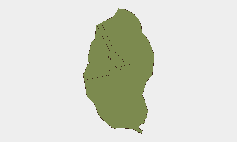
All four governorates (Northern, Capital, Southern, and Muharraq) register identical composite risk scores of 1.8, indicating geographically distributed threat surface rather than isolated hotspots. The Northern Governorate and Capital Governorate—home to government institutions, opposition constituencies, and U.S. military presence—remain primary focal points for both political tension and now direct foreign military targeting. Muharraq's airport and commercial ports elevate maritime and aviation security concerns, while the Southern Governorate's dispersed population and logistics infrastructure present secondary exposure. The June 27 Iranian drone strike suggests that external state actors can penetrate the entire island's airspace, elevating risk across all four zones simultaneously.
How GeoBit Would Assist
Security teams should deploy AOI Monitoring & Early Warning on critical infrastructure clusters (Salman Port, airports, government centers, expatriate residential zones) with persistent alerting for drone/missile signatures and air defense activation. OSINT fusion and corroboration across Iranian state media, IRGC channels (Telegram, X), and regional government statements will provide earlier attribution and intent signals before mainstream reporting. Conflict and Military force-structure and weapons-capability tracking will help teams model the range and payload of Iranian drone systems and anticipate follow-on attack vectors or escalation windows.
7-Day Outlook
Risk of further Iranian strikes remains elevated if regional tensions (including Israeli-Palestinian and broader U.S.-Iran dynamics) do not de-escalate. Bahrain's role as host to the U.S. Fifth Fleet and critical regional maritime chokepoints ensures it remains a secondary target of Iranian messaging and potential kinetic action. Domestic opposition activity may intensify rhetorically in response to the external threat, but near-term violence between government and opposition forces is not the primary risk driver; external state conflict is now the dominant scenario.
Highest-Risk Areas — Ranked
| # | State / Region | Risk |
|---|---|---|
| 1 | Northern Governorate | 1.8 |
| 2 | Capital Governorate | 1.8 |
| 3 | Southern Governorate | 1.8 |
| 4 | Muharraq Governorate | 1.8 |
Sources
Previous Daily Briefs
A new Bahrain brief is written every day — each with its own risk map and downloadable CSV. Here's the last week; use the calendar to go further back.
📅 Browse every day by calendar →
Highlighted days have a brief. Tap a day for that day's map & analysis, or “csv” for that day's dataset ($5).