Situation Summary
Belize remains characterized by endemic gang and organized crime activity, with no confirmed acute security incidents (terrorist attacks, major civil unrest, or destabilizing events) documented in open sources for the 24–48 hours ending 23 June 2026. Belize District and Orange Walk District continue to drive the country's composite threat profile, reflecting persistent small-arms violence and drug-trafficking operations. The overall threat trajectory remains elevated but stable, with no indication of imminent escalation.
Key Developments
- Belize (nationwide) – 23 June 2026: GeoBit event signals flagged a demand and investigation event, though open-source corroboration and specific location data are not available at this time.
- Belize (nationwide) – 23 June 2026: A physical assault incident was registered in the event feed; specific district and context remain unconfirmed in available open reporting.
- Belize (nationwide) – 22 June 2026: A threaten event involving Belize government and a drug trafficker was recorded; specific location and operational details are not detailed in current open-source intelligence.
*Note: Open-source reporting does not currently provide time-stamped confirmation or granular location data for these signals. GeoBit platform events may reflect intelligence feeds not yet publicly disclosed.*
Highest-Risk Areas
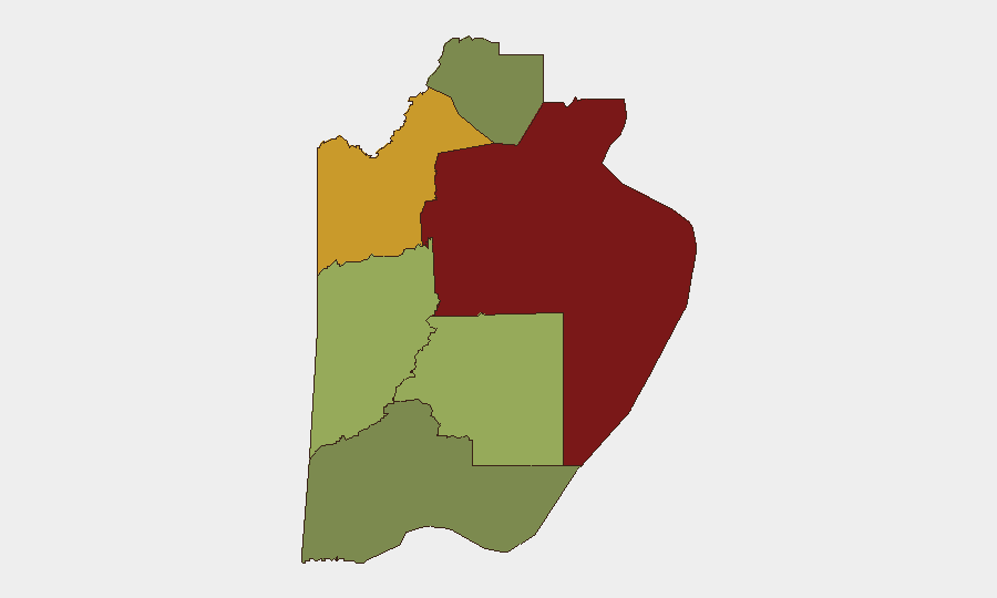
Belize District (risk score 95) and Orange Walk District (risk score 72) account for the majority of national threat exposure, driven primarily by gang territorial disputes, armed robbery, and drug-trafficking logistics. Belize City's Southside remains the single highest-concentration zone for gang violence, armed robbery, sexual assault, and homicide; U.S. government personnel are advised to avoid the area entirely. Cayo District (risk score 58) and Stann Creek District (risk score 48) present moderate but measurable risk. Southern districts (Toledo, Corozal) show lower absolute scores but warrant continued monitoring given their proximity to Central American trafficking corridors and ports of entry.
How GeoBit Would Assist
Corporate security and duty-of-care teams should employ AOI Monitoring & Early Warning to maintain persistent surveillance of high-risk districts (especially Belize City and Orange Walk), with alerts configured for security incidents, violence, or civil unrest. Network & Actor Analysis paired with OSINT fusion (X/Twitter, Telegram, YouTube, and multi-language social media) enables real-time tracking of gang communications, territorial claims, and emerging threats to personnel or assets. Routing & Network Analysis allows security teams to model safe and alternative routes for staff movement, while Risk & Threat Assessment and Conflict & Military mapping support scenario planning and incident response protocols.
7-Day Outlook
No significant shift in the threat baseline is anticipated over the next seven days. Organized crime and gang violence will likely persist at current endemic levels, with sporadic incidents continuing in Belize District and Orange Walk. Security teams should maintain heightened vigilance in southern and western border zones and monitor event signals for any indication of organized-crime escalation, territorial conflict, or drug-trafficking disruption that could trigger localized violence.
Highest-Risk Areas — Ranked
| # | State / Region | Risk |
|---|---|---|
| 1 | Belize District | 95 |
| 2 | Orange Walk District | 72 |
| 3 | Cayo District | 58 |
| 4 | Stann Creek District | 48 |
| 5 | Toledo District | 35 |
| 6 | Corozal District | 22 |
Sources
Previous Daily Briefs
A new Belize brief is written every day — each with its own risk map and downloadable CSV. Here's the last week; use the calendar to go further back.
📅 Browse every day by calendar →
Highlighted days have a brief. Tap a day for that day's map & analysis, or “csv” for that day's dataset ($5).