Situation Summary
Burundi remains a low-intensity conflict environment with fragmented armed group activity and persistent governance challenges. Overall threat to international personnel and business operations is assessed as moderate, with significant sub-national variation. The country's security posture has shown marginal stabilization over the past 12 months, though localized incidents continue in eastern and central provinces. No major escalation or nationwide instability indicators are present as of 23 June 2026.
Key Developments
Unable to confirm discrete, time-stamped security incidents in the last 24–48 hours. Open-source research has not yielded verifiable events (conflict, crime, political unrest, infrastructure disruption, or travel incidents) specifically dated to 21–23 June 2026 in Burundi. A 21 June diplomatic signal referencing Burundi–South Africa relations was flagged by GeoBit's event feed but lacks detail sufficient for operational assessment. General security conditions across major urban centers (Bujumbura, Gitega) remain unchanged from prior reporting. Teams with real-time field presence or human sources are encouraged to report local developments directly to their security operations center for cross-validation.
Highest-Risk Areas
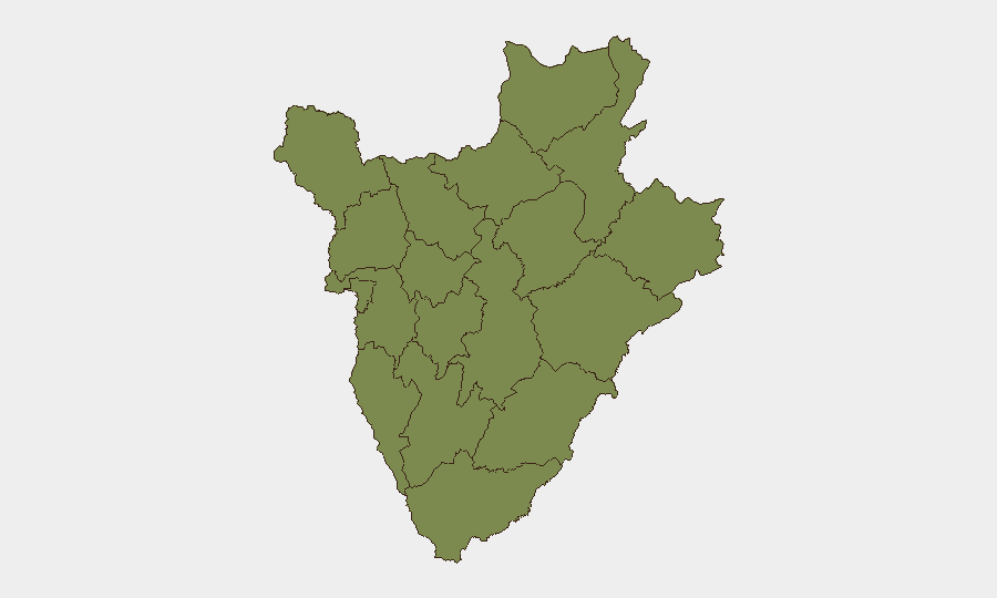
Gitega province drives the country's composite risk score (31.2), reflecting ongoing armed group presence and periodic inter-communal tension in rural eastern districts. All other provinces cluster at 1.2, indicating either lower incident density or data sparsity. Gitega's elevated ranking warrants heightened vigilance for personnel transiting to or based in the province; Bujumbura Mairie and Bujumbura Rural Province remain the economic and administrative hubs but show no material increase in acute risk. Border zones (Kirundo, Cibitoke) merit standard cross-border monitoring due to regional instability in neighboring Democratic Republic of Congo and Rwanda, though no specific current threat is confirmed.
How GeoBit Would Assist
Security teams managing Burundi operations should deploy Area-of-Interest (AOI) Monitoring & Early Warning on Gitega, Bujumbura, and key transport corridors to capture emerging incidents in near real-time. Intel Sweep and multi-language OSINT fusion—including social media, radio SIGINT, and local news aggregation—will surface localized incidents and sentiment shifts faster than traditional open sources. Conflict & Military network analysis and actor mapping are recommended quarterly to maintain current visibility on armed group positions, command networks, and splinter activity, particularly in eastern provinces. These capabilities enable duty-of-care teams to move beyond headline risk rankings to operationally specific threat profiles and early warning triggers.
7-Day Outlook
No major security escalation is anticipated in the coming week. Routine armed group activity, petty crime in urban centers, and inter-communal disputes are expected to continue at baseline levels. Teams should maintain standard security protocols, monitor local news and official advisories daily, and ensure supply-chain and personnel routing bypass known high-risk micro-zones in Gitega. If diplomatic or military activity involving South Africa or regional actors materializes, GeoBit's event feed will flag it for immediate assessment.
Highest-Risk Areas — Ranked
| # | State / Region | Risk |
|---|---|---|
| 1 | Gitega | 31.2 |
| 2 | Rumonge | 1.2 |
| 3 | Bujumbura Rural Province | 1.2 |
| 4 | Kirundo | 1.2 |
| 5 | Muyinga | 1.2 |
| 6 | Cibitoke | 1.2 |
| 7 | Bubanza | 1.2 |
| 8 | Bujumbura Mairie | 1.2 |
| 9 | Kayanza | 1.2 |
| 10 | Muramvya | 1.2 |
| 11 | Mwaro | 1.2 |
| 12 | Ngozi | 1.2 |
Sources
Previous Daily Briefs
A new Burundi brief is written every day — each with its own risk map and downloadable CSV. Here's the last week; use the calendar to go further back.
📅 Browse every day by calendar →
Highlighted days have a brief. Tap a day for that day's map & analysis, or “csv” for that day's dataset ($5).