Situation Summary
Cape Verde remains a low-threat operating environment with no reported security incidents, civil unrest, or infrastructure disruptions in the past 24–48 hours. The country maintains overall stability, ranked among the safest in the West African region. Current focus in open media is routine—World Cup participation and regional cybersecurity engagement—with no indicators of emerging instability or heightened travel risk.
Key Developments
No significant security, conflict, civil unrest, crime surge, political instability, infrastructure disruption, or travel-risk incidents have been detected or reliably reported in Cape Verde within the last 24–48 hours. Open-source intelligence monitoring (news, social media, regional feeds) shows no new event signals attributable to Cape Verde proper; two platform event flags citing "Western Cape vs Mozambican/Mozambique" conflict appear to reference geographic or data-labeling issues unrelated to Cape Verde's security posture and require platform clarification.
Routine activity noted: Cape Verde's national sports and regional cybersecurity participation continue without disruption.
Highest-Risk Areas
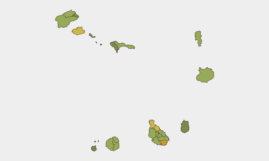
Praia (capital, risk 72) and São Miguel (risk 68) drive the country's composite risk profile, likely reflecting urban density, transient populations, and standard metropolitan crime exposure rather than acute conflict or instability. Secondary urban centers—São Vicente, Tarrafal, and São Filipe—register moderate risk (58–65), consistent with island economies' typical exposure to petty crime, maritime smuggling oversight, and occasional labor disputes. Tourist and commercial hubs (Sal, 48) maintain lower risk ratings. No recent developments have shifted these baseline profiles; rankings reflect structural economic and demographic factors, not emerging threats.
How GeoBit Would Assist
Security teams operating in Cape Verde should employ AOI Monitoring & Early Warning on Praia and secondary urban centers to detect any emerging labor, political, or crime signals with 24–72 hour lead time. Intel Sweep and X/Twitter & Telegram OSINT capabilities provide continuous multi-language monitoring of Portuguese and Cape Verdean sources to surface early indicators of unrest, maritime smuggling, or infrastructure disruption before they affect operations. Routing & Network Analysis supports duty-of-care planning for staff movement between islands and to high-risk districts, identifying secure transit options and backup routes in the event of localized civil unrest or port disruption.
7-Day Outlook
No acute threat escalation is anticipated over the next seven days. Baseline risk will remain low with standard seasonal and economic variables—increased maritime activity during fishing seasons, tourism peaks, and inter-island labor movement. Continued monitoring of Portuguese-language regional media and social platforms is warranted to detect any labor action, political speech, or criminal activity that could ripple across the archipelago.
Highest-Risk Areas — Ranked
| # | State / Region | Risk |
|---|---|---|
| 1 | Praia | 72 |
| 2 | São Miguel | 68 |
| 3 | São Vicente | 65 |
| 4 | Tarrafal | 62 |
| 5 | São Filipe | 58 |
| 6 | Santa Catarina | 58 |
| 7 | Santa Cruz | 55 |
| 8 | Mosteiros | 52 |
| 9 | São Salvador do Mundo | 52 |
| 10 | Ribeira Grande | 50 |
| 11 | Porto Novo | 48 |
| 12 | Sal | 48 |
Sources
Previous Daily Briefs
A new Cape Verde brief is written every day — each with its own risk map and downloadable CSV. Here's the last week; use the calendar to go further back.
📅 Browse every day by calendar →
Highlighted days have a brief. Tap a day for that day's map & analysis, or “csv” for that day's dataset ($5).