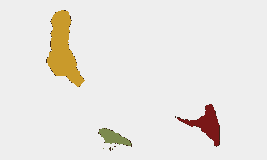
Situation Summary
Comoros remains a low-threat environment globally (rank #191) with no confirmed security incidents recorded in the past 24–48 hours across available open-source monitoring. The archipelago's overall stability is reinforced by an absence of active conflict, terrorism alerts, or civil unrest signals in current intelligence feeds. However, sub-national risk concentration in Anjouan and Grande Comore reflects persistent governance, administrative, and localized instability drivers that warrant continued monitoring for corporate and NGO operations.
Key Developments
- No confirmed security or unrest incidents recorded across Comoros, 16–18 July 2026. Multiple regional conflict and OSINT feeds (including specialist African event monitors and open-source intelligence aggregators) report an absence of new discrete events in the country over the last 24–48 hours.
Highest-Risk Areas
Anjouan (composite risk 88) is the highest-risk island and primary driver of country-level concern, reflecting historical fragmentation, periodic administrative disputes, and lower state capacity. Grande Comore (risk 72) presents secondary but significant risk, likely tied to capital-city governance challenges and port/maritime vulnerabilities. Moheli (risk 35), the smallest and least developed island, carries lower acute risk but remains subject to spillover effects from instability in neighboring Anjouan. Corporate teams should calibrate asset-protection and travel protocols by island rather than treating Comoros as uniform; Anjouan operations and transit warrant higher scrutiny.
How GeoBit Would Assist
For personnel and asset protection in Comoros, security teams should deploy AOI Monitoring & Early Warning on Anjouan and Grande Comore port/capital areas to detect emerging civil unrest, administrative tensions, or port disruptions before they escalate. OSINT fusion (combining X/Twitter sentiment, news feeds, and local radio SIGINT) provides early signals of political friction or crime-trend shifts that formal incident reports may lag. Routing & Network Analysis supports duty-of-care planning by identifying safer travel corridors and alternative transit routes between islands, particularly critical if inter-island ferry or aviation services face disruption.
7-Day Outlook
No acute threat trajectory change is anticipated over the next seven days; Comoros is likely to remain in a stable baseline. However, given the persistent sub-national risk concentration in Anjouan, continued low-level monitoring is warranted to detect any administrative disputes, maritime incidents, or governance tensions that could affect operations or travel.
Report date: 18 July 2026
Data window: 16–18 July 2026
Confidence: Moderate (based on absence of reporting; absence does not preclude small-scale or delayed-reporting incidents)
Highest-Risk Areas — Ranked
| # | State / Region | Risk |
|---|---|---|
| 1 | Anjouan | 88 |
| 2 | Grande Comore | 72 |
| 3 | Moheli | 35 |
Sources
Previous Daily Briefs
A new Comoros brief is written every day — each with its own risk map and downloadable CSV. Here's the last week; use the calendar to go further back.
📅 Browse every day by calendar →
Highlighted days have a brief. Tap a day for that day's map & analysis, or “csv” for that day's dataset ($5).
Atlas — our AI intelligence desk — emails them this snapshot personally. Nothing else, no list.