Situation Summary
Comoros remains a low-frequency threat environment (global rank #149, composite score 8) with no verified domestic security, political, or infrastructure incidents recorded in the past seven days. The archipelago's risk profile is driven primarily by localized governance and administrative fragility in Anjouan, rather than active conflict or organized violence. No material change to the baseline security posture is evident from current reporting.
Key Developments
No discrete security events within Comoros territory were verified for 2026-09-01 through 2026-09-08.
Maritime context (external to Comoros): A Comoros-flagged tanker, the *M/T Kylo*, was reported destroyed in the Gulf of Oman on 2026-09-06 following crew abandonment, consistent with ongoing regional maritime risk in the Strait of Hormuz area. This incident does not reflect instability in Comoros itself but underscores the exposure of Comoros-registered vessels to broader Red Sea/Gulf of Oman shipping volatility.
Highest-Risk Areas
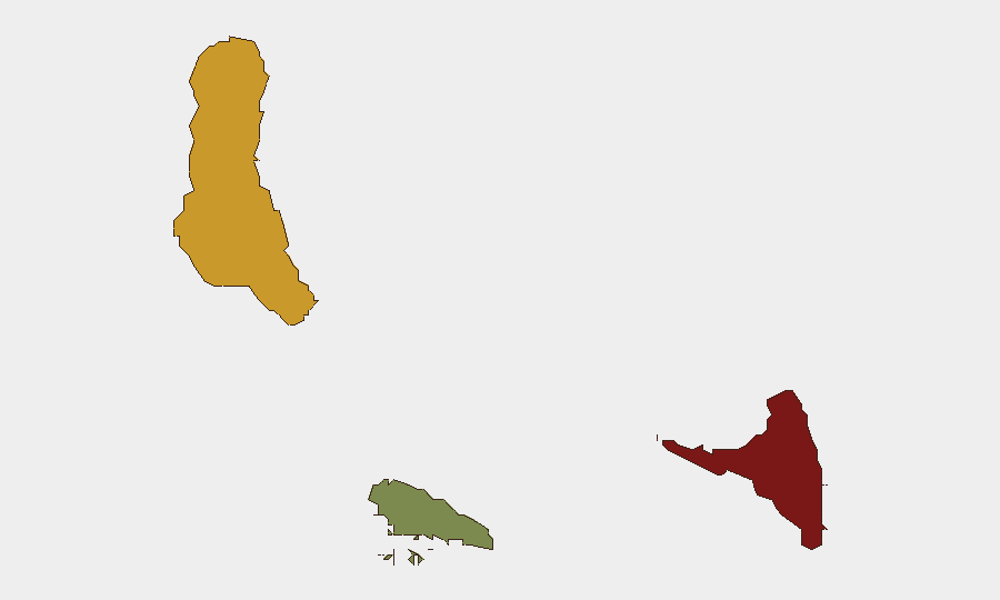
Anjouan (composite risk score 88) represents the primary domestic concern, driven by persistent administrative dysfunction and limited central authority reach—a chronic condition rather than an acute crisis. Grande Comore (score 72) carries secondary risk, likely reflecting the capital's role as a focal point for political and economic pressures. Moheli (score 35) remains substantially lower-risk. The gap between Anjouan and other islands reflects the island's history of separatist episodes and weak institutional capacity; monitoring should focus on governance indicators and intercommunal tensions rather than imminent organized violence.
How GeoBit Would Assist
For organizations with personnel or assets in Comoros, GeoBit's AOI Monitoring & Early Warning capability would provide persistent surveillance of Anjouan and Grande Comore with alerting on political, administrative, or security developments before they escalate. OSINT fusion (multi-language social media, X/Telegram, and local news aggregation) would surface community-level tensions or government announcements that may not immediately reach international wires. Risk & Threat Assessment workflows would allow security teams to track changes in the sub-national risk profile and adjust duty-of-care protocols accordingly.
7-Day Outlook
No material deterioration is anticipated in the near term. Comoros's risk profile remains stable and low-frequency; the absence of reporting in the current window is consistent with the baseline. Teams should continue standard monitoring protocols while remaining alert to any resurgence of Anjouan-specific governance disputes or economic pressures that could drive localized instability.
Note: This brief reflects a period of limited event activity. GeoBit recommends maintaining a persistent AOI watch on Anjouan and Grande Comore to capture early signals of administrative or political stress that might not generate immediate media coverage.
Highest-Risk Areas — Ranked
| # | State / Region | Risk |
|---|---|---|
| 1 | Anjouan | 88 |
| 2 | Grande Comore | 72 |
| 3 | Moheli | 35 |
Sources
Previous Weekly Briefs
A new Comoros brief is written every Monday, covering the week — each with its own risk map and downloadable CSV. Use the calendar to go further back.
- September 1, 2026
- August 30, 2026
- August 28, 2026
- August 26, 2026
- August 24, 2026
- August 22, 2026
- August 20, 2026
📅 Browse past briefs by calendar →
Highlighted days have a brief. Tap a day for that day's map & analysis, or “csv” for that day's dataset ($5).
Atlas — our AI intelligence desk — emails them this snapshot personally. Nothing else, no list.