Situation Summary
Dominican Republic remains a low-threat environment globally (composite threat score 13; rank #null) with no verified security incidents, civil unrest, crime escalations, or political instability corroborated in the last 24–48 hours. Web research and open-source monitoring have not surfaced travel-risk developments, infrastructure disruptions, or conflict indicators in this reporting period. La Vega province shows elevated composite risk (31.3) relative to other regions, though the underlying drivers require clarification against current conditions. The overall security posture is stable with no trajectory change evident from available signals.
Key Developments
No verified incidents meeting freshness and severity criteria were identified in the last 24–48 hours. The following activity was recorded but does not constitute a security event:
- 2026-06-15 · Dominican Republic / Multi-stakeholder. Diplomatic statement exchange with Switzerland (event type: Reject). Not a security or travel-risk incident.
- 2026-06-14 · Dominican Republic / National. Public statement issued. Content and context not corroborated as security-relevant.
- 2026-06-13 · Santiago de los Caballeros / Infrastructure. Cybersecurity services award announced for monorail project. Routine procurement activity; no disruption or threat indicated.
- 2026-06-13 · Dominican Republic / Multi-stakeholder. Public statements and diplomatic rejects involving Dominican Republic entities. No civil unrest or conflict indicators.
- Recent (undated) · Punta Cana region / Natural hazard. Seismic event M 3.1, 46 km NE of Punta Cana. Low magnitude; no reported damage or disruption.
Highest-Risk Areas
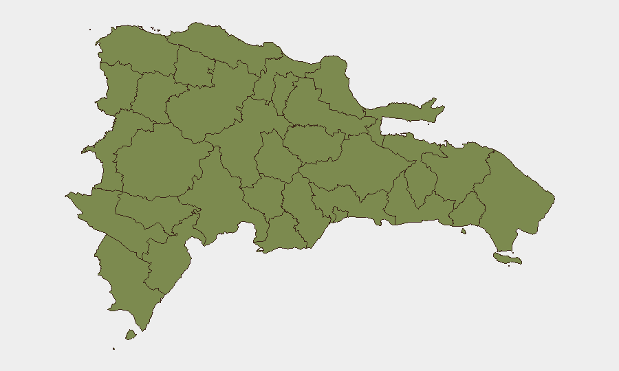
La Vega province is the single highest-risk sub-national area with a composite risk score of 31.3—substantially above the remaining 11 tracked provinces, which cluster at 1.3. The source and nature of La Vega's elevated risk require deeper investigation; GeoBit's sub-national ranking does not specify the underlying drivers (crime, political instability, infrastructure vulnerability, or other factors). All other monitored provinces—including Santiago (home to the capital region), Puerto Plata, and border zones (Dajabón, Elías Piña, Independencia)—show uniform baseline risk, suggesting either stable conditions or limited recent event signals in those areas.
How GeoBit Would Assist
Corporate security teams with personnel or assets in Dominican Republic should deploy AOI Monitoring & Early Warning on La Vega province to establish persistent watch with alerting for emerging incidents, combined with Intel Sweep and multi-language OSINT (X/Twitter, news, local media) to capture real-time unrest, crime clusters, or infrastructure disruptions that may affect business continuity. GIS & Spatial Analysis linked to the sub-national risk ranking would enable mapping of specific threats by location within high-risk zones, supporting duty-of-care route planning and asset positioning decisions.
7-Day Outlook
No imminent security deterioration is signaled by available intelligence. Conditions in Dominican Republic are expected to remain stable over the coming week absent new incident drivers. Duty-of-care teams should maintain baseline awareness of La Vega province and establish standing monitoring alerts to capture any escalation in that region before it affects operations.
Highest-Risk Areas — Ranked
| # | State / Region | Risk |
|---|---|---|
| 1 | La Vega | 31.3 |
| 2 | Monte Cristi | 1.3 |
| 3 | Dajabón | 1.3 |
| 4 | Santiago Rodríguez | 1.3 |
| 5 | Valverde | 1.3 |
| 6 | Puerto Plata | 1.3 |
| 7 | Santiago | 1.3 |
| 8 | Espaillat | 1.3 |
| 9 | Hermanas Mirabal | 1.3 |
| 10 | Elías Piña | 1.3 |
| 11 | San Juan | 1.3 |
| 12 | Independencia Province | 1.3 |
Sources
Previous Daily Briefs
A new Dominican Republic brief is written every day — each with its own risk map and downloadable CSV. Here's the last week; use the calendar to go further back.
📅 Browse every day by calendar →
Highlighted days have a brief. Tap a day for that day's map & analysis, or “csv” for that day's dataset ($5).