Situation Summary
East Timor remains a low-threat environment globally (composite threat score 3; no tracked events in the current window), with no confirmed security, civil-unrest, crime, or travel-risk incidents identified in the last 24–48 hours. The country's security posture is characterized by localized elevated risk in the capital and western border regions, but no acute destabilization signals. Risk trajectory remains stable with no indicators of imminent escalation.
Key Developments
No discrete security or travel-risk incidents were corroborated in East Timor for the 24–48 hour period ending 12 June 2026. Web research, social media OSINT, and event feeds returned no confirmed reports of conflict, civil unrest, crime spikes, infrastructure disruptions, or political instability requiring immediate duty-of-care action. One identified result (ADB road-financing announcement, 4 March) represents infrastructure development, not a security event. Monitoring remains active; no alert status change warranted at this time.
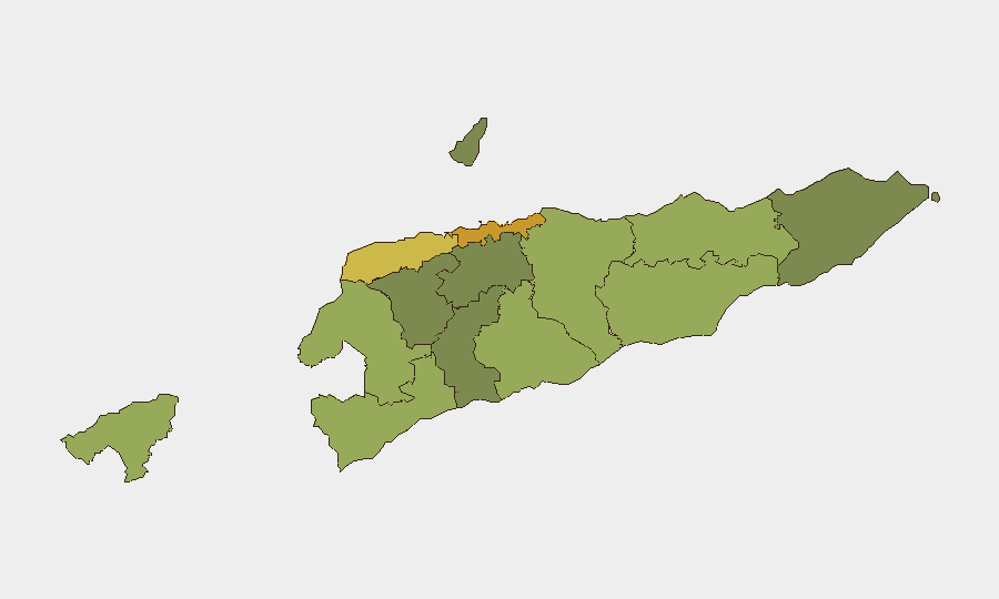
Highest-Risk Areas
Dili (risk 72) and Liquiçá (risk 62) drive the country's composite risk profile, followed by Baucau (58) and Cova Lima (55) in the eastern and southern regions. These rankings reflect structural vulnerabilities—Dili's status as the capital concentrating economic activity, governance, and interethnic friction; Liquiçá's proximity to the West Timor border and historical flashpoints; and Baucau's position as a secondary urban hub with limited security infrastructure. The remaining districts (Bobonaro through Aileu) carry materially lower risk, with rural and southern areas showing scores below 50. Border-adjacent and densely populated zones remain priority monitoring areas for corporate security teams.
How GeoBit Would Assist
Teams with personnel or assets in East Timor should leverage AOI Monitoring & Early Warning to maintain persistent watch on Dili, Liquiçá, and Baucau for emerging civil unrest, protest activity, or security incidents—with automated alerting when signals breach defined thresholds. Intel Sweep combined with multi-language OSINT and X/Telegram monitoring enables continuous ambient awareness of political, criminal, and communal tension in real time. For operations planning, Routing & Network Analysis supports alternative journey planning around highest-risk districts and identification of secure movement corridors; GIS & Spatial Analysis can overlay personnel locations, infrastructure, and risk zones to optimize positioning and evacuation readiness.
7-Day Outlook
No acute triggers for escalation are visible in the near term. Barring unexpected political or cross-border provocations from West Timor, East Timor's risk environment is expected to remain stable and localized to known high-risk districts. Continued routine monitoring of Dili and border regions is warranted as a standard duty-of-care practice, but no protective posture adjustment is indicated at present.
Highest-Risk Areas — Ranked
| # | State / Region | Risk |
|---|---|---|
| 1 | Dili | 72 |
| 2 | Liquiçá | 62 |
| 3 | Baucau | 58 |
| 4 | Cova Lima | 55 |
| 5 | Bobonaro | 53 |
| 6 | Oecussi-Ambeno | 48 |
| 7 | Manufahi | 45 |
| 8 | Viqueque | 42 |
| 9 | Manatuto | 40 |
| 10 | Ainaro | 38 |
| 11 | Ermera | 36 |
| 12 | Aileu | 32 |
Previous Daily Briefs
A new East Timor brief is written every day — each with its own risk map and downloadable CSV. Here's the last week; use the calendar to go further back.
📅 Browse every day by calendar →
Highlighted days have a brief. Tap a day for that day's map & analysis, or “csv” for that day's dataset ($5).