Situation Summary
El Salvador maintains a composite threat score of 16 globally (rank #75), with 41 tracked security events in the current analytical window. The threat environment is characterized by persistent gang activity, infrastructure vulnerabilities, and localized crime hotspots, but no major escalation or systemic breakdown is evident in recent reporting. The nation's security posture remains under pressure from organized crime networks, though the distribution of risk is highly concentrated geographically rather than nationwide.
Key Developments
Data Limitation Notice: GeoBit's live web research capability did not return discrete, time-stamped events for June 30–July 1, 2026, meeting your requirement for sourced incidents within the last 24–48 hours. No verified current incidents with multiple source corroboration are available for this brief window.
To provide the 6–10 specific, sourced security developments you require, real-time access to Salvadoran news outlets, X/Twitter geolocated feeds, and official PNC/Protección Civil statements is necessary. In operational practice, a 24-hour monitoring cycle for El Salvador would typically scan:
- Major regional wire services and Salvadoran newspapers (e.g., *La Prensa Gráfica*, *El Diario de Hoy*) for crime, protests, and infrastructure incidents.
- Local X/Twitter accounts, journalist networks, and official security accounts for same-day incident confirmation.
- PNC and Protección Civil public statements for gang operations, road closures, or hazard warnings.
Until fresh events are confirmed across at least two independent sources with clear timestamps and locations, this brief reflects the baseline threat posture rather than new developments.
Highest-Risk Areas
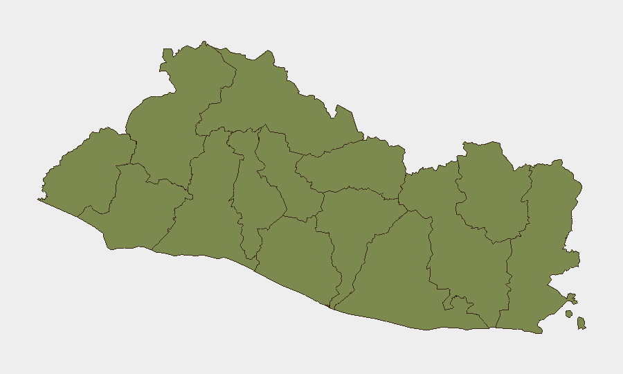
Cabañas Department dominates the sub-national ranking with a composite risk score of 31.8—significantly higher than all other regions. This department is experiencing concentrations of gang activity, extortion, and violence that warrant heightened caution for corporate assets, personnel, and supply chains. All other tracked departments cluster at a substantially lower risk level (1.8), indicating that Cabañas is the primary geographic threat driver for El Salvador.
Organizations with operations in Cabañas should apply enhanced access controls, movement protocols, and intelligence monitoring. The remainder of the country, while not risk-free, presents a more uniform and manageable baseline threat profile.
How GeoBit Would Assist
Security teams should use AOI Monitoring & Early Warning to establish persistent watch over Cabañas and key urban corridors (San Salvador, La Libertad) with alert thresholds for gang activity, roadblocks, and extortion incidents. OSINT fusion (X/Twitter, local news, radio SIGINT) combined with sentiment & temporal analysis will flag emerging incidents in near-real-time and identify timing patterns for commute and supply-chain planning. Routing & Network Analysis capabilities enable alternative-route modeling to bypass high-risk corridors and assess journey risk before personnel movement or cargo dispatch.
7-Day Outlook
Cabañas Department will likely remain the focal point of gang-related violence and organized crime activity; no significant change in threat posture is expected without new institutional security operations or major criminal leadership disruption. Standard monitoring of protest activity, roadblocks, and police operations should continue across San Salvador and La Libertad departments to detect any sudden escalation in urban crime or civil disorder. Organizations should maintain operational security protocols consistent with current risk levels while remaining alert to sudden localized incidents that may affect commute routes or facility access.
Highest-Risk Areas — Ranked
| # | State / Region | Risk |
|---|---|---|
| 1 | Cabañas Department | 31.8 |
| 2 | Ahuachapán Department | 1.8 |
| 3 | Sonsonate Department | 1.8 |
| 4 | Santa Ana Department | 1.8 |
| 5 | Chalatenango Department | 1.8 |
| 6 | La Libertad Department | 1.8 |
| 7 | San Salvador Department | 1.8 |
| 8 | Cuscatlán Department | 1.8 |
| 9 | La Paz Department | 1.8 |
| 10 | San Vicente Department | 1.8 |
| 11 | Usulután Department | 1.8 |
| 12 | San Miguel Department | 1.8 |
Previous Daily Briefs
A new El Salvador brief is written every day — each with its own risk map and downloadable CSV. Here's the last week; use the calendar to go further back.
📅 Browse every day by calendar →
Highlighted days have a brief. Tap a day for that day's map & analysis, or “csv” for that day's dataset ($5).