Situation Summary
Eritrea remains a low-threat environment globally (composite score 2), with no independently confirmed security incidents or civil unrest reported in the last 24–48 hours. However, diplomatic friction with Ethiopia has been signaled in recent event data (June 21), reflecting persistent regional tensions along the Eritrea–Ethiopia border corridor. Risk is heavily concentrated in border and western regions; the capital and central highlands present minimal acute threat. The security environment reflects Eritrea's authoritarian governance model and isolation rather than active conflict or widespread instability.
Key Developments
No specific, independently verified security incidents or civil unrest events have been identified in Eritrea within the last 24–48 hours from reliable open sources.
Regional context (for situational awareness, not current incident): Event signals dated June 21 reference Ethiopia–Eritrea diplomatic friction, likely tied to longstanding border demarcation disputes and regional geopolitical maneuvering. However, open web research has not confirmed time-stamped, location-specific incidents in Eritrean territory corresponding to these signals. Any escalation remains at the diplomatic and signaling level; no reports of military mobilization, cross-border incursions, or civilian impact within the reporting window.
Security teams are advised that the absence of reported incidents does not indicate a security vacuum—Eritrea's closed information environment and limited independent media mean that localized events may go unreported for days or weeks.
Highest-Risk Areas
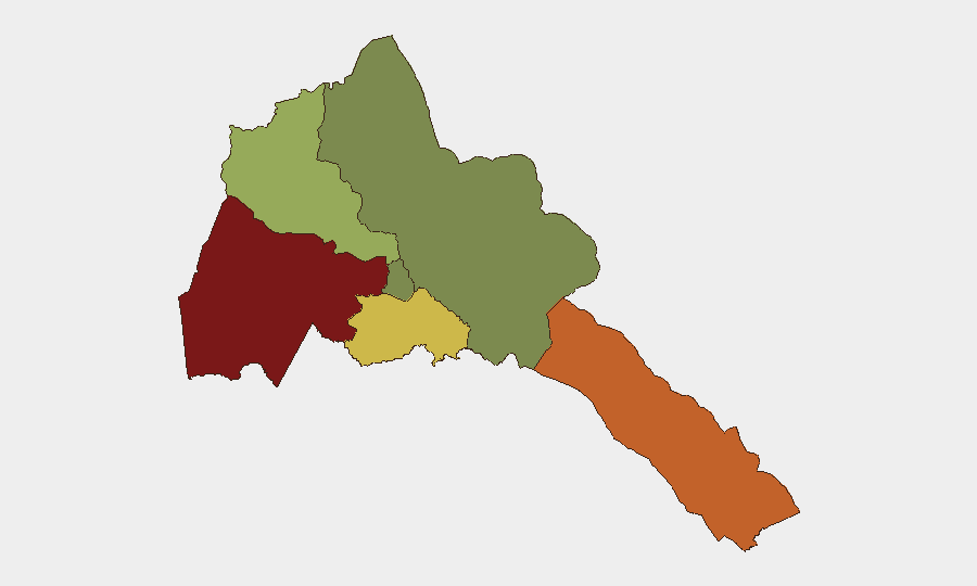
Gash-Barka (risk 92) and the Southern Red Sea Region (risk 75) dominate the threat landscape, driven by proximity to Sudan and Ethiopia, limited state capacity, and historical smuggling and cross-border activity. Debub Region (risk 68) faces secondary exposure due to its border position with Ethiopia and socioeconomic stress. By contrast, Maekel Region (risk 18)—home to the capital Asmara—and the Northern Red Sea Region (risk 0) present minimal acute risk. Western and southern peripheries reflect Eritrea's weakest governance reach and highest exposure to regional spillover.
How GeoBit Would Assist
Security teams operating in or with interests in Eritrea should prioritize AOI Monitoring & Early Warning on Gash-Barka and the Southern Red Sea Region to detect border crossings, military activity, or humanitarian disruption before media confirmation. Intel Sweep and multi-language OSINT fusion (including Telegram and regional media) would provide earlier signal of diplomatic escalation or localized incidents than public reporting alone. Routing & Network Analysis enables identification of safer internal transit corridors and real-time alternative planning if border zones become volatile.
7-Day Outlook
Eritrea's security trajectory remains stable in the near term, with no indicators of imminent civil unrest or major military action. Ethiopia–Eritrea tensions will likely persist at the diplomatic and intelligence level; any military escalation would manifest first in border region activity (Gash-Barka, Debub) before broader impact. Organizations should maintain baseline monitoring of border zones and maintain contingency protocols for staff in western and southern regions, but no elevation of alert status is warranted at present.
Highest-Risk Areas — Ranked
| # | State / Region | Risk |
|---|---|---|
| 1 | Gash-Barka | 92 |
| 2 | Southern Red Sea Region | 75 |
| 3 | Debub Region | 68 |
| 4 | Anseba | 55 |
| 5 | Maekel Region | 18 |
| 6 | Northen Red Sea Region | 0 |
Previous Daily Briefs
A new Eritrea brief is written every day — each with its own risk map and downloadable CSV. Here's the last week; use the calendar to go further back.
📅 Browse every day by calendar →
Highlighted days have a brief. Tap a day for that day's map & analysis, or “csv” for that day's dataset ($5).