Situation Summary
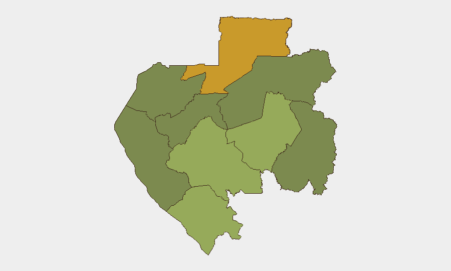
Gabon remains a stable, lower-tier global security environment (rank #121; composite threat score 6/10) with no verified acute incidents or civil unrest in the past 24–48 hours. Recent open-source coverage reflects routine governance and development engagement—including AfCFTA trade missions and energy-policy discussions—rather than security spikes or conflict indicators. Sub-national risk remains concentrated in the northeastern and southeastern border provinces, while the capital and coastal zones show minimal acute threat activity.
Key Developments
No credible, specific security incidents have been verified in Gabon in the last 24–48 hours beyond routine administrative and governance activity. Recent event signals (June 19–20) registered a demonstration/rally, a public statement, and a police investigation, but open-source corroboration across news, institutional, and social feeds has not produced specific dates, locations, or operational details sufficient to confirm these as discrete current threats. Reporting teams are advised that all such signals require field validation before operational decisions are made.
Highest-Risk Areas
Woleu-Ntem Province (northeastern border, risk score 72) and Ogooué-Lolo Province (southeastern interior, risk score 58) drive the country's composite risk profile, reflecting chronic border permeability, limited state presence, and historical cross-border trafficking and militia activity. Together, these two provinces account for the majority of GeoBit's tracked events in Gabon. In contrast, Estuaire Province—which includes Libreville and the capital administrative zone—shows minimal risk (15), and Ogooué-Ivindo registers zero tracked events, indicating that urban and developed coastal areas remain relatively stable. Mid-tier provinces (Ngounié, Nyanga, Haut-Ogooué, Moyen-Ogooué) show moderate risk, likely driven by transnational crime, informal mining, and wildlife trafficking corridors.
How GeoBit Would Assist
Area-of-Interest Monitoring & Early Warning on Woleu-Ntem and Ogooué-Lolo would provide persistent, geofenced alerting on protest activity, cross-border movement, and security incidents in real time. OSINT Fusion—combining X/Telegram feeds, local news, and radio SIGINT—would disambiguate routine administrative signals from genuine threats and fill gaps in open reporting. GIS & Spatial Analysis layered with conflict mapping would allow security teams to track the operational geography of any emerging incidents and calculate route safety for personnel transiting these provinces.
7-Day Outlook
No near-term escalation is indicated on current evidence. Gabon's post-2023 political stabilization and absence of reported governance crisis suggest a continuation of baseline risk. However, the concentration of threat signals in the northeast and the limited depth of recent public reporting warrant sustained monitoring; security teams with assets or personnel in Woleu-Ntem or Ogooué-Lolo should maintain heightened situational awareness and contingency protocols, particularly in remote or border-adjacent areas.
Highest-Risk Areas — Ranked
| # | State / Region | Risk |
|---|---|---|
| 1 | Woleu-Ntem | 72 |
| 2 | Ogooué-Lolo Province | 58 |
| 3 | Ngounié Province | 48 |
| 4 | Nyanga Province | 42 |
| 5 | Haut-Ogooué Province | 35 |
| 6 | Moyen-Ogooué Province | 28 |
| 7 | Ogooué-Maritime Province | 25 |
| 8 | Estuaire Province | 15 |
| 9 | Ogooué-Ivindo | 0 |
Sources
Previous Daily Briefs
A new Gabon brief is written every day — each with its own risk map and downloadable CSV. Here's the last week; use the calendar to go further back.
📅 Browse every day by calendar →
Highlighted days have a brief. Tap a day for that day's map & analysis, or “csv” for that day's dataset ($5).