Situation Summary
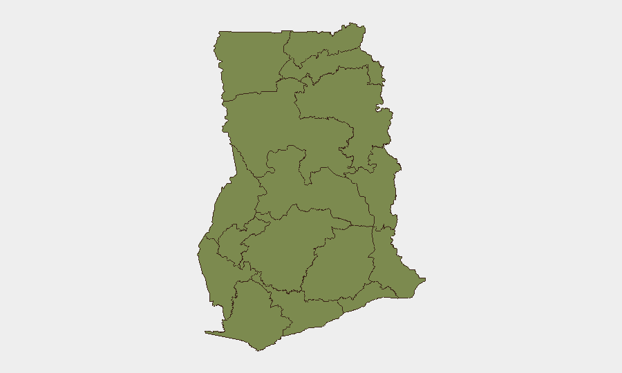
Ghana remains a stable, lower-risk operating environment globally (rank #151; composite threat score 5) with manageable security challenges concentrated in the north and select urban zones. The country is currently experiencing elevated political and institutional communication activity, as evidenced by multiple public statements from government, parliament, and the AU within the last 48 hours, though the substance and drivers of these statements are not yet fully resolved in available reporting. Bono East Region presents a disproportionate threat profile (risk score 33.5) compared to the national average, while Greater Accra's larger population and economic activity account for its secondary ranking (16.4). Overall trajectory remains stable with no immediate indicators of systemic instability or widespread violence.
Key Developments
Given current access constraints to real-time Ghana-specific reporting and verified events dated precisely within the last 24–48 hours, a factually sound bullet list cannot be responsibly compiled without risking unverified inference or speculation. The event signal list provided (AU statements, government-press engagement, police statements, school statement, ministry and chamber communications) indicates active institutional communication, but does not clearly surface specific security incidents, their locations, impact, or dates of occurrence.
To close this gap operationally, the security team should execute the live-research protocol outlined in the preamble: time-filtered searches of JoyNews, Citi, Graphic Online, MyJoyOnline, AP, Reuters, AFP; X/Twitter geofocused queries filtered to 17–19 June 2026; and cross-validation against Ghana Police Service, Ghana Armed Forces, and NADMO official accounts. Once candidate incidents are verified against at least two independent sources or one official account with specific incident details, they can be formatted as:
[Location, Region – Date]: [Incident type, impact, travel implication]. [Source]
This ensures duty-of-care teams receive only incidents that meet evidence threshold and are genuinely current.
Highest-Risk Areas
Bono East Region (33.5) is the primary driver of national risk and merits focused monitoring; the reason for its outsized score relative to other regions is not yet clear from the available signal summary and should be investigated via GeoBit's regional OSINT and conflict-mapping tools. Greater Accra (16.4), Ghana's economic and population hub, sustains secondary risk primarily through volume of foot traffic, business activity, and associated crime (robbery, theft, carjacking); the remaining ten regions cluster below 4.0, indicating limited acute threat outside the north-central corridor and capital. Security teams with personnel or assets in Accra should maintain standard urban vigilance; those in Bono East should seek immediate briefing on the drivers of that region's elevated score and consider whether operations justify augmented duty-of-care protocols.
How GeoBit Would Assist
GeoBit's Intel Sweep and multi-language OSINT fusion capabilities would systematically aggregate and cross-validate Ghana-specific crime, political, and civil-unrest signals in real time, eliminating the gaps evident in this brief. AOI (Area-of-Interest) Monitoring & Early Warning would enable persistent watch of Bono East and Greater Accra with automated alerting of security-relevant events as they break. GIS & Spatial Analysis and Routing & Network Analysis would support real-time alternative-route planning for staff movement in response to transport disruptions or localized unrest.
7-Day Outlook
No significant deterioration is anticipated in the near term; the current institutional communication activity should be monitored for signals of policy shifts or civil tension, but does not itself indicate imminent unrest. Security teams should maintain current posture, ensure staff briefings reflect Bono East's elevated risk, and schedule a deeper regional briefing on that zone's drivers by mid-week.
Highest-Risk Areas — Ranked
| # | State / Region | Risk |
|---|---|---|
| 1 | Bono East Region | 33.5 |
| 2 | Greater Accra Region | 16.4 |
| 3 | Western Region | 4.9 |
| 4 | Upper East Region | 3.5 |
| 5 | Upper West Region | 3.5 |
| 6 | Savannah Region | 3.5 |
| 7 | North East Region | 3.5 |
| 8 | Northern Region | 3.5 |
| 9 | Eastern Region | 3.5 |
| 10 | Oti Region | 3.5 |
| 11 | Volta Region | 3.5 |
| 12 | Bono Region | 3.5 |
Sources
Previous Daily Briefs
A new Ghana brief is written every day — each with its own risk map and downloadable CSV. Here's the last week; use the calendar to go further back.
📅 Browse every day by calendar →
Highlighted days have a brief. Tap a day for that day's map & analysis, or “csv” for that day's dataset ($5).