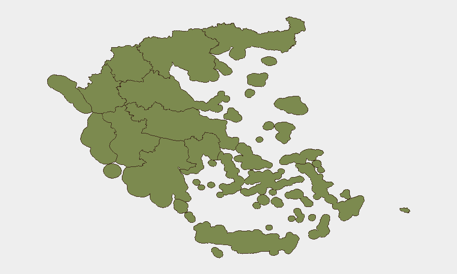
Situation Summary
Greece remains a moderate-risk environment (global rank #140, composite score 7) with 89 tracked security events. The country faces a complex mixture of labour unrest, agricultural sector protests, and ongoing political tensions—particularly around Cyprus relations and EU engagement. Threat intensity remains below historical peaks, but several developments in the past 48 hours suggest rising pressure in Central Greece and Central Macedonia, the two highest-risk regions.
Key Developments
- Central Greece · 2026-06-22 – Unspecified threat reported; context and scope not yet clarified in available reporting. Monitor official Hellenic Police (ΕΛ.ΑΣ.) statements for details.
- Cyprus–Athens · 2026-06-21 – Public statement issued by Nicosia; bilateral tensions remain elevated. Implications for maritime/energy-sector operations in the Aegean require monitoring.
- Nationwide · 2026-06-21 – Opposition appeals to government on unspecified issue; political friction ongoing but no immediate civil unrest reported.
- Refugee-related statement · 2026-06-21 – Public statement from refugee advocacy or affected communities. No specific incident location or scale confirmed; context suggests sustained migration/asylum dialogue.
- Nationwide · 2026-06-23 – Police arrest/detention action reported; specific charges and location not yet detailed. Standard follow-up monitoring advised.
- Farmer demonstrations · 2026-06-23 – Agricultural sector protest activity confirmed; locations and scale not yet specified. Farmer unrest has historically caused transport disruptions and blockades, particularly affecting road access to Central Macedonia and Attica.
- Worker demonstrations · 2026-06-22 – Labour movement rally activity reported; sector and location not specified. Recent Greek labour actions have centred on wages, pensions, and public-sector conditions.
- Scientific investigation · 2026-06-22 – Investigation into scientist-related matter; no security implication apparent unless connected to espionage or sanctions-evasion concerns.
Highest-Risk Areas
Central Greece and Central Macedonia dominate the risk landscape, with composite scores of 31.4 and 22 respectively, reflecting ongoing labour disputes, agricultural unrest, and logistical chokepoints. Attica (Athens and surroundings, score 17.3) hosts the capital, government, major ports, and international media, making it a focal point for political demonstrations and coordinated action. The Aegean islands (South and Northern Aegean, scores 11.7 and 9.1) carry elevated risk due to proximity to Turkey, ongoing Cyprus-related tensions, and maritime-security concerns. Lower-risk zones (Peloponnese, Western regions, Thessaly, and the Holy Mountain) currently show minimal threat activity.
How GeoBit Would Assist
OSINT & Event Monitoring – Intel Sweep, multi-language X/Twitter and Telegram OSINT, and multi-outlet news aggregation would provide real-time confirmation of protest locations, scale, and sectoral drivers (labour, agricultural, political). Geospatial Analysis – GIS mapping and AOI (Area of Interest) monitoring would track demonstration hotspots, roadblocks, and transport chokepoints in Central Greece and Central Macedonia, enabling duty-of-care teams to route personnel and supply chains safely. Early Warning – Sentiment and temporal analysis of social media and opposition statements would provide 24–72-hour lead time on planned actions, while network analysis of farmer and labour unions would identify escalation risk before mass mobilisation.
7-Day Outlook
Labour and agricultural protest activity is likely to intensify through late June, driven by seasonal wage negotiations and EU subsidy cycles. Farmer blockades may expand into transport corridors, particularly affecting access to Thessaloniki and ports. Cyprus-related political rhetoric will likely persist but remains below military-escalation thresholds; maritime-sector operations should maintain elevated situational awareness.
Highest-Risk Areas — Ranked
| # | State / Region | Risk |
|---|---|---|
| 1 | Central Greece | 31.4 |
| 2 | Central Macedonia | 22 |
| 3 | Attica | 17.3 |
| 4 | South Aegean | 11.7 |
| 5 | Northern Aegean | 9.1 |
| 6 | Crete | 6.5 |
| 7 | Peloponnese Region | 4 |
| 8 | Western Macedonia | 1.4 |
| 9 | Eastern Macedonia and Thrace | 1.4 |
| 10 | Western Greece | 1.4 |
| 11 | Thessaly | 1.4 |
| 12 | Autonomous Monastic State of the Holy Mountain | 1.4 |
Sources
Previous Daily Briefs
A new Greece brief is written every day — each with its own risk map and downloadable CSV. Here's the last week; use the calendar to go further back.
📅 Browse every day by calendar →
Highlighted days have a brief. Tap a day for that day's map & analysis, or “csv” for that day's dataset ($5).