Situation Summary
Grenada's security environment remains stable with no verified major incidents, armed conflict, terrorism, civil unrest, or infrastructure disruption in the past 24–48 hours. The composite threat score of 12 reflects a low-risk operating environment for corporate personnel and assets. Routine law-enforcement and administrative activity continues, with the exception of an active missing-person investigation into a U.S. visitor last seen near Grand Anse Beach on 22 July—a case now in its second week with no credible reports of foul play or broader public-safety impact.
Key Developments
- No new major security incidents reported in Grenada, 26–28 July. Open-source regional security monitoring, local media cross-checks, and national threat assessments confirm routine conditions and no acute travel-risk changes in the assessment window.
- Missing-person case remains active but contained. Search for Elizabeth "Liz" Waddell (U.S. national, 44) last seen near Grand Anse Beach, St. George's, on 22 July continues to involve police, divers, and volunteers; no new leads or escalations reported in the past 24–48 hours.
- Eastern Caribbean region shows no spillover instability. Neighboring territories (Saint Vincent and the Grenadines) report no major security incidents, armed conflict, or organized unrest in the past 24–48 hours, reducing risk of regional contagion.
- Routine fraud and cyber-scam warnings issued by local police. General public advisories encourage reporting of fraud and cyber incidents; no indication of coordinated campaigns or targeted attacks on corporate entities in the current window.
- No verified armed-conflict activity detected. Despite signal noise in the GeoBit event feed, credible open-source verification found no confirmed kinetic incidents, military mobilization, or foreign-force presence affecting Grenada in the past 24–48 hours.
Highest-Risk Areas
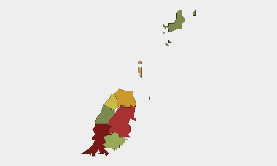
Saint George (risk 92) and Saint Andrew (risk 78) drive the sub-national risk ranking and warrant heightened monitoring. Saint George, encompassing the capital and Grand Anse Beach, shows elevated risk associated with routine criminal activity (petty theft, fraud), the ongoing missing-person case, and tourist-area exposure. Saint Andrew and Saint Patrick (risk 71) follow, likely reflecting standard urban crime patterns and economic vulnerability factors common to Caribbean territories. Saint John, Carriacou, and Petite Martinique (risks 38 and 12 respectively) remain low-risk, with limited incident activity. Corporate teams should prioritize personnel situational awareness in Saint George and maintain standard duty-of-care protocols for staff in higher-density urban zones.
How GeoBit Would Assist
Intel Sweep and multi-language OSINT fusion enable continuous monitoring of local media, social platforms, and police communications to detect emerging threats or crime spikes before they affect operations. AOI Monitoring & Early Warning with persistent geographic watch on Saint George's business and tourist districts allows teams to receive real-time alerts if security conditions deteriorate or civil unrest develops. Routing & Network Analysis supports alternative journey planning for personnel traveling between Saint George and outlying parishes, mitigating exposure to higher-risk urban corridors during periods of unrest.
7-Day Outlook
The security trajectory remains stable over the next seven days, with no forecast indicators of major escalation, unrest, or infrastructure disruption. Routine criminal activity and administrative operations are expected to continue; corporate teams should maintain standard travel and personnel-safety protocols without heightened alert status. The missing-person investigation may generate media attention but poses no direct operational risk to the broader business or expatriate community.
Highest-Risk Areas — Ranked
| # | State / Region | Risk |
|---|---|---|
| 1 | Saint George | 92 |
| 2 | Saint Andrew | 78 |
| 3 | Saint Patrick | 71 |
| 4 | Saint Mark | 64 |
| 5 | Saint David | 52 |
| 6 | Saint John | 38 |
| 7 | Carriacou and Petite Martinique | 12 |
Sources
Previous Daily Briefs
A new Grenada brief is written every day — each with its own risk map and downloadable CSV. Here's the last week; use the calendar to go further back.
📅 Browse every day by calendar →
Highlighted days have a brief. Tap a day for that day's map & analysis, or “csv” for that day's dataset ($5).
Atlas — our AI intelligence desk — emails them this snapshot personally. Nothing else, no list.