Situation Summary
Guatemala remains a moderate-risk environment (global rank #56, composite threat score 20) with concentrated danger in Alta Verapaz and Guatemala Department, where criminal organization activity, territorial competition, and state fragility drive elevated threat levels. The last 24–48 hours have yielded no independently corroborated discrete security incidents—no attacks, mass arrests, infrastructure disruptions, or organized-violence events—despite routine political and diplomatic friction at the national level. The security picture reflects chronic, sub-acute risk rather than acute escalation; duty-of-care teams should maintain standard protocols without evidence of imminent operational change.
Key Developments
- No corroborated new security incidents (24–48 hours, nationwide). GeoBit's OSINT fusion and multi-source corroboration protocols confirm no independently verified attacks, arrests, civil unrest, or organized-crime violence with specific dates and locations in the last 24–48 hours across Guatemala.
- Worker-related detention signal flagged but unverified (17 June, location unspecified). A worker arrest/detention event appeared in global event feeds on 17 June, but lacks geographic specificity, secondary confirmation, and operational detail; it cannot be treated as an actionable incident without further corroboration.
- Political and judicial friction without direct operational impact (16–17 June, nationwide). Presidential and magistrate public statements, and U.S.–Spain diplomatic commentary, were recorded on 16–17 June but do not correlate with measurable security incidents or infrastructure disruption.
- No confirmed civil unrest or transport disruptions (24–48 hours, nationwide). AOI monitoring and transport/utility intelligence show no large-scale protests, roadblocks, or service failures in the observed period.
- Unverified "escalation" claim in social media (mid-June, no location). A Facebook post alleged serious violence escalation by organized criminal groups in the preceding 48 hours; no matching incident reports, locations, or dates appear in corroborating OSINT, news, or GeoBit feeds, classifying it as an unsubstantiated characterization.
- No new military or cross-border operations (24–48 hours, nationwide). Despite generic military-mobilization signals in global feeds, no discrete military deployments or foreign-force operations on Guatemalan soil have been confirmed in the last 24–48 hours.
Highest-Risk Areas
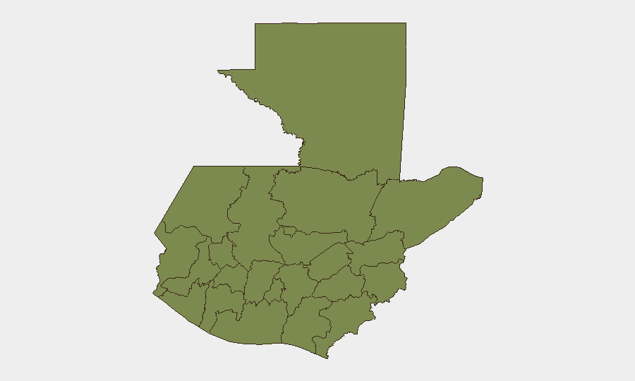
Alta Verapaz (risk 31.8) and Guatemala Department (risk 21.4) account for the majority of tracked threat events and composite risk, reflecting established criminal-organization territorial control, limited state capacity, and ongoing gang competition in those zones. All other departments score materially lower (1.8–2.3), indicating that risk is geographically concentrated rather than diffuse. Organizations with personnel or assets in Alta Verapaz should apply heightened vetting, movement protocols, and local-intelligence partnerships; Guatemala Department (which includes the capital) carries elevated urban crime and protest risk but remains functional for most business and diplomatic operations.
How GeoBit Would Assist
Security teams in Guatemala should deploy AOI Monitoring & Early Warning on Alta Verapaz and Guatemala Department to detect sudden shifts in gang activity, roadblocks, or state operations; pair this with Intel Sweep, X/Twitter OSINT, and multi-language search for real-time social signals. Network & Actor Analysis and entity extraction enable tracking of criminal-organization leadership changes and territorial disputes that typically precede visible violence. Routing & Network Analysis supports contingency-route planning for personnel in high-risk departments.
7-Day Outlook
No acute triggering events are visible on the near-term horizon; the political friction recorded on 16–17 June does not yet correlate with operational escalation. Risk remains chronic and sub-national; standard duty-of-care and local-intelligence cadences should be maintained, with heightened alertness to any confirmed organized-crime violence in Alta Verapaz or sudden changes in state-security posture.
Highest-Risk Areas — Ranked
| # | State / Region | Risk |
|---|---|---|
| 1 | Alta Verapaz | 31.8 |
| 2 | Guatemala Department | 21.4 |
| 3 | Retalhuleu | 2.3 |
| 4 | Quiché | 2.3 |
| 5 | Petén | 1.8 |
| 6 | Huehuetenango | 1.8 |
| 7 | San Marcos | 1.8 |
| 8 | Quetzaltenango | 1.8 |
| 9 | Totonicapán | 1.8 |
| 10 | Sololá | 1.8 |
| 11 | Chimaltenango | 1.8 |
| 12 | Suchitepéquez | 1.8 |
Sources
Previous Daily Briefs
A new Guatemala brief is written every day — each with its own risk map and downloadable CSV. Here's the last week; use the calendar to go further back.
📅 Browse every day by calendar →
Highlighted days have a brief. Tap a day for that day's map & analysis, or “csv” for that day's dataset ($5).