Situation Summary
Guinea remains classified as a moderate global security concern (#49 globally, composite threat score 8.4) with acute concentration of risk in Kankan Region, which scores 35.9—nearly six times higher than all other regions. The 31 May legislative and municipal elections have drawn continental-level security attention, with the African Union Peace and Security Council convening on 4 June 2026 specifically to assess transition and security implications. Current indicators point to underlying vulnerabilities in terrorism recruitment and radicalization pathways, particularly in Upper Guinea, alongside routine health and civil-order risks in major urban centers.
Key Developments
- African Union Peace and Security Council session (Guinea-wide, 4 June 2026): The AU's 1351st session was scheduled specifically to receive updates on post-election security conditions and transition stability in Guinea, signaling sustained continental concern over the security environment following the 31 May polls.
- Terrorism-linked arrests in Upper Guinea (early June timeframe): Security reporting indicates recent arrests connected to terrorism and radicalization networks in the Upper Guinea region, reflecting ongoing recruitment and transit risks; specific incident dates and locations remain under-reported in open sources.
- Conventional military activity reported (3 June 2026): A military-force event was recorded on 3 June, though open-source confirmation of specific location, nature, or operational context remains limited at this time.
- Shigellosis circulation (Guinea, recent): Active disease surveillance reports circulating *Shigella* cases across Guinea, presenting a secondary health and duty-of-care risk, particularly in urban and transit corridors with limited sanitation infrastructure.
Note on reporting gaps: Open web sources do not currently provide clearly timestamped, independently confirmed incident-level details (riots, clashes, roadblocks, major crimes, infrastructure attacks) for the 3–4 June window in Guinea. Incident-level precision for the past 24–48 hours will require cross-reference with specialized security platforms (GardaWorld, Control Risks, HX, International SOS, Dataminr) or real-time OSINT feeds with geofencing capability.
Highest-Risk Areas
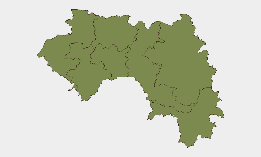
Kankan Region dominates the threat landscape at a risk score of 35.9, more than five times the national mean and indicating acute exposure to extremism, trafficking, or border-related violence. All other tracked regions—Boké, Labé, Kindia, Conakry, Mamou, Faranah, and Nzérékoré—cluster at 5.9, suggesting either more stable conditions or lower reporting density. The disparity points to Kankan's proximity to porous borders with Mali and Sierra Leone, regional mining activity, and documented terrorism recruitment networks; corporate and NGO teams operating in or transiting through Kankan should implement heightened situational awareness and contingency protocols.
How GeoBit Would Assist
Security teams would deploy AOI Monitoring & Early Warning to track Kankan, border corridors with Mali/Sierra Leone, and mining zones for emerging activity signals. Multi-language OSINT and X/Twitter geofencing OSINT combined with sentiment and temporal analysis would provide near-real-time detection of protest, roadblock, or violence indicators across Conakry and regional hubs. Network & Actor Analysis applied to terrorism and trafficking networks would clarify recruitment and transit pathways, informing risk-mitigation and personnel routing decisions.
7-Day Outlook
Post-election consolidation and AU-level engagement will likely frame the security agenda through mid-June; no major destabilizing incidents are currently forecast, but underlying structural risks—radicalization, border fluidity, health outbreaks—remain persistent. Teams should maintain elevated monitoring of Kankan and Upper Guinea corridors and expect routine political activity and civil-order management in Conakry and secondary cities.
Highest-Risk Areas — Ranked
| # | State / Region | Risk |
|---|---|---|
| 1 | Kankan Region | 35.9 |
| 2 | Boké Region | 5.9 |
| 3 | Labé Region | 5.9 |
| 4 | Kindia Region | 5.9 |
| 5 | Conakry | 5.9 |
| 6 | Mamou Region | 5.9 |
| 7 | Faranah Region | 5.9 |
| 8 | Nzérékoré Region | 5.9 |
Sources
Previous Daily Briefs
A new Guinea brief is written every day — each with its own risk map and downloadable CSV. Here's the last week; use the calendar to go further back.
📅 Browse every day by calendar →
Highlighted days have a brief. Tap a day for that day's map & analysis, or “csv” for that day's dataset ($5).