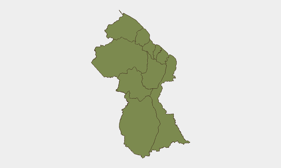
Situation Summary
Guyana faces a significant maritime and governance crisis following the MV Barima ferry capsizing (July 18–21), with confirmed death tolls ranging from 27–41 and 83 people still unaccounted for, compounded by crew impairment (marijuana use) and data-integrity failures in passenger manifests. Criminal and administrative investigations into the incident have exposed institutional weaknesses in maritime oversight and personnel conduct across the Guyana Police Force, Guyana Defence Force, and Maritime Administration Department. Concurrent crime activity in interior mining regions (armed attacks on remote camps) and intensified asset-confiscation enforcement against organized-crime proceeds add complexity to the current risk environment. Overall threat trajectory remains elevated, with reputational and operational vulnerabilities in transport, border security, and institutional credibility likely to persist for weeks.
Key Developments
- MV Barima ferry disaster, North Atlantic coast (July 18–21, 2026): Capsizing confirmed with 27–41 deaths, 69–77 rescued, 83–61 missing; conflicting casualty figures and unmanifested passenger records (at least 32 survivors not on official list) indicate crisis-management and data-integrity failures affecting victim tracking and casualty accountability.
- Captain and crew member detained, Georgetown (July 21–22, 2026): MV Barima captain and at least one crew member tested positive for marijuana and are in police custody; raises acute questions about crew impairment at time of incident and regulatory screening gaps.
- Government suspends ferry operations and personnel (July 19–21, 2026): Guyana suspended the MV Barima's loading and dispatch team and opened criminal and administrative investigations; suspension includes personnel from Guyana Police Force, Guyana Defence Force, and Maritime Administration Department.
- International diplomatic pressure (July 20–21, 2026): Neighboring head of state publicly confirmed casualty figures and investigation status, elevating international visibility of incident; opposition parties and foreign partners demanding independent investigation, increasing political pressure on government transparency and maritime safety credibility.
- Armed mining-camp attack, Cuyuni River interior (July 20–21, 2026): Three masked, armed assailants attacked 68 Backdam mining site; ongoing police manhunt underscores elevated crime risk in interior mining districts and remote work zones.
- Asset-confiscation enforcement push (July 2026, emphasis last 48h): Government moving to intensify permanent deprivation of illicit proceeds (property, bank accounts, gold) linked to organized crime; heightens anti-money-laundering enforcement risk for businesses and individuals with exposure to financial-crime investigations.
Highest-Risk Areas
Barima-Waini (risk 31.3) dominates the sub-national ranking, driven by the MV Barima incident and ongoing maritime-transport vulnerabilities on the North Atlantic corridor connecting Georgetown and Port Kaituma. Demerara-Mahaica (risk 14), encompassing Georgetown and the capital region, reflects institutional and governance fractures exposed by the ferry disaster and investigative demands. Interior mining regions—notably Cuyuni-Mazaruni and Potaro-Siparuni—face persistent armed-crime and armed-robbery risks targeting remote work camps and personnel. Risk concentration in northern and coastal zones reflects transport, regulatory, and criminal-enterprise exposure; interior zones reflect occupational and remote-site vulnerabilities.
How GeoBit Would Assist
Corporate security teams should employ AOI (area-of-interest) monitoring and early warning on Barima-Waini and North Atlantic maritime routes to track ferry operations, search-and-recovery activity, and investigative developments in real time. Maritime and aviation tracking paired with network and actor analysis would identify personnel changes, regulatory enforcement, and institutional shifts in maritime administration and Guyana Defence Force maritime units. Intel Sweep and multi-language OSINT on asset-confiscation enforcement, organized-crime targeting, and interior crime incidents would provide early signals affecting business continuity, employee safety, and supply-chain exposure.
7-Day Outlook
Investigation findings and casualty-figure reconciliation are expected within 7–14 days, likely to trigger additional personnel suspensions or arrests and heighten reputational pressure on government institutions. Search-and-recovery operations will continue, with secondary incidents (overcrowding, inadequate safety inspections on remaining ferry services) a material risk as public demand for transport alternatives persists. Armed-crime activity in interior mining zones is expected to remain elevated; corporate presence in Cuyuni-Mazaruni and Potaro-Siparuni should anticipate increased police sweeps and potential supply-route disruptions.
Highest-Risk Areas — Ranked
| # | State / Region | Risk |
|---|---|---|
| 1 | Barima-Waini | 31.3 |
| 2 | Demerara-Mahaica | 14 |
| 3 | Potaro-Siparuni | 4.9 |
| 4 | Upper Demerara-Berbice | 4.9 |
| 5 | Cuyuni-Mazaruni | 1.3 |
| 6 | Pomeroon-Supenaam | 1.3 |
| 7 | Essequibo Islands | 1.3 |
| 8 | Mahaica-Berbice | 1.3 |
| 9 | East Berbice-Corentyne | 1.3 |
| 10 | Upper Takutu-Upper Essequibo | 1.3 |
Sources
Previous Daily Briefs
A new Guyana brief is written every day — each with its own risk map and downloadable CSV. Here's the last week; use the calendar to go further back.
📅 Browse every day by calendar →
Highlighted days have a brief. Tap a day for that day's map & analysis, or “csv” for that day's dataset ($5).
Atlas — our AI intelligence desk — emails them this snapshot personally. Nothing else, no list.