Situation Summary
Jamaica's composite threat score remains moderate (22/100), with the country unranked globally among tracked nations. Current available intelligence does not confirm specific security incidents within the last 24–48 hours; most recent reportable events date to mid-July or earlier. Risk remains concentrated in two high-scoring parishes—Clarendon and Saint Andrew (both 31.3)—while the majority of the island registers minimal threat signals. The security environment appears stable but localized, with no indicators of imminent escalation at the national level.
Key Developments
No confirmed incidents within the 24–48 hour window. Available open-source reporting and real-time web research have not yielded verifiable Jamaica security or unrest events dated 2026-07-25 to 2026-07-26. The most recent dated reports in circulation describe operations and incidents from July 18–23:
- St Andrew South curfew (concluded 2026-07-23): A 48-hour curfew in sections of the St Andrew South policing division ended by Thursday evening, indicating prior tension but no active restriction as of this brief date.
- Mandeville area shootings (July 18–21): Fatal shootings in Mandeville and Top Greenvale claimed multiple lives in mid-week, but these fall outside the 48-hour reporting window.
- Ocho Rios police operation (reported July 22, operation ~July 21–22): An 18-person detention in the Paradise community followed coordinated raids; no escalation reported since.
- St Catherine police shooting (July 20, under INDECOM investigation): A fatal shooting during an alleged confrontation in Crescent district; investigation status unclear.
The absence of fresh, time-stamped incidents in real-time feeds may indicate either genuine operational calm or typical reporting lag in open-source channels.
Highest-Risk Areas
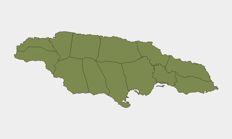
Clarendon and Saint Andrew parishes dominate Jamaica's risk profile, each scoring 31.3—more than five times the national average. Saint Andrew encompasses Kingston and its immediate suburban zones, historically the locus of gang violence, turf disputes, and police operations. Clarendon, in the central island, has shown elevated incident density. Trelawny (6.3) ranks third but at substantially lower risk. The remaining nine parishes all register 1.3 or minimal composite scores, suggesting that security risk is genuinely concentrated in two urban/semi-urban zones rather than distributed across the island. Corporate and NGO operations in Kingston and surrounding Saint Andrew warrant elevated due-diligence; Clarendon-based activities merit standard heightened awareness; other parishes present baseline Caribbean risk profiles.
How GeoBit Would Assist
Intel Sweep and OSINT Fusion enable continuous monitoring of Jamaica's event landscape across news, social media, and regional feeds, surfacing incidents and sentiment shifts hours or days before mainstream circulation. AOI Monitoring & Early Warning with persistent focus on Clarendon and Saint Andrew parishes would alert security teams to curfews, operations, or violence spikes in real time, supporting evacuation or shelter-in-place decisions. Network & Actor Analysis maps gang and enforcement-actor relationships, helping teams understand turf lines and operational patterns that inform safe routing and personnel positioning. Routing & Network Analysis identifies alternative travel corridors around high-risk zones for staff and supply movements.
7-Day Outlook
No intelligence suggests imminent national-level instability or escalation. Localized gang violence and police operations will likely continue at current levels in Clarendon and Saint Andrew; monitoring for curfew re-imposition or major incidents remains prudent. Risk trajectory is flat to slightly elevated heading into the final week of July, with no indicators of seasonal or political drivers likely to shift the threat posture materially upward.
Highest-Risk Areas — Ranked
| # | State / Region | Risk |
|---|---|---|
| 1 | Clarendon | 31.3 |
| 2 | Saint Andrew | 31.3 |
| 3 | Trelawny | 6.3 |
| 4 | Saint Ann | 4.7 |
| 5 | Hanover | 1.3 |
| 6 | Westmoreland | 1.3 |
| 7 | Saint James | 1.3 |
| 8 | Saint Elizabeth | 1.3 |
| 9 | Manchester | 1.3 |
| 10 | Saint Catherine | 1.3 |
| 11 | Saint Mary | 1.3 |
| 12 | Portland | 1.3 |
Sources
Previous Daily Briefs
A new Jamaica brief is written every day — each with its own risk map and downloadable CSV. Here's the last week; use the calendar to go further back.
📅 Browse every day by calendar →
Highlighted days have a brief. Tap a day for that day's map & analysis, or “csv” for that day's dataset ($5).
Atlas — our AI intelligence desk — emails them this snapshot personally. Nothing else, no list.