Situation Summary
Kenya remains a moderate-risk environment (global rank #92) with acute volatility concentrated in Nairobi County and localized protest activity in Laikipia. The past 48 hours have seen escalating civil unrest tied to health-security infrastructure (Ebola facility construction), a cross-border abduction case raising rendition concerns, and ongoing political governance friction. Security posture is currently stable at the national level, but localized protest intensity and rule-of-law questions present near-term operational friction for corporate teams.
Key Developments
- Nanyuki, Laikipia County (10–11 June): Hundreds of protesters continued demonstrations against construction of a US Ebola quarantine facility near BATUK/Nanyuki air base. Police responded with tear gas and water cannon; at least one protester death was reported during the week's unrest, indicating potential for crowd-control escalation and disruption to regional transport/logistics corridors.
- Nairobi, Kilimani area (11 June): South Sudanese anti-corruption whistleblower Abraham Awolich was reportedly abducted and forcibly transported to Juba. The case raises cross-border rendition and extrajudicial detention risks, with implications for foreign nationals, activists, and corporate witnesses in Nairobi.
- Nairobi (11 June): President Ruto and Finnish President Stubb held bilateral talks focused on global security cooperation, health-security resilience, and critical-sector infrastructure. Agreements on education and health may signal medium-term institutional changes affecting operational landscape.
- Nairobi (11 June): Kenyan authorities formally activated the National Ebola Preparedness and Response Plan, announcing health-security funding and surveillance measures. This signals elevated emergency-management activity and potential for facility restrictions or public-health access controls.
- Nationwide (10–11 June): Media and advocacy groups amplified warnings on missing children crisis and child abduction/exploitation risks, reflecting persistent street-level crime and personal-security concerns, particularly for families and vulnerable populations in urban centers.
- Nairobi (10–11 June): Law Society of Kenya petition against Nakuru Governor Susan Kihika over an alleged unconstitutional hospital raid continues in legal/political forums, signaling ongoing governance friction with potential implications for local rule-of-law credibility and administrative stability in Central Kenya.
Highest-Risk Areas
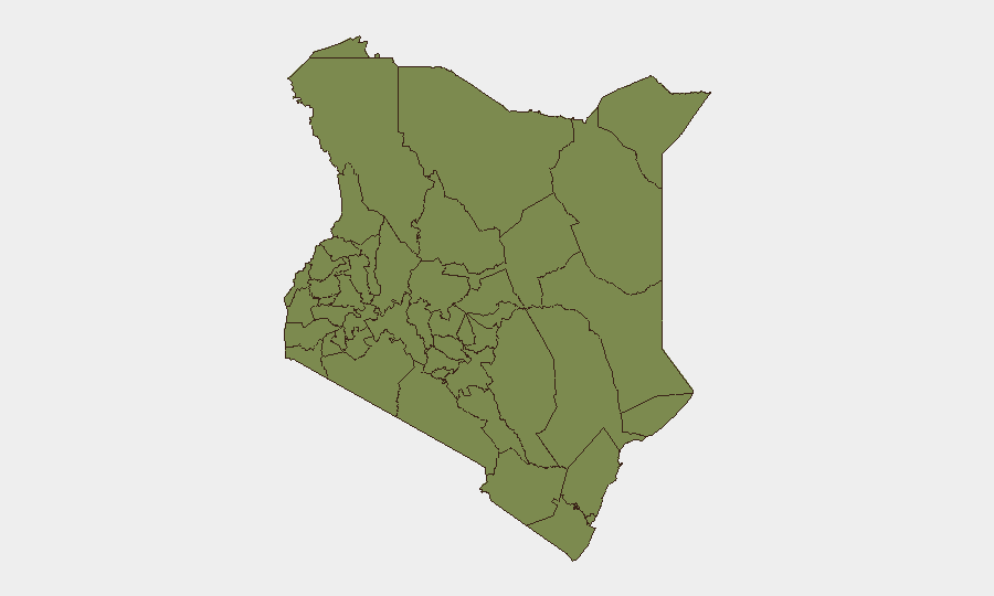
Nairobi County (risk 32.2) dominates the threat landscape, reflecting concentrated exposure to kidnapping, abduction, civil unrest, and governance disputes; Samburu County (8.6) and Meru County (3.4) follow, though at substantially lower intensity. The remaining counties cluster at similar low-to-moderate risk (2.2–3.4), indicating that national security challenges are heavily Nairobi-centric, with secondary risk in pastoral and rural northern regions. Laikipia's current protest activity is not yet reflected in the composite score but represents acute near-term volatility.
How GeoBit Would Assist
Security teams operating in Kenya should deploy AOI Monitoring & Early Warning on Nairobi, Laikipia, and Nakuru to detect protest escalation, law-enforcement activity, and governance disruptions in real time. OSINT Fusion & Corroboration (X, Telegram, local media, and event feeds) will track cross-border abduction patterns and rendition risks affecting foreign nationals and corporate witnesses. Risk & Threat Assessment and Network & Actor Analysis help identify protest leaders, political factions, and organized-crime actors driving localized instability.
7-Day Outlook
Laikipia protests are likely to remain volatile over the near term, with potential for continued police dispersals and sporadic violence if facility construction proceeds. Nairobi abduction and disappearance risks will remain elevated; corporate teams should reinforce duty-of-care protocols for high-profile or politically exposed staff. National-level governance friction (Nakuru dispute) and health-emergency activation will create administrative and logistical friction but are unlikely to trigger capital-region lockdown or mass unrest.
Highest-Risk Areas — Ranked
| # | State / Region | Risk |
|---|---|---|
| 1 | Nairobi County | 32.2 |
| 2 | Samburu | 8.6 |
| 3 | Meru County | 3.4 |
| 4 | Busia County | 2.2 |
| 5 | Kakamega County | 2.2 |
| 6 | Vihiga County | 2.2 |
| 7 | Nandi County | 2.2 |
| 8 | Elgeyo-Marakwet County | 2.2 |
| 9 | Uasin Gishu County | 2.2 |
| 10 | Baringo | 2.2 |
| 11 | Laikipia County | 2.2 |
| 12 | Isiolo | 2.2 |
Sources
Previous Daily Briefs
A new Kenya brief is written every day — each with its own risk map and downloadable CSV. Here's the last week; use the calendar to go further back.
📅 Browse every day by calendar →
Highlighted days have a brief. Tap a day for that day's map & analysis, or “csv” for that day's dataset ($5).