Resumen de la Situación
La puntuación de amenaza compuesta de Kenia de 96 (ranking #17 a nivel mundial) refleja un entorno de seguridad volátil impulsado por inestabilidad política, conflictos armados localizados y amenazas cibernéticas emergentes. Las últimas 48 horas han visto un ciberataque de alto perfil contra la presidencia, violencia motivada políticamente que interrumpe procesos electorales y presión miliciana continua en regiones fronterizas del noreste. La trayectoria de amenaza sigue siendo elevada e impredecible en múltiples dominios —cibernético, disturbios civiles y terrorismo— con concentración geográfica en condados de pastoreo y feudos de la oposición.
Desarrollos Clave
- Nairobi (sitio web oficial de la presidencia), 18 de julio de 2026 – Ciberataque y desfiguración de president.go.ke, incluyendo demanda de rescate (5 BTC); la Autoridad de TIC y NC4 lanzaron investigación forense; no se reportó breach de datos confirmado.
- Ol Kalou, Condado de Nyandarua (estación electoral AC Primary), 18 de julio de 2026 – Asaltantes armados y enmascarados en vehículos deportivos utilizaron gas lacrimógeno y agredieron físicamente a periodistas del Nation Media Group durante votación de elecciones suplementarias; cámara incautada, personal tasereado; indicadores de coordinación política.
- Sub-Condado de Mandera Central (campamento de seguridad Irresuki), 22 de junio de 2026 – Fuerzas de Defensa de Kenia repelieron asalto coordinado de Al-Shabaab; sin bajas de KDF reportadas; atacantes se retiraron con probable heridas (rastros de sangre observados).
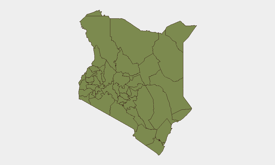
Áreas de Riesgo Más Elevado
El Condado de Samburu (riesgo 97,5) lidera el ranking subnacional, impulsado por conflictos de recursos pastorales y actividad miliciana transfronteriza; Embu (83,6) y Condado de Nairobi (78,9) reflejan una mezcla de violencia intercomunal, crimen organizado e inestabilidad política. La franja pastoral norteña (Samburu, Laikipia, Isiolo) enfrenta presión sostenida de Al-Shabaab y saqueadores; el ranking de Nairobi refleja riesgo de terrorismo e inestabilidad política aguda, evidenciado por el ciberataque contra instituciones estatales e interrupciones en día de elecciones. Los condados occidentales (Kakamega, Busia, Vihiga, Nandi) registran riesgo elevado vinculado a tensiones políticas históricas y redes criminales organizadas. Los activos corporativos y personal deben priorizar conciencia situacional en Nairobi y evitar viajes a Samburu/Isiolo sin protocolos de seguridad endurecidos.
Cómo GeoBit Prestaría Asistencia
Los equipos de seguridad deben desplegar Monitoreo de AOI y Alerta Temprana en nodos políticos e infraestructura crítica de Nairobi (edificios gubernamentales, oficinas de medios, telecomunicaciones) para detectar anomalías pre-incidente y movilización de protestas; combinar con OSINT de X/Twitter y Telegram y análisis de sentimiento para rastrear narrativas políticas e incitación en tiempo real. Inteligencia de amenazas cibernéticas y escaneo Shodan del perímetro digital de gobierno y corporaciones de Kenia identificaría endpoints vulnerables y actividad de amenaza persistente. Capacidad de monitoreo electoral y mapeo de conflictos de Nyandarua y condados occidentales permiten protocolos de enrutamiento anticipado y seguridad del personal en puntos de tensión electoral.
Perspectiva de 7 Días
Las tensiones políticas probablemente permanecerán elevadas durante cualquier ciclo electoral en curso, con instancias repetidas de violencia en día de votación y acoso cibernético de objetivos estatales. Se espera que la presión de Al-Shabaab sobre fuerzas de seguridad del noreste persista; conflictos pastorales localizados probablemente se intensificarán en Samburu y Laikipia conforme escasez de recursos en estación seca alcanza pico. Las entidades corporativas deben esperar enfoque continuo de infraestructura digital y operaciones mediáticas; se recomiendan comunicaciones alternativas y protocolos sin conexión para ubicaciones de alto riesgo.
Zonas de Mayor Riesgo — Clasificadas
| # | Estado / Región | Riesgo |
|---|---|---|
| 1 | Samburu | 97.5 |
| 2 | Embu | 83.6 |
| 3 | Nairobi County | 78.9 |
| 4 | Kakamega County | 71.4 |
| 5 | Nakuru | 70.3 |
| 6 | Kiambu | 69.1 |
| 7 | Laikipia County | 68.6 |
| 8 | Nyeri | 68.6 |
| 9 | Isiolo | 68 |
| 10 | Busia County | 67.5 |
| 11 | Vihiga County | 67.5 |
| 12 | Nandi County | 67.5 |
Fuentes
Informes Diarios Anteriores
Cada día se publica un nuevo informe de Kenya — cada uno con su propio mapa de riesgo y CSV descargable. Aquí está la última semana; usa el calendario para ir más atrás.
📅 Browse every day by calendar →
Highlighted days have a brief. Tap a day for that day's map & analysis, or “csv” for that day's dataset ($5).
Atlas — our AI intelligence desk — emails them this snapshot personally. Nothing else, no list.