Situation Summary
Kuwait remains in a heightened threat posture following Iran-linked conventional military strikes on July 18, 2026, which targeted energy infrastructure, residential areas, and military-associated sites. While the immediate attack phase has concluded, diplomatic tensions persist across multiple actors (Iran, Israel, United States), with Kuwait issuing formal disapprovals and public statements to regional parties. Small arms combat by authorities was reported on July 20, though context remains limited. The overall threat score (39, composite) places Kuwait in the lower-to-moderate global tier, but recent kinetic activity and sub-national concentration of risk in Jahra Governorate warrant sustained monitoring.
Key Developments
- Kuwait airspace / nationwide, July 18, 2026 — Air defenses intercepted hostile missiles and drones; explosions confirmed as interception activity. (Note: outside 24-48h window; included for operational context.)
- Kuwait International Airport, Kuwait City, July 18, 2026 — Operations temporarily suspended and flight schedules disrupted due to attack activity.
- Power and water desalination facility, Kuwait (unspecified location), July 18, 2026 — Fire reported after strike; multiple generating units taken offline for repairs; ministry confirmed damage to electricity and water supply infrastructure.
- Oil installation, Kuwait, July 18, 2026 — Material damage reported to unspecified facility during same attack wave.
- Small arms combat incident, July 20, 2026 — Authorities engaged in armed confrontation; specific location and casualty toll not yet confirmed in available reporting.
- Kuwait diplomatic posture, July 20, 2026 — Multiple public statements and formal disapprovals issued by Kuwait toward Iran, Israel, and military actors, signaling active political friction.
Note: Confirmed developments for July 21–22 remain limited in available open-source channels. GeoBit recommends real-time X/Telegram OSINT and local media monitoring for updates on infrastructure restoration and security incidents.
Highest-Risk Areas
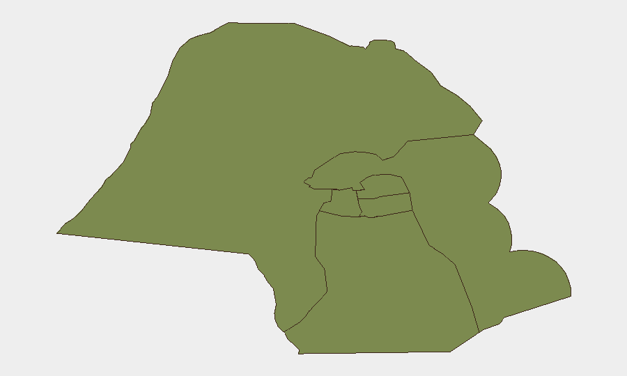
Jahra Governorate ranks significantly above all other administrative divisions (31.3 vs. 1.3 across remaining five governorates), making it the primary locus of current risk. Jahra's elevated score likely reflects proximity to military installations (Ali Al Salem Air Base, Camp Arifjan) and border zones; these assets remain potential targets in the event of further Iran-backed strikes or regional escalation. The remaining five governorates—including Capital Governorate (Kuwait City)—show uniform, low composite scores, suggesting either more dispersed lower-level threats or concentration of security measures. For corporate duty-of-care teams, Jahra warrants enhanced situational awareness; Capital and Ahmadi (oil sector hub) require continuous monitoring for secondary effects (power outages, supply-chain disruption).
How GeoBit Would Assist
GeoBit's Intel Sweep (multi-language event feeds, X/Telegram OSINT, and entity extraction) provides real-time tracking of Iranian statements, U.S. military posture, and Kuwaiti official responses to flag escalation early. AOI Monitoring & Early Warning with persistent watch over Jahra, military bases, and energy infrastructure enables automatic alerting on new kinetic activity, personnel movement, or facility damage. GIS & Spatial Analysis combined with Satellite & Imagery assessment allows teams to assess damage extent to oil and desalination assets, forecast supply disruptions, and route personnel or assets away from high-risk zones in near real-time.
7-Day Outlook
Immediate kinetic risk appears contained, but diplomatic friction between Iran, Kuwait, and U.S./Israeli interests remains elevated. Infrastructure repairs (power, water, airport) will likely dominate the next week; delays or secondary incidents (fuel shortages, water rationing) could trigger civil unrest or secondary security events. Recommend sustained monitoring of Iranian messaging, U.S. military signaling, and Kuwaiti official statements for indications of further escalation or de-escalation.
Highest-Risk Areas — Ranked
| # | State / Region | Risk |
|---|---|---|
| 1 | Jahra Governorate | 31.3 |
| 2 | Ahmadi Governorate | 1.3 |
| 3 | Farwaniya Governorate | 1.3 |
| 4 | Hawalli Governorate | 1.3 |
| 5 | Mubarak al-Kabir Governorate | 1.3 |
| 6 | Capital Governorate | 1.3 |
Sources
Previous Daily Briefs
A new Kuwait brief is written every day — each with its own risk map and downloadable CSV. Here's the last week; use the calendar to go further back.
📅 Browse every day by calendar →
Highlighted days have a brief. Tap a day for that day's map & analysis, or “csv” for that day's dataset ($5).
Atlas — our AI intelligence desk — emails them this snapshot personally. Nothing else, no list.