Situation Summary
Liberia remains at composite threat rank #143 globally with a moderate 5/50 threat score and no major security incidents reported in the last 24–48 hours. The country's risk profile is heavily concentrated in two counties—Grand Bassa (31.4) and Montserrado (27.1)—which account for the majority of tracked activity, while ten other counties show minimal baseline risk (1.4 each). Current intelligence does not indicate any new spikes in conflict, civil unrest, or politically destabilizing events that would materially alter the near-term security posture for corporate operations or expatriate personnel.
Key Developments
No credible, verifiable security, conflict, crime, or political-instability incidents have been reported across open-source news outlets, wire services, NGOs, or geolocatable social-media reporting for Liberia in the 24–48 hours prior to 21 June 2026. Standard monitoring channels (international media, government advisories, humanitarian updates) show no acute alerts. Organizations with personnel or assets in Liberia should rely on subscription intelligence feeds, embassy cables, or ground-level reporting networks for detection of lower-visibility localized incidents that may not yet appear in public-domain sources.
Highest-Risk Areas
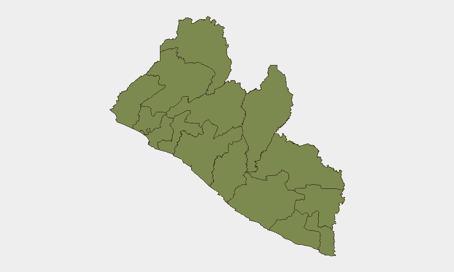
Grand Bassa County (31.4) and Montserrado County (27.1)—which includes the capital Monrovia and surrounding port and commercial zones—drive nearly all of Liberia's composite risk score. The disparity between these two counties and the remaining ten (each at 1.4) suggests that risk in Liberia is tightly geographically concentrated in areas of higher population density, economic activity, and administrative function. Organizations should prioritize security protocols, access controls, and contingency planning for operations in Monrovia and coastal Grand Bassa; regional operations in the interior and northern counties present significantly lower tracked risk, though infrastructure and communications limitations may reduce visibility.
How GeoBit Would Assist
Teams can employ AOI Monitoring & Early Warning to maintain persistent surveillance of Monrovia and Grand Bassa County for emerging incidents, with automated alerting on civil unrest, security force activity, or infrastructure disruption. Intel Sweep, OSINT fusion, and multi-language X/Twitter and Telegram monitoring provide real-time detection of low-visibility local incidents, rumors, and crowd activity before they reach mainstream media. Routing & Network Analysis supports contingency planning and alternative-route identification for personnel and asset movements in higher-risk zones. For teams with extended or sensitive operations, Conflict & Military mapping and regime-stability monitoring help track underlying political and institutional dynamics that could trigger rapid changes in the security environment.
7-Day Outlook
No near-term escalation in major conflict, political instability, or humanitarian crisis is indicated by current open-source signals. Baseline security conditions in high-risk Monrovia and Grand Bassa areas should remain stable, though petty crime, occasional inter-communal tensions, and localized infrastructure disruptions remain routine risks. Organizations should maintain standard duty-of-care protocols and monitor subscription feeds for any intelligence on political or economic shocks that could rapidly alter conditions, particularly ahead of any upcoming electoral or fiscal calendar events.
Highest-Risk Areas — Ranked
| # | State / Region | Risk |
|---|---|---|
| 1 | Grand Bassa County | 31.4 |
| 2 | Montserrado County | 27.1 |
| 3 | Grand Cape Mount County | 1.4 |
| 4 | Lofa County | 1.4 |
| 5 | Gbarpolu County | 1.4 |
| 6 | Bomi County | 1.4 |
| 7 | Margibi County | 1.4 |
| 8 | Bong County | 1.4 |
| 9 | Rivercess County | 1.4 |
| 10 | Nimba County | 1.4 |
| 11 | Grand Gedeh County | 1.4 |
| 12 | Sinoe County | 1.4 |
Previous Daily Briefs
A new Liberia brief is written every day — each with its own risk map and downloadable CSV. Here's the last week; use the calendar to go further back.
📅 Browse every day by calendar →
Highlighted days have a brief. Tap a day for that day's map & analysis, or “csv” for that day's dataset ($5).