Situation Summary
Malawi's internal security environment remains stable with no documented civil unrest, major crime incidents, or political violence reported within its territory in the last 24–48 hours. The primary acute risk affecting Malawian nationals originates externally: ongoing xenophobic violence in South Africa has displaced approximately 300 Malawians and injured two, triggering a cross-border repatriation operation complicated by border-crossing bottlenecks and reported security threats to humanitarian workers. Central and Northern Regions maintain elevated composite risk scores (31.2 each), though current drivers appear structural rather than event-driven; Southern Region shows significantly lower threat profile (1.2).
Key Developments
- Durban, South Africa – 22–23 June 2026: Malawian nationals sheltering at Sherwood Hall/Community Centre remained under police security following clashes between crowds and police during repatriation processing on 22 June; processing resumed on 23 June with reported restoration of calm.
- Johannesburg vicinity, South Africa–Malawi border – 22–23 June 2026: Approximately 500 Malawian nationals attempting to return from South Africa were stranded after bus convoys from Cape Town and Durban could not cross into Malawi due to permit and administrative issues, creating humanitarian and travel-risk exposure.
- South Africa (multiple locations) – 22–23 June 2026: Malawi government confirmed two nationals injured and ~300 displaced in recent xenophobic attacks; official statement issued assurances on repatriation facilitation and citizen safeguarding (figures cited "as of yesterday," indicating 24–48 hour window).
- South Africa repatriation routes and gathering points – 22–23 June 2026: Humanitarian workers assisting in Malawian repatriation reported security threats while operating along transit corridors and at assembly sites, elevating operational risk for non-governmental assistance missions.
- Malawi national media discourse – 22–23 June 2026: MBC and other outlets elevated coverage of regional security issues affecting Malawi and neighbors in context of cross-border displacement, reflecting heightened official and public attention to external threats impacting citizens abroad.
Highest-Risk Areas
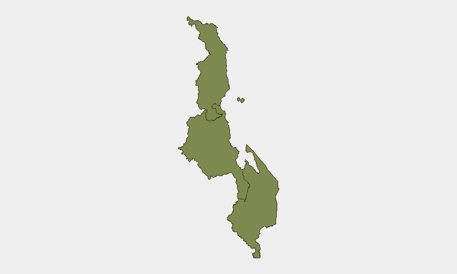
Central and Northern Regions are jointly ranked as highest-risk (31.2 composite score each), though available open-source reporting does not attribute this to acute internal conflict or unrest in the 24–48 hour window. Risk drivers in these regions likely reflect structural factors—governance, informal commerce, cross-border population movement, and regional spillover from neighboring countries—rather than active incidents. Southern Region's substantially lower score (1.2) suggests better security fundamentals or lower strategic volatility. The primary external risk vector—South African xenophobic violence and repatriation-related complications—affects all Malawian nationals regardless of region, but poses operationalized risk to supply chains, workforce mobility, and humanitarian logistics involving Central and Northern entry/exit corridors.
How GeoBit Would Assist
Security teams would deploy AOI Monitoring & Early Warning to track repatriation processing sites and border crossings for secondary clashes or bottleneck escalation; OSINT fusion (X/Telegram, local media, humanitarian networks) to corroborate displacement figures and humanitarian-worker threat reports in real time; and Routing & Network Analysis to identify alternative border crossings and supply-chain workarounds if primary transit routes remain compromised. Concurrent regime-stability and conflict search would flag any secondary civil unrest in Malawi triggered by repatriation influx or resource strain.
7-Day Outlook
Repatriation operations will likely continue over the next week with gradual border-crossing normalization as Malawi and South African authorities coordinate permits and logistics. Risk of secondary incidents at gathering points or transit corridors remains elevated but is expected to diminish as processing throughput improves. No indicators suggest imminent internal unrest in Malawi, though monitoring of repatriation-affected communities in Central Region is warranted for downstream humanitarian or security complications.
Highest-Risk Areas — Ranked
| # | State / Region | Risk |
|---|---|---|
| 1 | Central Region, Malawi | 31.2 |
| 2 | Northern Region, Malawi | 31.2 |
| 3 | Southern Region, Malawi | 1.2 |
Sources
Previous Daily Briefs
A new Malawi brief is written every day — each with its own risk map and downloadable CSV. Here's the last week; use the calendar to go further back.
📅 Browse every day by calendar →
Highlighted days have a brief. Tap a day for that day's map & analysis, or “csv” for that day's dataset ($5).