Situation Summary
Namibia remains a low-threat environment with no major security incidents recorded in the past 24–48 hours. The country's composite threat score of 5 (ranked #142 globally) reflects a stable overall security posture. However, concentrated risk in Otjozondjupa Region (score 31.8) and elevated incidents in Erongo and Khomas warrant targeted monitoring of those areas. Operational disruptions (fuel shortages at wildlife resorts) and administrative changes (visa requirements for US/UK nationals) present duty-of-care considerations but do not indicate deterioration in physical security.
Key Developments
- Nationwide, 2026-07-16 to 2026-07-19 — No major security incidents documented in the last 24–48 hours; country assessed as low-threat environment.
- Nationwide, recent/ongoing — Fuel shortages reported at multiple Namibia Wildlife Resorts locations (Halali, Okaukuejo, Terrace Bay, Sesriem, Ai-Ais Hotsprings), creating travel and operational disruptions for corporate personnel and supply chains.
- Zambezi River border area (Namibia–Botswana–Zimbabwe), recent publication — Zambian authorities searching for bodies of ten Ethiopian nationals believed drowned while attempting to cross the river; highlights irregular migration and cross-border hazards in that region.
- Ohangwena Region, recent publication — Most retail outlets allegedly breaching labour standards; Ministry of Labour compliance issue rather than direct security threat.
- Oshikoto Region (Tsumeb Magistrate's Court), recent publication — Five suspects remanded in connection with N$1.8 million fraud against a pensioner; two suspects linked to separate murder case.
- Kavango East Region (Sarusungu Combined School), recent publication — Ministry of Education investigating alleged assault of learners by police officers during a search; law-enforcement accountability concern.
- Nationwide, policy change (effective date not specified) — Visa-free entry ended for US, UK, and 30+ other nationalities; advance visa approval now required. Affects travel planning and personnel onboarding.
- Nationwide, ongoing — Communications regulator advisory: SIM card registration alone does not prevent phishing and social-engineering fraud; cyber and financial-crime risk persists.
Highest-Risk Areas
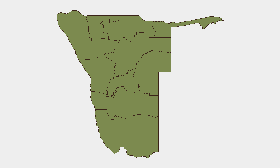
Otjozondjupa Region drives nearly 60% of the country's composite risk (31.8 of ~5 national score), indicating either a concentrated incident cluster or sustained instability in that region. Erongo and Khomas regions show elevated but secondary risk (21.1 each). The remaining nine regions cluster at 1.8, suggesting either low-incident profiles or sparse reporting. Teams with operations in Otjozondjupa should prioritize situational awareness; personnel in Erongo and Khomas warrant standard vigilance. The disparity suggests Otjozondjupa warrants deeper investigation into root drivers—whether criminal, political, or resource-related.
How GeoBit Would Assist
Teams should use AOI Monitoring & Early Warning to establish persistent watch on Otjozondjupa and Erongo regions with real-time alerting on arrests, military activity, or civil unrest. Intel Sweep (global event feeds, OSINT fusion, multi-language search, and entity extraction) would track fuel-supply chains affecting resorts and cross-border migration patterns near Zambezi. Routing & Network Analysis supports alternative journey planning around fuel-shortage zones and border crossing hazards.
7-Day Outlook
No imminent escalation is forecast. The absence of incidents over 24–48 hours and low global ranking suggest continued stability. Fuel shortages may persist short-term, requiring operational workarounds; monitoring visa-processing backlogs for US/UK personnel is prudent. Watch Otjozondjupa for any uptick in detention or military activity that might signal emerging instability.
Highest-Risk Areas — Ranked
| # | State / Region | Risk |
|---|---|---|
| 1 | Otjozondjupa | 31.8 |
| 2 | Erongo Region | 21.1 |
| 3 | Khomas | 21.1 |
| 4 | Kunene Region | 1.8 |
| 5 | Omusati | 1.8 |
| 6 | Ohangwena | 1.8 |
| 7 | Oshana | 1.8 |
| 8 | Oshikoto | 1.8 |
| 9 | Kavango West | 1.8 |
| 10 | Omaheke | 1.8 |
| 11 | Kavango East | 1.8 |
| 12 | Zambezi | 1.8 |
Sources
Previous Daily Briefs
A new Namibia brief is written every day — each with its own risk map and downloadable CSV. Here's the last week; use the calendar to go further back.
📅 Browse every day by calendar →
Highlighted days have a brief. Tap a day for that day's map & analysis, or “csv” for that day's dataset ($5).
Atlas — our AI intelligence desk — emails them this snapshot personally. Nothing else, no list.