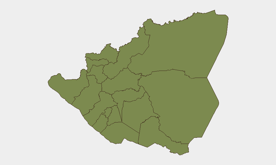
Situation Summary
Nicaragua remains a low-threat environment at the national level (global rank #67, composite score 18), with no verified security incidents, armed clashes, protests, or infrastructure disruptions reported in the last 24–48 hours across available open sources. Risk remains geographically concentrated in the South Caribbean Coast and Estelí Department, where organized-crime activity, smuggling networks, and persistent gang presence drive substantially higher threat scores than the capital and western departments. The absence of acute incidents in the current reporting window reflects the baseline stability of most populated areas, though underlying vulnerabilities in remote regions persist.
Key Developments
No verified security incidents meeting incident criteria (specific location, confirmed date within last 24–48 hours, cross-source corroboration) were identified in Nicaragua during the 30 June–2 July 2026 reporting window.
GeoBit's AI incident monitoring and cross-referenced open-source search (news wires, diplomatic advisories, NGO alerts, social media) returned no confirmed reports of protests, armed clashes, major crime events, infrastructure failures, or travel-risk escalations in Nicaragua with reliable time-stamps and geographic specificity for this period. The event signals displayed in the platform feed do not resolve to validated, localized Nicaraguan incidents and appear to reflect data-feed artifacts or cross-regional event aggregation rather than country-specific confirmed developments.
Highest-Risk Areas
The South Caribbean Coast (risk 31.5) and Estelí Department (risk 24) account for the majority of tracked threat activity and dominate the national risk profile. The Caribbean coastal region's remoteness, weak state presence, and role as a transit corridor for drug trafficking, human smuggling, and contraband create persistent vulnerability to organized-crime violence and territorial disputes among trafficking organizations. Estelí, located in the north-central highlands, experiences elevated gang activity and extortion networks targeting local commerce and agricultural producers. By contrast, Managua Department (3.4) and western departments (Boaco, Carazo, Chontales, Rivas, Chinandega, Nueva Segovia, Madriz—all 1.5) show substantially lower composite risk, reflecting greater state security presence, economic activity, and lower trafficking-related competition.
How GeoBit Would Assist
Teams with personnel or assets in Nicaragua should employ AOI (Area-of-Interest) Monitoring & Early Warning on the South Caribbean Coast and Estelí to detect emerging gang activity, trafficking movements, or localized violence before it escalates. Intelligence & OSINT capabilities—including X/Twitter and Telegram monitoring, multi-language search, and entity extraction—enable continuous watch on criminal-network communications and regime-stability signals. Routing & Network Analysis can identify safer transit corridors and alternative supply-chain pathways in higher-risk regions, reducing exposure during movement or logistics operations.
7-Day Outlook
No imminent security escalation is anticipated in the near term based on current signals and baseline threat patterns. Conditions in the Caribbean Coast and Estelí are expected to remain consistent with historical norms—low-frequency but chronic organized-crime activity—absent new triggering events (e.g., major trafficking-organization leadership changes, political unrest, or security-force interventions). Teams should maintain standard duty-of-care protocols for high-risk regions and monitor GeoBit alerts for any shift in event frequency or geographic distribution.
Highest-Risk Areas — Ranked
| # | State / Region | Risk |
|---|---|---|
| 1 | South Caribbean Coast | 31.5 |
| 2 | Estelí Department | 24 |
| 3 | Masaya Department | 10.9 |
| 4 | Managua Department | 3.4 |
| 5 | Boaco Department | 3.4 |
| 6 | Carazo Department | 1.5 |
| 7 | Chontales Department | 1.5 |
| 8 | Rivas Department | 1.5 |
| 9 | Río San Juan Department | 1.5 |
| 10 | Chinandega Department | 1.5 |
| 11 | Nueva Segovia Department | 1.5 |
| 12 | Madriz Department | 1.5 |
Sources
Previous Daily Briefs
A new Nicaragua brief is written every day — each with its own risk map and downloadable CSV. Here's the last week; use the calendar to go further back.
📅 Browse every day by calendar →
Highlighted days have a brief. Tap a day for that day's map & analysis, or “csv” for that day's dataset ($5).