Situation Summary
Oman faces a sharp escalation in maritime security risk following a cluster of attacks on commercial shipping in the Gulf of Oman and Sea of Oman over 8–14 June 2026. Three separate incidents targeting foreign-flagged vessels with Indian crews—including a fatal U.S. Navy strike on MT Setubelo that killed three seafarers on 13 June—have elevated transit hazards and triggered high-level diplomatic protest from India. While the country's overall composite threat ranking remains moderate (#67 globally, score 2.0), the concentration of maritime incidents in a compressed timeframe signals a localized but acute operational risk window for commercial shipping and energy transport using Omani approaches.
Key Developments
- 13 June 2026, Gulf of Oman (off Oman coast): U.S. Navy strike on the Palau-flagged tanker MT Setubelo killed three Indian seafarers and prompted crew evacuation; India lodged formal diplomatic protests with U.S. officials on 13–14 June in response to the fatalities.
- 14 June 2026, near Shinas Port, northern Oman: Guinea-Bissau-flagged vessel MT Jal Veer (20 Indian crew) reported attacked; all crew reported safe and under evacuation to Shinas with no confirmed casualties.
- 8–14 June 2026, Gulf of Oman / Sea of Oman (multiple points): Security analysts identified a "cluster of attacks" on commercial shipping during this 6-day window, including incidents on MT Marivex (8 June, fire following attack; 24 crew rescued by Royal Oman Air Force) and subsequent strikes, raising short-term risk for tankers and bulk carriers transiting the region.
- 14 June 2026, Muscat: Omani authorities announced six new national digital and cybersecurity projects as part of a broader digital-transformation and infrastructure-resilience initiative, reflecting heightened official concern over cyber and critical-infrastructure security in the region.
- 10–14 June 2026, UN Security Council: UN Secretary-General remarks highlighted "escalating attacks and rhetoric" affecting navigational rights in Middle East sea lanes, explicitly referencing freedom of navigation concerns in waters off Oman and calling for a Gulf security architecture respecting state sovereignty.
Highest-Risk Areas
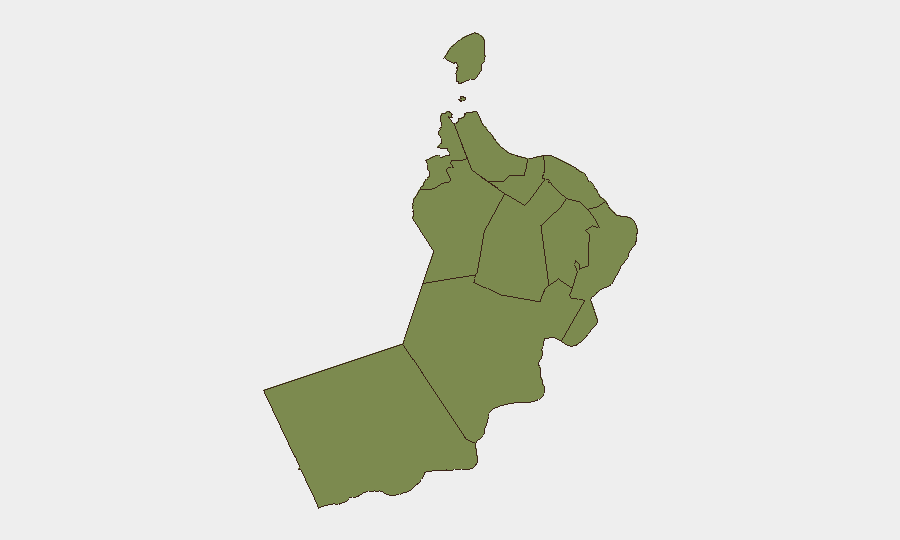
Al Wusta Governorate carries the dominant sub-national risk (31.4), driven by its coastal exposure and proximity to major shipping lanes transiting the Gulf of Oman and Arabian Sea approaches. Al Batinah North Governorate ranks second (4.2), reflecting its role as a commercial and port-adjacent zone and proximity to the Shinas incident on 14 June. All other governorates cluster at substantially lower risk (1.4), indicating that maritime and coastal security challenges are geographically concentrated rather than dispersed; inland and northern regions face minimal acute threat. The disparity underscores that companies and personnel should calibrate protective measures by proximity to shipping lanes and coastal ports.
How GeoBit Would Assist
Maritime & Aviation tracking combined with persistent Area-of-Interest (AOI) monitoring of high-risk shipping corridors off Al Wusta and Al Batinah North would provide real-time alerts on vessel movements and anomalies near Omani approaches. Multi-source OSINT fusion (X/Twitter, Telegram, maritime feeds, port authority releases) enables rapid corroboration and timeline sequencing of incidents, critical for duty-of-care teams managing crews on transiting vessels. Route & Network Analysis would support alternative maritime routing away from the highest-incident corridors, reducing exposure for energy and commercial transport during the current elevated-risk window.
7-Day Outlook
Maritime risk is expected to remain elevated for 7–14 days pending clarification of attack attribution, U.S. Navy operations tempo, and Omani and regional maritime security response. Shipping operators should anticipate continued advisory warnings and possible insurance / underwriting adjustments for Gulf of Oman transits. Onshore security in Muscat and other urban centers remains low-risk; the threat is concentrated in maritime transit zones.
Highest-Risk Areas — Ranked
| # | State / Region | Risk |
|---|---|---|
| 1 | Al Wusta Governorate | 31.4 |
| 2 | Al Batinah North Governorate | 4.2 |
| 3 | Muscat Governorate | 1.4 |
| 4 | Al Buraymi Governorate | 1.4 |
| 5 | Ad Dhahirah Governorate | 1.4 |
| 6 | Musandam Governorate | 1.4 |
| 7 | Al Batinah South Governorate | 1.4 |
| 8 | Ad Dakhiliyah Governorate | 1.4 |
| 9 | Ash Sharqiyah North Governorate | 1.4 |
| 10 | Ash Sharqiyah South Governorate | 1.4 |
| 11 | Dhofar Governorate | 1.4 |
Sources
Previous Daily Briefs
A new Oman brief is written every day — each with its own risk map and downloadable CSV. Here's the last week; use the calendar to go further back.
📅 Browse every day by calendar →
Highlighted days have a brief. Tap a day for that day's map & analysis, or “csv” for that day's dataset ($5).