Situation Summary
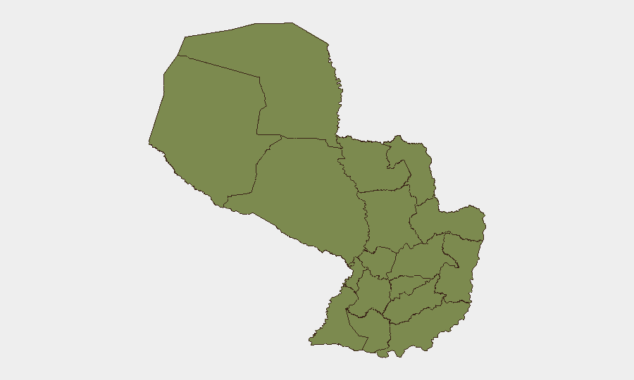
Paraguay remains a low-threat environment globally (ranked #100) with a composite threat score of 12 across 22 tracked events. No security incidents, civil unrest, infrastructure disruption, or travel-risk developments have been corroborated in Paraguay over the past 24–48 hours. The country's risk profile is heavily concentrated in the Chaco region, particularly Presidente Hayes Department, while most populated eastern departments maintain baseline threat levels consistent with routine crime and regulatory activity.
Key Developments
No discrete security events meeting verification and recency criteria have been identified in Paraguay within the last 24–48 hours. Web and open-source monitoring (X/Twitter, news feeds, local reporting) have not surfaced corroborated incidents of conflict, unrest, political instability, crime escalation, or infrastructure disruption during this window.
Highest-Risk Areas
Presidente Hayes Department dominates Paraguay's risk profile, with a composite score of 31.8—nearly 15 times higher than all other departments. This Chaco region state faces persistent challenges from land-use disputes, informal settlement, and historically documented trafficking and smuggling activity, though acute incident reporting has been limited. Boquerón, also in the Chaco, carries elevated but secondary risk (2.1). The remaining 10 departments, including major population centers (Alto Paraná, Caaguazú, Itapúa, Concepción, and San Pedro), are grouped at equivalent low-risk scores (1.8), indicating that threat concentration is regional rather than nationwide and that most of Paraguay's urban and rural infrastructure operates under stable conditions.
How GeoBit Would Assist
Corporate security teams with operations or personnel in Presidente Hayes or Boquerón departments can use AOI Monitoring & Early Warning to establish persistent watch on high-risk zones and receive automated alerts when new incidents emerge. GIS & Spatial Analysis capabilities can map supply chains, travel routes, and asset locations against sub-national risk data to identify exposure and design avoidance strategies. Intel Sweep and multi-language OSINT (web, Telegram, radio SIGINT) provide continuous monitoring of local reporting, social media, and informal networks to detect emerging threats (trafficking, unrest, regulatory action) before they escalate or affect operations. These tools collectively enable duty-of-care teams to maintain situational awareness and adjust protocols without overreacting to a baseline-low threat environment.
7-Day Outlook
No significant security developments are anticipated in Paraguay over the next 7 days based on current indicators and historical seasonality. Standard monitoring should continue to focus on Presidente Hayes Department and border regions; any sudden spike in reporting or institutional alerts would warrant rapid reassessment. Corporate operations in eastern and central departments remain well-positioned for normal business continuity.
Next brief: 2026-07-02 (or upon alert trigger)
Highest-Risk Areas — Ranked
| # | State / Region | Risk |
|---|---|---|
| 1 | Presidente Hayes Department | 31.8 |
| 2 | Boquerón | 2.1 |
| 3 | Concepción Department | 1.8 |
| 4 | San Pedro Department | 1.8 |
| 5 | Guairá Department | 1.8 |
| 6 | Amambay Department | 1.8 |
| 7 | Canindeyú Department | 1.8 |
| 8 | Caaguazú Department | 1.8 |
| 9 | Alto Paraná Department | 1.8 |
| 10 | Caazapá Department | 1.8 |
| 11 | Itapúa Department | 1.8 |
| 12 | Alto Paraguay Department | 1.8 |
Sources
Previous Daily Briefs
A new Paraguay brief is written every day — each with its own risk map and downloadable CSV. Here's the last week; use the calendar to go further back.
📅 Browse every day by calendar →
Highlighted days have a brief. Tap a day for that day's map & analysis, or “csv” for that day's dataset ($5).