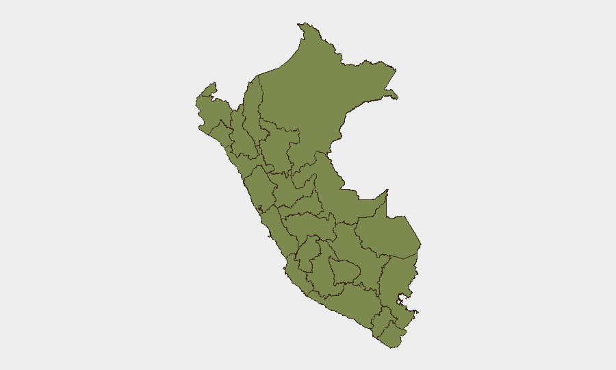
Situation Summary
Peru remains a composite-risk environment with structural vulnerabilities in organized crime, trafficking, and regional governance, placing it at #69 globally. The most acute concentration of threat activity is in Huánuco (composite score 31.5) and Lima (27.9), reflecting both criminal networks and intermittent civil unrest. Event signals from 18–20 June indicate scattered political disapproval, media occupation, police statements, and localized demonstration activity in Arequipa, though the specific triggering incidents require verification against established news sources. The security picture has not deteriorated materially in the past 48 hours but reflects persistent baseline instability rather than acute escalation.
Key Developments
Event Signal Verification Notice: GeoBit's event feed has captured multiple signals dated 18–20 June (public statements, demonstrations, investigations, media statements) and a demonstration recorded in Arequipa on 18 June. However, specific incident details, casualty counts, cause, and real-time status cannot be confirmed from available open sources within the last 24–48 hours. Security teams should cross-check the following channels for current situational updates:
- U.S. Embassy Lima security alerts (website and official social media)
- Peruvian wire services (RPP, La República, El Comercio) with date filters for 19–20 June
- X/Twitter OSINT using Spanish keywords (*Perú protesta, bloqueo, paro, disturbios, Arequipa, Lima*) filtered to last 24 hours, then corroborated against at least one news outlet
Arequipa demonstration (18 June): Signal recorded but underlying cause, scale, and current status require verification.
Lima-level political activity (20 June): Public statements, disapproval by representatives, and government investigation signals detected but lack incident-level context.
Structural baseline: Criminal activity, trafficking networks, and resource-dispute tensions remain endemic in Huánuco, Cusco periphery, and southern highlands (Puno, Arequipa) regardless of this week's specific event noise.
Highest-Risk Areas
Huánuco dominates the sub-national risk index (31.5) due to entrenched trafficking networks, competing drug-trafficking organizations, and weak institutional control. Lima's elevated score (27.9) reflects both organized crime (robbery, extortion, kidnapping) and periodic civil unrest tied to political economy. Ancash (3.2) and the southern tier (Arequipa, Puno) show elevated but secondary risk, driven by mining-related conflict, indigenous land disputes, and trafficking transit routes. These five regions account for the overwhelming majority of Peru's tracked threat events; the remaining seven regions score below 2.5, indicating lower-frequency or lower-intensity activity.
How GeoBit Would Assist
Security teams should activate AOI Monitoring & Early Warning for Lima and Huánuco with alerts configured for civil unrest, criminal incident upticks, and political signaling. Parallel X/Twitter & Telegram OSINT and multi-language search capability allows near-real-time detection of protest mobilization, road blockades, or labor strikes before they impact supply chains or personnel movement. GIS & Spatial Analysis combined with conflict and crime search enables rapid identification of safe corridors and alternative routing around hotspots, critical for duty-of-care teams managing field operations or asset movement.
7-Day Outlook
No imminent nationwide escalation is signaled, but localized unrest in Lima or Arequipa remains plausible given baseline political and economic tensions. Personnel and asset managers should assume 5–7 day persistence of background civil-disorder risk in major urban centers and maintain heightened situational awareness around transport hubs (Jorge Chávez International Airport, major highways) and government districts. Verification of the specific June 18–20 incident triggers is essential before operational adjustments; overnight Peruvian news cycles should clarify the context by morning UTC.
Highest-Risk Areas — Ranked
| # | State / Region | Risk |
|---|---|---|
| 1 | Huánuco | 31.5 |
| 2 | Lima | 27.9 |
| 3 | Ancash | 3.2 |
| 4 | Arequipa | 2.6 |
| 5 | Piura | 2.1 |
| 6 | La Libertad | 2.1 |
| 7 | Puno | 2.1 |
| 8 | Loreto | 1.5 |
| 9 | Tumbes | 1.5 |
| 10 | Lambayeque | 1.5 |
| 11 | Amazonas | 1.5 |
| 12 | Cajamarca | 1.5 |
Sources
Previous Daily Briefs
A new Peru brief is written every day — each with its own risk map and downloadable CSV. Here's the last week; use the calendar to go further back.
📅 Browse every day by calendar →
Highlighted days have a brief. Tap a day for that day's map & analysis, or “csv” for that day's dataset ($5).