Situation Summary
Saint Kitts and Nevis presents a low overall threat environment as of 20 June 2026, with composite global ranking of 4 and no tracked major incidents within territorial waters or on land in the past 48 hours. However, the jurisdiction experienced a material maritime security incident on 19 June when a Saint Kitts and Nevis–flagged cargo vessel was damaged by Russian drone strikes in the Black Sea, resulting in three crew injuries and fire damage. Domestic civil unrest, organized crime activity, and infrastructure disruption remain absent from corroborated reporting; political activity is routine.
Key Developments
- Black Sea, off Ukrainian coast – 19 June 2026: A Saint Kitts and Nevis–flagged civilian cargo ship sustained damage from Russian UAV attacks, with three crew members injured and a fire reported. The vessel remained afloat and resumed transit after assistance from Ukrainian patrol assets; no fatalities on this vessel were reported, though a Panamanian-flagged ship in the same attack suffered one killed and two wounded.
- Legislative activity – 18 June 2026: Saint Kitts and Nevis National Assembly passed several bills in routine sitting; no political unrest or emergency measures noted in any source.
- GEOBIT event signal correlation – 20 June 2026: Platform signals indicate overlapping investigate, public statement, arrest/detain, and demonstration/rally events concentrated on 19–20 June, but open-source corroboration for acute domestic incidents remains absent; signals may reflect routine administrative or regional media activity not yet fully indexed.
- No confirmed civil unrest, crime spikes, or infrastructure disruption reported within Saint Kitts and Nevis territory in the last 48 hours across national government, local media, and regional aggregators.
Highest-Risk Areas
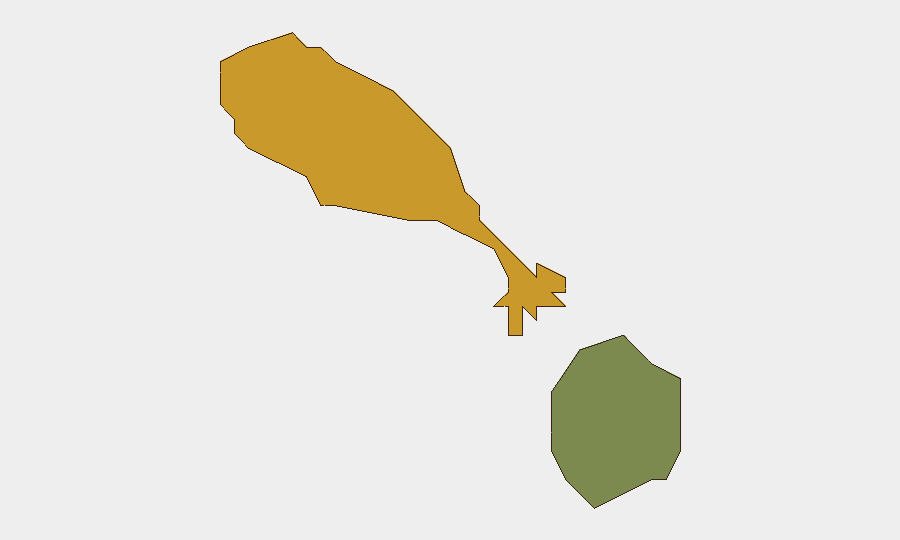
Saint Kitts island (composite risk score 72) significantly outweighs Nevis (28), indicating the capital and primary urban centers bear the concentration of tracked risk drivers. This disparity likely reflects higher population density, commercial activity, and therefore greater exposure to routine crime, labor activity, and administrative events. Nevis' lower score reflects its smaller population and economic footprint. Neither sub-national region shows acute destabilization; risk ranking reflects baseline structural factors rather than acute incident clustering.
How GeoBit Would Assist
AOI Monitoring & Early Warning with persistent watch on port facilities, airport, and financial centers would flag sudden civil unrest, infrastructure disruption, or security incidents in real time. Maritime & Aviation Tracking combined with Intel Sweep and multi-language OSINT would have provided advance intelligence on the 19 June Black Sea attack and related crew welfare developments affecting Saint Kitts and Nevis–registered assets. Network & Actor Analysis applied to labor, political, and criminal actors would enable early detection of emerging tensions before they crystallize into measurable incidents.
7-Day Outlook
No acute escalation is anticipated in the near term absent new external shocks or labor/political mobilization. The 19 June maritime incident affects Saint Kitts and Nevis primarily through flag-registry liability and crew welfare rather than territorial security. Routine baseline monitoring for labor action, inter-island tensions, and transnational crime should continue; no indicators presently warrant elevated alert status.
Highest-Risk Areas — Ranked
| # | State / Region | Risk |
|---|---|---|
| 1 | Saint Kitts | 72 |
| 2 | Nevis | 28 |
Sources
Previous Daily Briefs
A new Saint Kitts and Nevis brief is written every day — each with its own risk map and downloadable CSV. Here's the last week; use the calendar to go further back.
📅 Browse every day by calendar →
Highlighted days have a brief. Tap a day for that day's map & analysis, or “csv” for that day's dataset ($5).