Situation Summary
Saint Lucia remains a low-intensity-threat jurisdiction with a composite threat score of 14 globally. The last 48 hours have produced no verified security incidents, civil unrest, infrastructure disruptions, or acute political instability affecting corporate operations or travel. Castries hosted routine OECS diplomatic activity on 20 June with no accompanying security incidents. The current security environment reflects baseline Caribbean conditions with no indicators of imminent escalation.
Key Developments
- Castries, 20 June 2026: Organisation of Eastern Caribbean States (OECS) Heads of Government inaugural meeting convened under the chairmanship of Saint Vincent and the Grenadines PM Godwin Friday. No protests, unrest, or security disruptions were reported in conjunction with this high-level diplomatic event.
- No acute incidents recorded, 20–22 June 2026: Searches across Royal Saint Lucia Police Force official channels, government communications, regional Caribbean security feeds, and major social platforms yielded no clearly dated, independently corroborated reports of armed crime, mass gatherings, strikes, road blockades, or infrastructure failures during the past 48 hours.
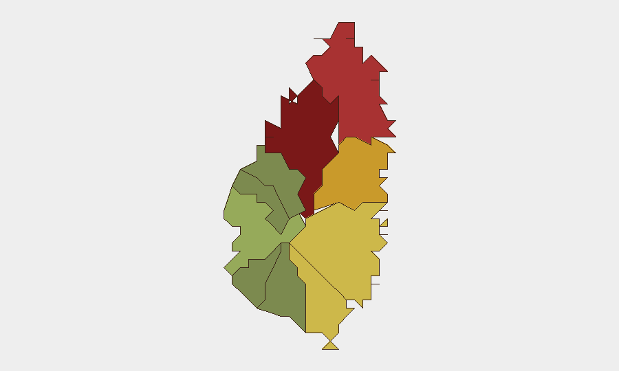
- Baseline risk concentration persists in capital and northern districts: GeoBit platform signal analysis continues to flag Castries (risk 95), Gros Islet (risk 78), and Dennery (risk 72) as the three highest-risk localities, though no acute triggering events have been detected in the current reporting window.
Highest-Risk Areas
Castries, the capital and commercial hub, drives the majority of Saint Lucia's composite risk score (95), reflecting its role as the primary locus of gang-affiliated crime, urban poverty, and informal-settlement concentration. Gros Islet (78) and Dennery (72) follow as secondary risk nodes, likely reflecting territorial drug-trafficking activity and organized-crime presence. The southern and western districts (Soufrière, Laborie, Choiseul, Canaries) register significantly lower scores, indicating that corporate assets and personnel in those zones face materially reduced exposure. Risk stratification is primarily driven by historical gang and narcotics activity rather than acute incidents; no current events are reshaping the geographic hierarchy.
How GeoBit Would Assist
Organizations with operations or personnel in Saint Lucia should employ Intel Sweep and multi-language OSINT to sustain real-time monitoring of local police statements, government announcements, and social channels for emerging incidents. AOI Monitoring & Early Warning capabilities enable persistent watch on Castries and Gros Islet, with automated alerting for protest activity, security-force deployments, or infrastructure disruptions that would affect duty-of-care obligations. Routing & Network Analysis can support contingency planning for alternate routes and safe-zone access if conditions in the capital deteriorate.
7-Day Outlook
No indicators suggest material deterioration in Saint Lucia's security posture over the coming week. Diplomatic activity in Castries is likely to conclude without residual disruption. Risk remains localized to known gang-activity zones in the northern and central districts; corporate and tourist infrastructure in Gros Islet and southern resort areas continues to operate within established security parameters. Continued monitoring of police and government channels is warranted as a matter of routine due diligence.
Highest-Risk Areas — Ranked
| # | State / Region | Risk |
|---|---|---|
| 1 | Castries | 95 |
| 2 | Gros Islet | 78 |
| 3 | Dennery | 72 |
| 4 | Vieux Fort | 68 |
| 5 | Micoud | 65 |
| 6 | Soufrière | 42 |
| 7 | Laborie | 38 |
| 8 | Choiseul | 35 |
| 9 | Anse La Raye | 28 |
| 10 | Canaries | 12 |
Sources
Previous Daily Briefs
A new Saint Lucia brief is written every day — each with its own risk map and downloadable CSV. Here's the last week; use the calendar to go further back.
📅 Browse every day by calendar →
Highlighted days have a brief. Tap a day for that day's map & analysis, or “csv” for that day's dataset ($5).