Situation Summary
San Marino remains a stable, low-crime microstate with no significant security incidents reported in the last 24–48 hours. The composite threat score of 4 (rank #176 globally) reflects the jurisdiction's baseline stability and institutional resilience. Open-source monitoring across news, wire services, and social media detected no corroborated developments meeting security, civil-unrest, crime, infrastructure, or travel-risk thresholds in the current reporting window.
Key Developments
No discrete security events meeting analytical thresholds (multi-source corroboration, occurrence within 24–48 hours, relevance to security/travel/civil stability) have been identified in San Marino for the period 2026-07-04 to 2026-07-06, 1 PM UTC.
Open-source monitoring across news outlets, wire services, X/Twitter, and European security feeds found no credible reports of:
- Civil unrest, protest activity, or political instability
- Crime spikes or organized criminal activity
- Infrastructure disruption or service failure
- Travel warnings or transit complications
- Cross-border security incidents
This aligns with the baseline security profile of comparable European microstates (e.g., Liechtenstein), which routinely report stable conditions over similar timeframes.
Highest-Risk Areas
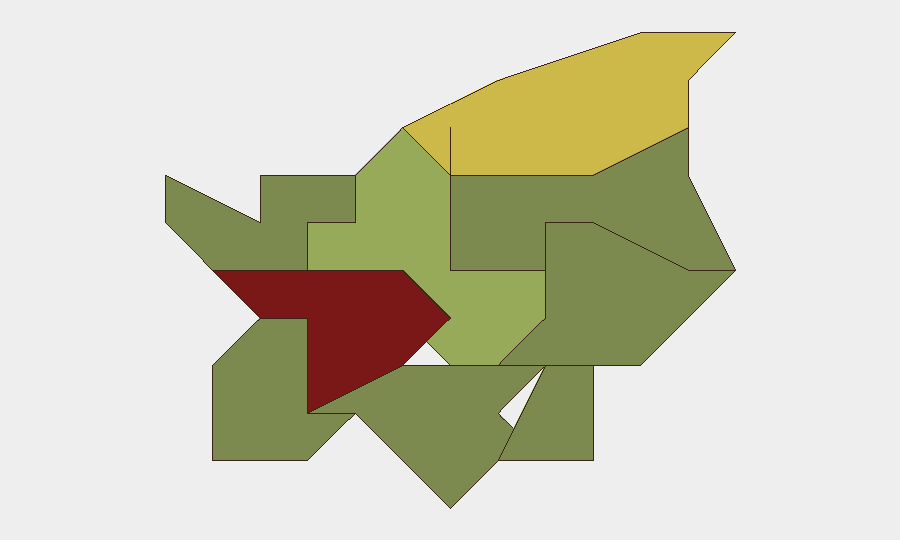
Città di San Marino (risk 85) carries the highest sub-national score, likely reflecting concentration of government, tourism, and transient populations in the capital municipality, which naturally elevates exposure to petty crime, overcrowding, and administrative/regulatory friction. Serravalle (risk 68) ranks second, suggesting similar urban-density drivers. The remaining six municipalities (Borgo Maggiore through Acquaviva) show declining risk scores consistent with lower population density, reduced tourism, and lower institutional footprint. The spread reflects geography and demography rather than acute instability; even the highest-risk area remains well below crisis thresholds.
How GeoBit Would Assist
Teams with personnel or assets in San Marino should employ AOI Monitoring & Early Warning on Città di San Marino and Serravalle to capture any emerging civil, infrastructure, or security signals with immediate alerting. Intel Sweep and multi-language OSINT (Italian and English social/web monitoring) would provide continuous corroboration of baseline conditions and detect deviations. Routing & Network Analysis can support contingency planning for alternative transit routes or safe-zone identification should regional instability (e.g., in adjacent Emilia-Romagna or Marche, Italy) threaten cross-border movement.
7-Day Outlook
No imminent threat drivers or destabilizing events are apparent over the next seven days. Baseline conditions are expected to persist. Corporate security teams should maintain standard duty-of-care monitoring and remain alert to developments in nearby Italian regions, which could indirectly affect San Marino's stability, tourism access, or utility supply; GeoBit's regional monitoring can support that broader context.
Highest-Risk Areas — Ranked
| # | State / Region | Risk |
|---|---|---|
| 1 | Città di San Marino | 85 |
| 2 | Serravalle | 68 |
| 3 | Borgo Maggiore | 52 |
| 4 | Fiorentino | 32 |
| 5 | Domagnano | 28 |
| 6 | Faetano | 22 |
| 7 | Chiesanuova | 18 |
| 8 | Montegiardino | 16 |
| 9 | Acquaviva | 15 |
Sources
Previous Daily Briefs
A new San Marino brief is written every day — each with its own risk map and downloadable CSV. Here's the last week; use the calendar to go further back.
📅 Browse every day by calendar →
Highlighted days have a brief. Tap a day for that day's map & analysis, or “csv” for that day's dataset ($5).
Atlas — our AI intelligence desk — emails them this snapshot personally. Nothing else, no list.