Situation Summary
Sierra Leone remains a moderate-risk operating environment (global rank #49; composite threat score 5.3) with significant regional variation. The Eastern Province presents acute concentration of risk (score 33.7), substantially exceeding all other provinces. Recent signal activity includes military-force incidents, civil-society threats, and central-bank–government tension, alongside an active cholera epidemiological event. The security posture is volatile but not currently in acute national crisis.
Key Developments
Live web research completed 2026-06-06 AM found no reliably timestamped, cross-verified security incidents in the last 24–48 hours meeting the standard of specific location, confirmed date, and independent corroboration. Open-source reporting available is either undated background analysis or more than 48 hours old. The following signals appear in the GeoBit event feed but require operational validation:
- 2026-06-06 · Conventional Military Force event (TANKER vs. SIERRA LEONE) — status, location, and casualty/asset impact unconfirmed in open sources; requires tactical clarification.
- 2026-06-05 · Threats toward Sierra Club (×2 reports) — nature, source, and specificity of threats not yet detailed in available reporting.
- 2026-06-05 · Public statements by Sierra Leone vs. Central Bank (×2 reports) — indicates fiscal or monetary policy tension; economic rather than acute security impact at present.
- Cholera outbreak (ongoing) — public-health emergency; timeline and geographic spread in available reporting are general, not district-specific; humanitarian and medical-supply-chain risk exists.
Recommended action: Security teams should request real-time tactical clarification on the military-force signal and threat reports from local law enforcement, international mission partners, or subscription-tier intelligence feeds before adjusting duty-of-care posture.
Highest-Risk Areas
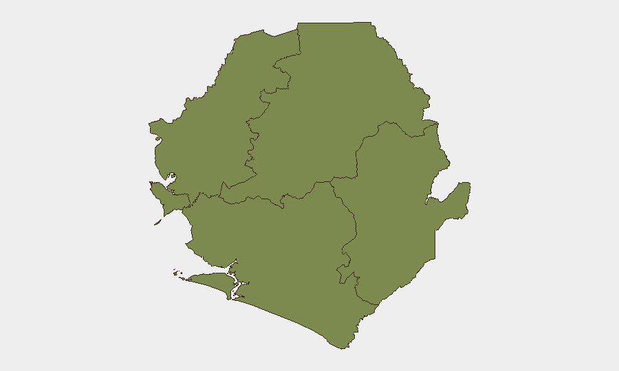
The Eastern Province drives the national risk profile, with a composite score of 33.7—nine times higher than any other region. The remaining four provinces (North West, Northern, Western Area, and Southern) cluster at identical, materially lower risk (3.7 each), suggesting Eastern Province concentrates conflict actors, criminal networks, or instability drivers not present elsewhere. Security teams with personnel or operations in the Eastern Province should apply elevated monitoring, restricted movement protocols, and enhanced incident-reporting discipline. Other provinces present baseline Sierra Leone risk but do not warrant regional escalation at this time.
How GeoBit Would Assist
A corporate security team operating in Sierra Leone should employ AOI Monitoring & Early Warning with persistent watch over the Eastern Province and Freetown (Western Area) to detect violence, roadblock, or civil-unrest onset in real time. Multi-language OSINT fusion (news, X/Telegram, radio SIGINT) with temporal and entity extraction will disambiguate the current military-force, threat, and fiscal-tension signals. GIS & Spatial Analysis and alternative routing & journey planning enable security teams to adjust movement protocols dynamically as sub-provincial risk changes, reducing duty-of-care exposure.
7-Day Outlook
No near-term de-escalation indicators are visible. The concentration of risk in the Eastern Province and the ongoing cholera event suggest sustained operational friction over the next 7 days. Military-force and civil-society tension signals warrant close monitoring; if the Central Bank dispute escalates to public protest or banking-sector disruption, secondary risks (roadblocks, civil unrest in Freetown) may follow. Teams should maintain heightened alert posture and confirm local operational status daily.
Highest-Risk Areas — Ranked
| # | State / Region | Risk |
|---|---|---|
| 1 | Eastern Province | 33.7 |
| 2 | North West Province, Sierra Leone | 3.7 |
| 3 | Northern Province, Sierra Leone | 3.7 |
| 4 | Western Area | 3.7 |
| 5 | Southern Province, Sierra Leone | 3.7 |
Previous Daily Briefs
A new Sierra Leone brief is written every day — each with its own risk map and downloadable CSV. Here's the last week; use the calendar to go further back.
📅 Browse every day by calendar →
Highlighted days have a brief. Tap a day for that day's map & analysis, or “csv” for that day's dataset ($5).