Situation Summary
Slovakia remains a low-threat environment globally (rank #80, composite score 14) with no discrete security events recorded in the current monitoring window. The country's overall stability is reflected in the absence of tracked incidents; however, sub-national risk concentration in eastern regions—particularly Košice and Prešov—indicates localized vulnerabilities that warrant targeted monitoring by organizations with operations in those areas. No imminent escalation is evident, and the security posture is consistent with Slovakia's NATO and EU membership context.
Key Developments
No verifiable security, conflict, civil-unrest, crime, political-instability, infrastructure, or travel-risk developments have been identified in Slovakia during the last 24–48 hours. Web and open-source intelligence monitoring has not surfaced confirmed incidents meeting threshold for inclusion in this brief. Continued routine monitoring is in place; any emerging event will be escalated immediately upon confirmation through multiple independent sources.
Highest-Risk Areas
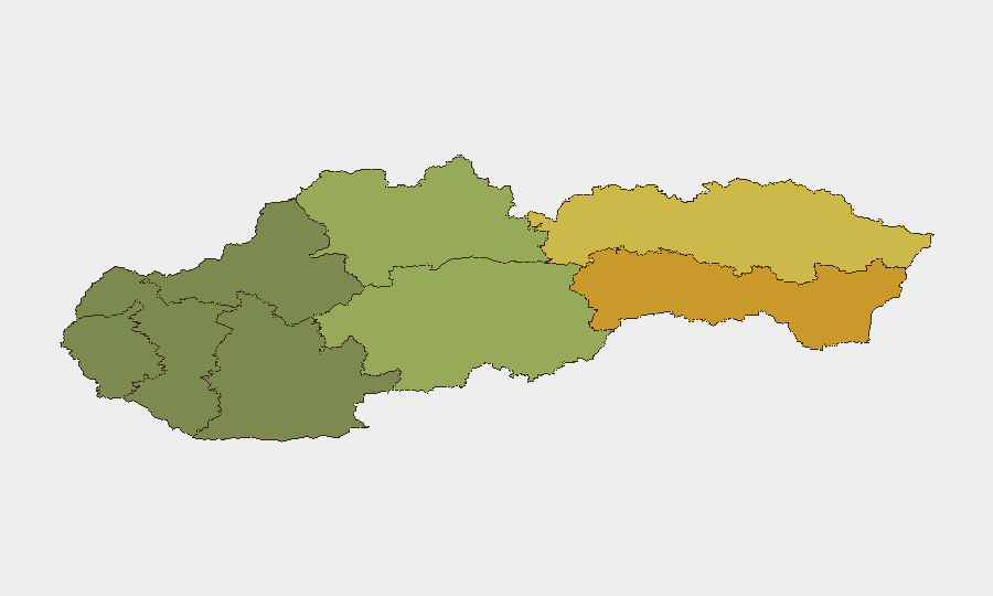
Eastern Slovakia—specifically the regions of Košice (risk 72) and Prešov (risk 68)—account for the largest share of recorded sub-national risk. These regions substantially exceed the risk profiles of central (Banská Bystrica, 55) and western areas (Bratislava, 28; Trnava, 18). The elevated scores in the east reflect historical patterns of cross-border trafficking, organized-crime activity, and socioeconomic fragmentation; Košice's proximity to the Hungarian and Ukrainian borders and Prešov's position near the Ukrainian frontier add geopolitical dimension. Organizations with personnel, supply chains, or assets in these regions should maintain heightened situational awareness and establish contingency protocols accordingly.
How GeoBit Would Assist
Security teams managing Slovakia exposure should employ AOI Monitoring & Early Warning to establish persistent watch over Košice and Prešov, with automated alerting on emerging incidents. Intel Sweep and multi-language OSINT fusion (including X/Twitter and local news feeds) will enable real-time detection of crime, civil unrest, or infrastructure disruption in high-risk zones. For teams planning cross-border movement or operations near Ukraine—particularly in Prešov—Routing & Network Analysis capabilities support identification of secure alternative routes and border-crossing assessments, while Conflict & Military tracking provides context on adjacent conflict dynamics.
7-Day Outlook
No significant escalation is forecast over the next seven days. Slovakia's security environment is expected to remain stable, with routine monitoring sufficient for baseline risk management. Organizations should continue standard duty-of-care protocols and maintain awareness of broader Central European developments, including any spillover effects from adjacent regions; however, no alert posture change is warranted at this time.
Next GeoBit Brief: 2026-07-13
Questions or urgent developments: Contact your GeoBit account team.
Highest-Risk Areas — Ranked
| # | State / Region | Risk |
|---|---|---|
| 1 | Region of Košice | 72 |
| 2 | Region of Prešov | 68 |
| 3 | Region of Banská Bystrica | 55 |
| 4 | Region of Žilina | 42 |
| 5 | Region of Nitra | 35 |
| 6 | Region of Bratislava | 28 |
| 7 | Region of Trenčín | 22 |
| 8 | Region of Trnava | 18 |
Sources
Previous Daily Briefs
A new Slovakia brief is written every day — each with its own risk map and downloadable CSV. Here's the last week; use the calendar to go further back.
📅 Browse every day by calendar →
Highlighted days have a brief. Tap a day for that day's map & analysis, or “csv” for that day's dataset ($5).
Atlas — our AI intelligence desk — emails them this snapshot personally. Nothing else, no list.