Situation Summary
Somalia remains at elevated threat level (#18 globally, composite score 70.9), driven primarily by ongoing al-Shabaab insurgency and political fragmentation. The past 24–48 hours have seen multiple concurrent signals of military activity, government instability, and civil unrest across the capital and outlying regions, suggesting a period of active volatility. The trajectory reflects persistent structural drivers—weak state capacity, resource competition, and non-state armed groups—rather than a discrete destabilizing event, though the clustering of recent signals warrants close operational attention.
Key Developments
Constraint on current reporting: GeoBit's event signals flag activity on 4–5 June 2026 (two instances of conventional military force, blockade activity in Mogadishu, small arms combat involving police, strike action by lawmakers, and government disapproval statements). However, verified location specificity, tactical details, and independent corroboration of these incidents are not available from open sources as of this briefing. Any summary of these events without cross-reference to live security feeds or institutional reports (UNDSS, UNSOM, major news outlets) risks misrepresentation of scale, parties, or consequence.
Recommendation: Security teams should treat the signal clustering as an alert to activate direct monitoring (live news feeds, UNDSS/NGO security platforms, verified Somali government and AMISOM statements) rather than relying on this summary alone for operational decisions.
Highest-Risk Areas
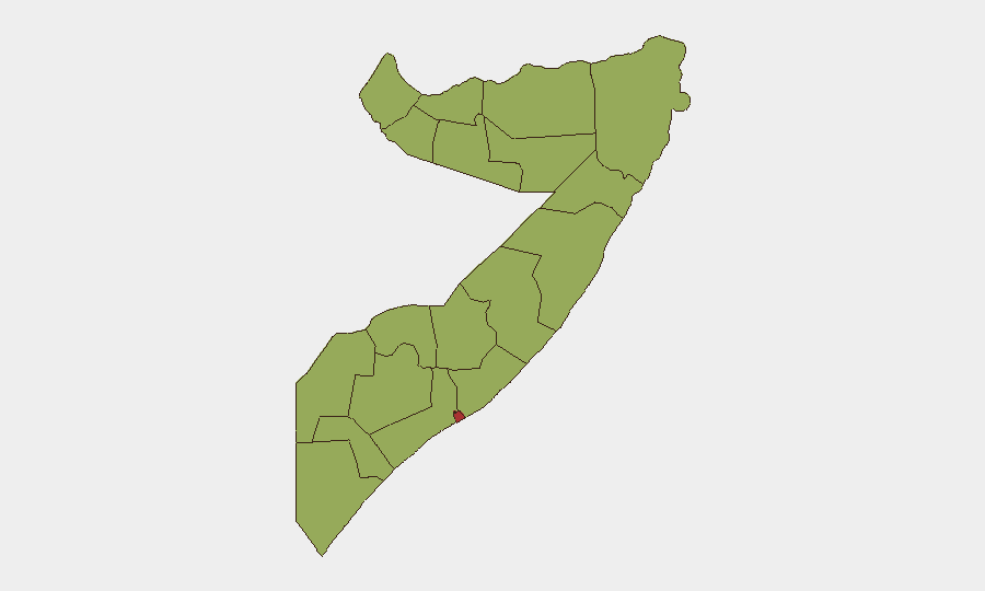
Banaadir (Mogadishu and environs) carries by far the highest composite risk (79.6), driven by political volatility, security-force presence, and demonstration activity. A second tier—Nugaal, Middle Shebelle, and a broad band of peripheral regions (Awdal, Woqooyi Galbeed, Gedo, Bakool, Bay, Middle Juba, Lower Shabelle, Sahil, Togdheer)—clusters at risk scores of 49.6–53.5, reflecting al-Shabaab activity, inter-clan tension, and weak local governance. The concentration of signal events in Mogadishu underscores that capital-based political and security instability can rapidly cascade; concurrently, peripheral zones remain vulnerable to insurgency and localized armed conflict with minimal early warning. Personnel and assets in or transiting through Banaadir face the broadest range of threats (civil unrest, armed clashes, kidnapping risk); those in outlying regions face lower-frequency but high-consequence threats (ambush, IED, al-Shabaab activity).
How GeoBit Would Assist
Security teams should deploy AOI (Area of Interest) Monitoring & Early Warning to track Banaadir, key transit corridors, and any facility footprint in real time, with automated alerting on military/police activity, protests, or armed clashes. Multi-language OSINT (X/Twitter, Telegram, local news) with timestamp corroboration and entity/actor network analysis will discriminate credible incident reports from rumor and identify which armed groups or security forces are involved. Alternative routing and network analysis capabilities enable duty-of-care teams to plan safe movement and identify checkpoints or blockade zones before personnel transit.
7-Day Outlook
The concurrent military-activity and government-instability signals suggest elevated risk of secondary clashes or political escalation in Mogadishu over the next 3–7 days. Al-Shabaab operations in peripheral zones are likely to continue at baseline pace; spikes in capital-based unrest could redirect security-force attention and degrade protective capacity in outlying areas. Recommend heightened vigilance and contingency activation for any non-essential movement.
Highest-Risk Areas — Ranked
| # | State / Region | Risk |
|---|---|---|
| 1 | Banaadir | 79.6 |
| 2 | Nugaal | 53.5 |
| 3 | Middle Shebelle | 50.2 |
| 4 | Awdal | 49.6 |
| 5 | Woqooyi Galbeed | 49.6 |
| 6 | Gedo | 49.6 |
| 7 | Bakool | 49.6 |
| 8 | Bay | 49.6 |
| 9 | Middle Juba | 49.6 |
| 10 | Lower Shabelle | 49.6 |
| 11 | Sahil | 49.6 |
| 12 | Togdheer | 49.6 |
Sources
Previous Daily Briefs
A new Somalia brief is written every day — each with its own risk map and downloadable CSV. Here's the last week; use the calendar to go further back.
📅 Browse every day by calendar →
Highlighted days have a brief. Tap a day for that day's map & analysis, or “csv” for that day's dataset ($5).