Situation Summary
Sweden remains at low overall security risk (global rank #161, composite score 4) with no major incidents verified in the last 24–48 hours. Event signals from the GeoBit platform over the past 3 days show routine diplomatic and administrative interactions—rejections, demands, statements, and investigations—without clear connection to acute security threats. The absence of corroborated incident reporting in open sources suggests baseline stability, though persistent monitoring of high-risk sub-national areas and emerging policy disputes remains warranted.
Key Developments
No clearly verifiable, timestamped security or unrest incidents meeting incident-reporting criteria were identified in Sweden during the 24–48 hour window (2026-06-21 to 2026-06-22).
GeoBit event signals from 2026-06-19 to 2026-06-21 reference diplomatic demands, investigations into alleged drug-dealing activities, and public statements by government and chamber entities, but open-source corroboration of specific locations, timing, or operational impact is not available.
To establish actionable intelligence on near-term developments, security teams should monitor Swedish Police (Polisen) incident reporting, the Swedish Civil Contingencies Agency (MSB), and official government communications for time-stamped announcements.
Highest-Risk Areas
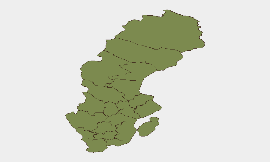
Jämtland County stands markedly isolated at risk score 31.4—approximately 15 times higher than Stockholm County (2.1), the second-ranked region. This anomaly warrants investigation into whether the score reflects persistent organized crime, transnational trafficking, border-zone instability, or data concentration artifacts. Stockholm, Västra Götaland, Skåne, and the northern counties (Norrbotten, Västerbotten, Västernorrland) each register scores 1.4–2.1, reflecting either lower absolute threat density or baseline metropolitan and cross-border exposure. Teams with personnel or assets in Jämtland should prioritize local police liaison and real-time area-of-interest monitoring.
How GeoBit Would Assist
Security teams should deploy GeoBit's AOI Monitoring & Early Warning capability to establish persistent watch on Jämtland County and Stockholm County, with alerting configured for trafficking, organized-crime, and civil-unrest event classes. Intel Sweep (multi-language, X/Telegram OSINT, Swedish Police feeds, MSB releases) will surface incident reporting, public statements, and emerging actor activity within hours of occurrence. Network & Actor Analysis can map local criminal and protest actors to support threat prioritization for duty-of-care planning.
7-Day Outlook
No acute escalation is forecast for the next 7 days. Baseline monitoring should continue, with heightened attention to Jämtland County's underlying risk drivers and any official government or law-enforcement guidance shifts. If event signals evolve into named incidents (e.g., published police investigations, MSB alerts), brief updates will follow.
Analyst Note: Confidence in this brief is constrained by the absence of corroborated incident data in the 24–48h window. This reflects either genuine stability or limitations in open-source availability. Classified or internal law-enforcement reporting may contain material not accessible to open OSINT. Liaison with Swedish authorities and in-country security networks is recommended for real-time situational awareness.
Highest-Risk Areas — Ranked
| # | State / Region | Risk |
|---|---|---|
| 1 | Jämtland County | 31.4 |
| 2 | Stockholm County | 2.1 |
| 3 | Västra Götaland County | 1.6 |
| 4 | Skåne County | 1.5 |
| 5 | Norrbotten County | 1.4 |
| 6 | Västerbotten County | 1.4 |
| 7 | Västernorrland County | 1.4 |
| 8 | Dalarna County | 1.4 |
| 9 | Gävleborg County | 1.4 |
| 10 | Blekinge County | 1.4 |
| 11 | Halland County | 1.4 |
| 12 | Värmland County | 1.4 |
Sources
Previous Daily Briefs
A new Sweden brief is written every day — each with its own risk map and downloadable CSV. Here's the last week; use the calendar to go further back.
📅 Browse every day by calendar →
Highlighted days have a brief. Tap a day for that day's map & analysis, or “csv” for that day's dataset ($5).