Situation Summary
Togo remains stable with no significant security incidents, civil unrest, or infrastructure disruptions reported in the past 24–48 hours. The country's composite threat score (50) places it at rank #36 globally, reflecting persistent but contained risks concentrated in the northern Savanes and Kara regions. The security environment is characterized by absence of acute crisis rather than fundamental stability; routine monitoring of border areas and northern regions remains warranted for duty-of-care purposes.
Key Developments
No discrete, corroborated security events affecting Togo have been reported in the last 24–48 hours by major news outlets, verified social media accounts, or embassy alerts. Web research across international wire services, regional West African media, and monitored X/Twitter feeds yielded no reports of organized protests, armed clashes, significant criminal incidents, infrastructure failures, or official travel warnings specific to the country during this window.
Highest-Risk Areas
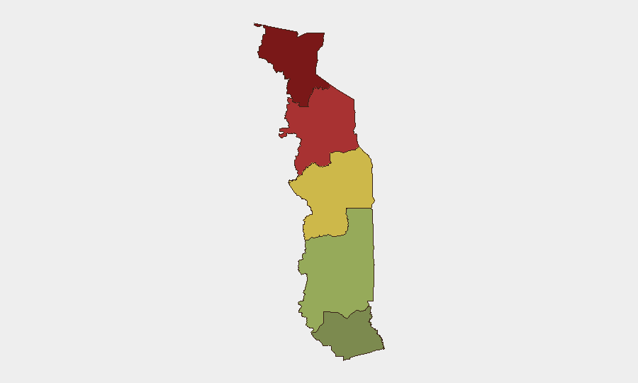
Risk concentration in Togo is heavily skewed toward the north. Savanes Region (risk score 92) and Kara Region (risk score 78) together account for the dominant share of national threat activity, driven by chronic border-security challenges with Burkina Faso, porous smuggling corridors, and historical militia activity. Centrale Region (risk 65) presents moderate concern. By contrast, Maritime Region (risk 28)—home to the capital Lomé and primary economic zones—remains substantially lower-risk. Organizations with staff or operations in northern Togo should maintain heightened vigilance; those concentrated in the south face materially lower exposure.
How GeoBit Would Assist
Security and risk teams operating in or with exposure to Togo should use GeoBit's AOI Monitoring & Early Warning to establish persistent watch over northern border zones and Savanes/Kara regions, with automated alerting on social media, local news, and radio SIGINT for signs of organized activity, cross-border movement, or civil unrest. Intel Sweep and multi-language OSINT (including regional West African media feeds) will provide continuous near-real-time situational awareness when incidents occur, allowing teams to detect emerging issues before they escalate. Routing & Network Analysis enables alternative journey planning for personnel transit, particularly through the north, reducing exposure to known risk corridors.
7-Day Outlook
No acute security escalation is expected in the near term absent a significant external trigger (e.g., spillover from Burkina Faso unrest or major regional political event). Baseline risk in northern regions will remain elevated but consistent with recent months. Continued monitoring of official embassy travel advisories and regional media for any signals of cross-border incursions, protest organization, or security-force posturing is appropriate for risk teams with personnel or assets in-country.
Next Scheduled Brief: 2026-06-29
Report Date: 2026-06-28
Data Window: 2026-06-27 00:00 – 2026-06-28 23:59 UTC
Highest-Risk Areas — Ranked
| # | State / Region | Risk |
|---|---|---|
| 1 | Savanes Region | 92 |
| 2 | Kara Region | 78 |
| 3 | Centrale Region | 65 |
| 4 | Plateaux Region | 45 |
| 5 | Maritime Region | 28 |
Sources
Previous Daily Briefs
A new Togo brief is written every day — each with its own risk map and downloadable CSV. Here's the last week; use the calendar to go further back.
📅 Browse every day by calendar →
Highlighted days have a brief. Tap a day for that day's map & analysis, or “csv” for that day's dataset ($5).