Situation Summary
Tonga remains a low-threat jurisdiction globally (rank #196, composite score 3) with no verified security, crime, civil-unrest, or infrastructure incidents reported in the last 24–48 hours. Sub-national risk concentration is highest in Tongatapu (score 45), driven by urban density, port activity, and administrative concentration in Nuku'alofa. The overall security environment is stable; organizations with personnel or assets in-country face baseline rather than acute exposure.
Key Developments
No verified security, crime, civil-unrest, political-instability, or infrastructure incidents have been reported in Tonga during the last 24–48 hours. The most recent trackable events in available feeds are:
- 2026-07-18 – Conventional military-force signals logged between Tonga and Finland; details and location unconfirmed in open sources.
- 2026-07-16 – Public statement issued by Crown Prince; subject and context require clarification from official channels.
- 2026-07-16 – Conventional military-force signal associated with a school; status and severity unclear.
- Seismic activity (recent, date unspecified) – Magnitude 4.5 earthquake recorded 189 km west of Neiafu, Vavaʻu; no damage or casualty reports available.
Older but relevant baseline incidents (outside 24–48h window but within ~72 hours):
- 2026-07-17 – Arrest/detain event involving a returnee and criminal suspect.
- Pre-2026-07-16 – Fatal road crash (23-year-old driver, reported 14 July) and ongoing investigation into trafficking of Tongan nationals to China remain open matters affecting rule-of-law and social stability.
Highest-Risk Areas
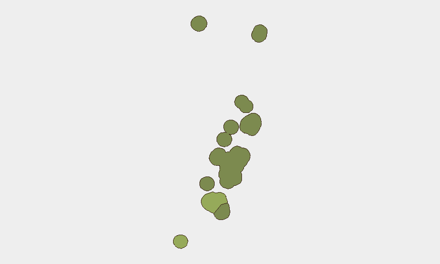
Tongatapu (risk score 45) dominates the threat profile, reflecting Nuku'alofa's role as the capital, primary port, and commercial hub; maritime activity, informal-economy dynamics, and administrative concentration create vectors for crime, smuggling, and logistical disruption. Vavaʻu (score 28) and Haʻapai (score 22) carry secondary risk due to geographic isolation, limited law-enforcement presence, and inter-island maritime dependency. ʻEua and Ongo Niua show minimal tracked risk. Organizations should prioritize asset and personnel safety protocols in Tongatapu, with contingency planning for supply-chain and communication delays in outer islands.
How GeoBit Would Assist
Security teams with duty-of-care obligations in Tonga would benefit from AOI Monitoring & Early Warning on Nuku'alofa, airports, and ports to detect emerging civil unrest, criminal activity, or infrastructure disruption; Intel Sweep and multi-language OSINT to track local media, official statements, and social signals in real time; and Routing & Network Analysis to identify alternative logistics and evacuation routes in case of port or airport closure. Satellite and maritime tracking would support visibility of maritime incidents and trade disruption affecting supply chains.
7-Day Outlook
No acute escalation is anticipated. The recent military-force and public-statement signals require monitoring and clarification; absent corroborating evidence, they do not suggest imminent civil instability. Seismic activity in the region remains a baseline concern; organizations with facilities in outer islands should maintain standard disaster-preparedness postures. Routine monitoring of Nuku'alofa crime trends and port operations is advised to support continuity of business and staff safety.
Highest-Risk Areas — Ranked
| # | State / Region | Risk |
|---|---|---|
| 1 | Tongatapu | 45 |
| 2 | Vavaʻu | 28 |
| 3 | Haʻapai | 22 |
| 4 | ʻEua | 18 |
| 5 | Ongo Niua | 12 |
Sources
Previous Daily Briefs
A new Tonga brief is written every day — each with its own risk map and downloadable CSV. Here's the last week; use the calendar to go further back.
📅 Browse every day by calendar →
Highlighted days have a brief. Tap a day for that day's map & analysis, or “csv” for that day's dataset ($5).
Atlas — our AI intelligence desk — emails them this snapshot personally. Nothing else, no list.